First Alert Forecast: Snow arrives Friday afternoon and evening
[anvplayer video=”5166515″ station=”998131″]
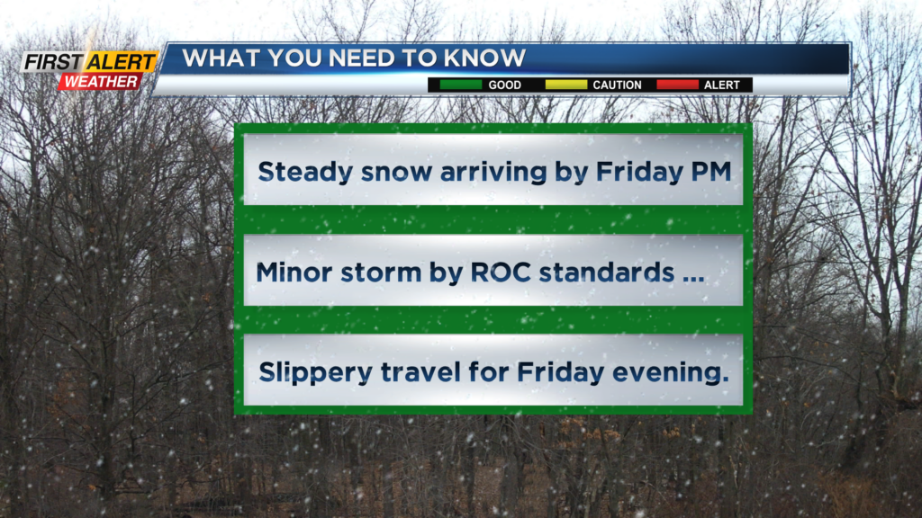
ROCHESTER, N.Y. – Cold, but tranquil weather will continue for the next 36 hours in Western News York. However, as has been the trend over the last few weeks, there is another storm that we are tracking for the end of the week. It appears this will be a minor winter event by Rochester standards, but no doubt there will be some slippery travel by Friday late afternoon and evening.
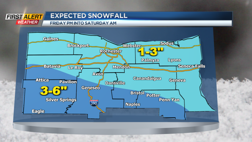
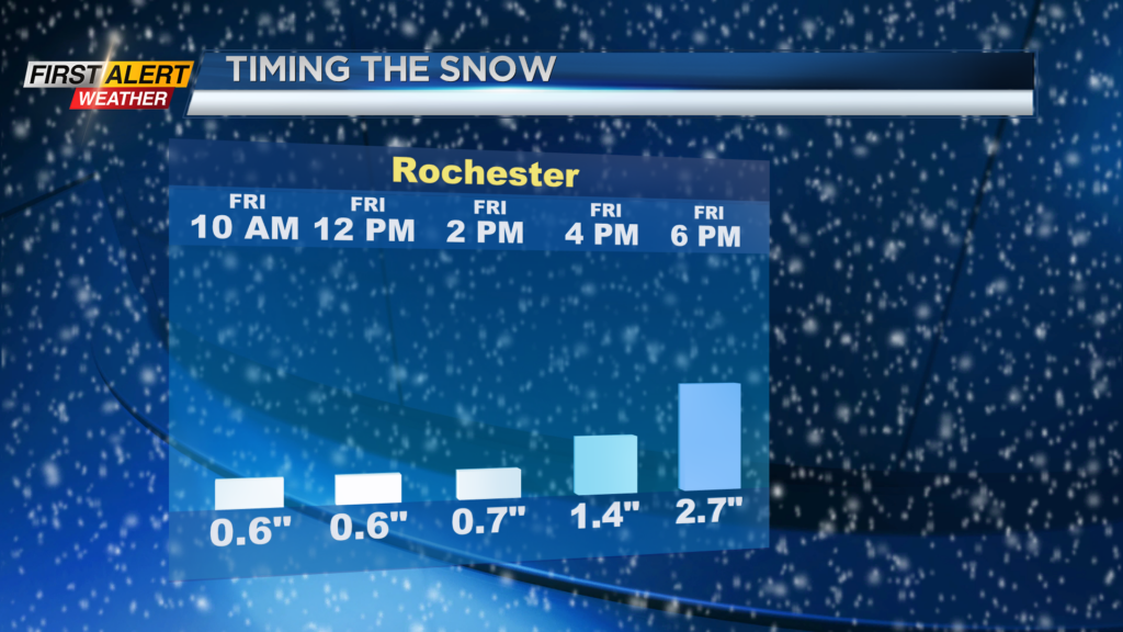
Tonight, look for mostly cloudy skies and just a few scattered flurries possible. The low temperature in the upper 20s. Thursday will feature some morning clouds and a passing flurry. Then skies may brighten for the afternoon with the high temperature near 34 degrees. A low-pressure system will be passing south of the Pennsylvania border on Friday and Friday night. This will bring an area wide snowfall, which will arrive by mid to late afternoon. Look for an accumulation of one to two inches by the evening commute. The temperature will rise into the middle 30s. Then snow should begin to taper off before midnight with another one to two inches likely. This will bring snow totals to between two to four inches by Saturday morning. This appears to be a manageable amount of snow and, as a result, the News10NBC First Alert meteorologists have not issued a yellow alert at this time. However, we continue to watch the forecast data for any changes on this developing storm.
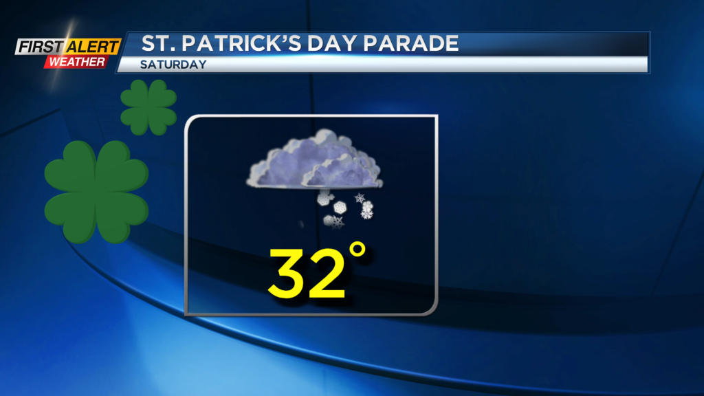
If you are heading to the St. Patrick’s Day parade downtown on Saturday, make sure you dress for the conditions. It will be cold with occasional snow showers, with the temperature remaining in the 30s.
Stay tuned to News 10NBC First Alert weather for updates to the forecast.