First Alert Forecast: Spring is arriving about five weeks early
[anvplayer video=”5162269″ station=”998131″]
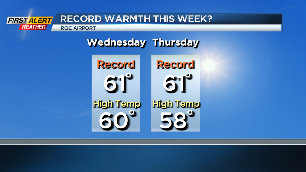
ROCHESTER, N.Y. – Spring does not officially arrive until March 20, but this is the kind of mild weather that we normally enjoy during the latter half of March. Each day during the upcoming work week we will have unseasonably warm weather. In fact, by Wednesday and Thursday it will be pushing closer towards record high temperatures. And the record for Wednesday has stood for 74 years in Rochester.
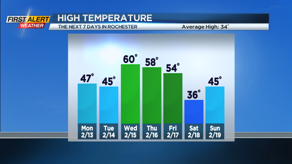
Tonight, you can expect mainly clear or fair skies, as high clouds drift through during the overnight. The temperature will fall to the lower to middle 20s. Monday expect more sunshine, then clouds will increase for the afternoon. The high temperature again will be in the upper 40s. Tuesday skies will become mostly sunny with readings in the middle 40s. Wednesday will feature partial sunshine with the chance of a spotty rain shower. The high temperature will be near the record of 61 degrees set back in 1949. Thursday there will be a better chance of a few afternoon rain showers, but even with the rain the mercury will be in the upper 50s.
Friday there will be a significant change with windy and colder weather arriving. We expect the temperature to fall rapidly through the 30s and 20s with rain showers changing to snow showers. As a result, it will be much colder for the start of the weekend.
Stay tuned to News 10NBC First Alert weather for updates on the forecast.