First Alert Forecast: Still Looking For Winter And Not Finding It
[anvplayer video=”5156240″ station=”998131″]
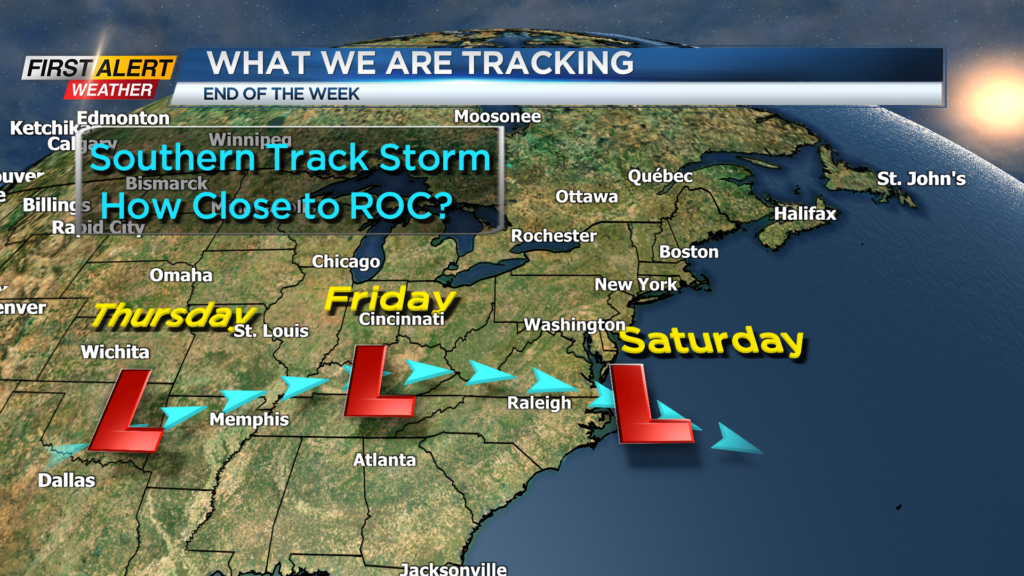
ROCHESTER, N.Y. – It is not good news if you are a winter enthusiast. Today makes 11 days in a row with above average temperatures for Rochester and for the season we are now 27 inches below normal for total snowfall. It appears that this calm weather will continue for much of the upcoming week. However, the News 10NBC First Alert meteorologists are tracking a southern track storm which may have impact by the end of the week.
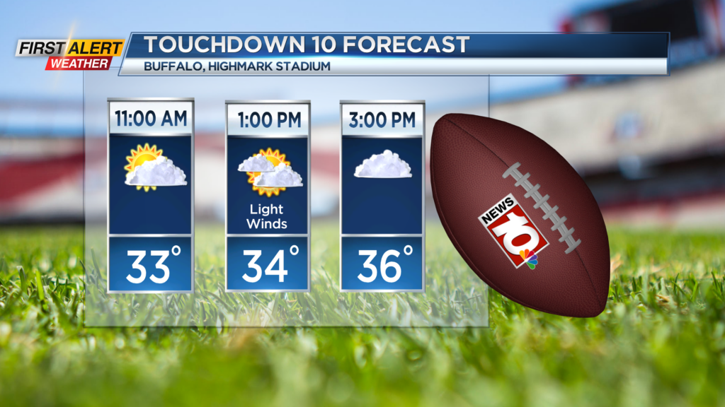
Tonight look for mostly cloudy skies with some of the cloud cover beginning to break up during the wee hours of the morning. This drier air will continue into Sunday, which is good news if you heading out to the Bills game Highmark Stadium. Most of Western New York will find partial sunshine, light winds and the temperature rising above freezing. The high temperature will be in the upper 30s.
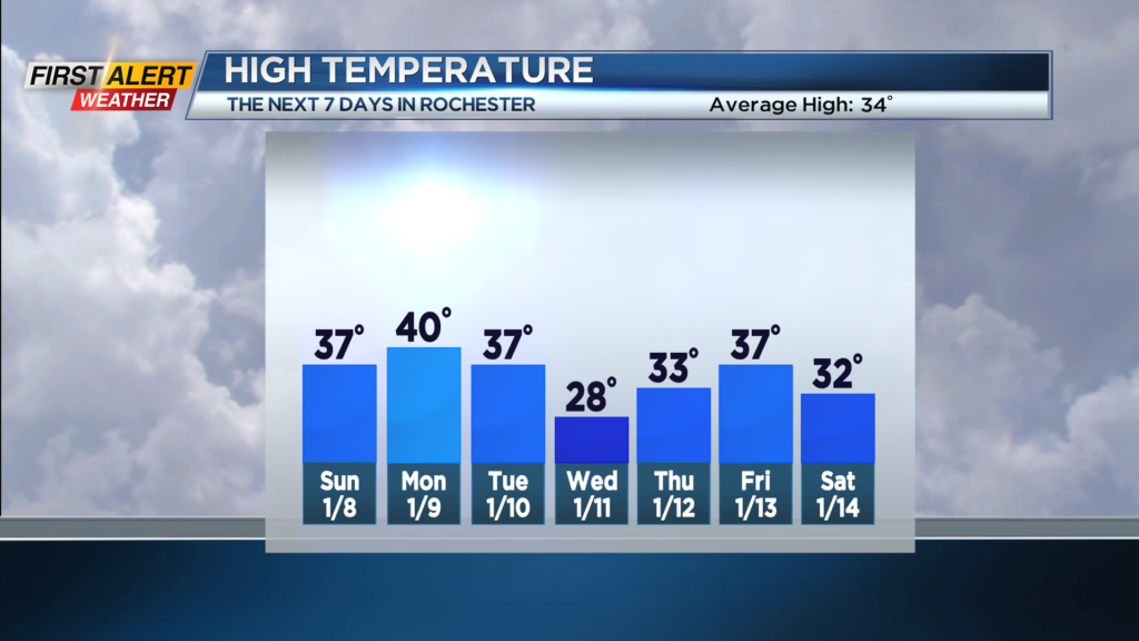
Monday, Tuesday and Wednesday also appears to be uneventful with a blend of clouds and sunshine. It should be mainly dry for all three days with the temperature running in the upper 30s to near 40 degrees. Wednesday will be a little colder with limited sunshine and a temperature falling through the 20s.
The weather pattern does get more interesting later in the week. Latest computer models is showing a storm likely for Thursday, Friday and Saturday and it will take a more southern track heading into the weekend. There is still a great deal of uncertainty on the impact for Rochester, but accumulating snow is possible.
Stay tuned to News 10NBC First Alert weather for updates on the forecast.