First Alert Forecast: Storm is forecast to move north of Rochester
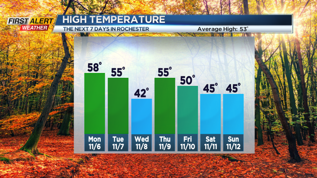
ROCHESTER, N.Y. – A low-pressure system now located along the U.S.-Canada border, just west of the Great Lakes, will move east over the next 36 hours. This storm will grow stronger as it eventually tracks north of Western New York into Canada by Monday night. This will initially usher in milder temperatures to start the work week, but some gusty winds will be likely for Monday night and Tuesday. The News 10NBC First Alert meteorologists expect a few passing showers, but the temperature will be falling again for Election Day with some chilly weather returning for the middle of the week.
Sunday night, we will find partly cloudy skies this evening, but the clouds will be increasing during the overnight. Light winds will bring the temperature into the mid-to upper 30s. Monday should be dry for the morning, but a few spotty showers are possible anywhere from midday into the afternoon. The temperature should reach the upper 50s. Monday night a few more spotty showers are possible, but it will be a gusty wind with the low temperature near 50 degrees. Tuesday, Election Day, will feature some breaks of sun for the morning, but another shower is possible for the afternoon. Again, some gusty winds are expected with the temperature falling through the 50s. Wednesday looks mainly dry, but it will be chilly with the temperature only in the lower 40s.
Stay tuned to News 10NBC First Alert weather for updates on the forecast.