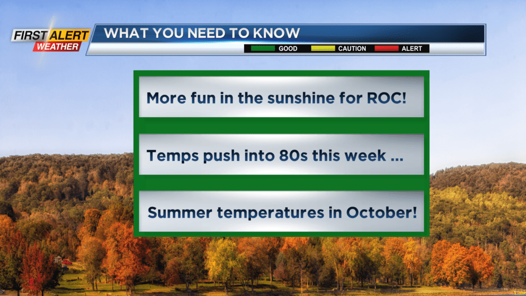
First Alert Forecast: Summer-like temperatures in October
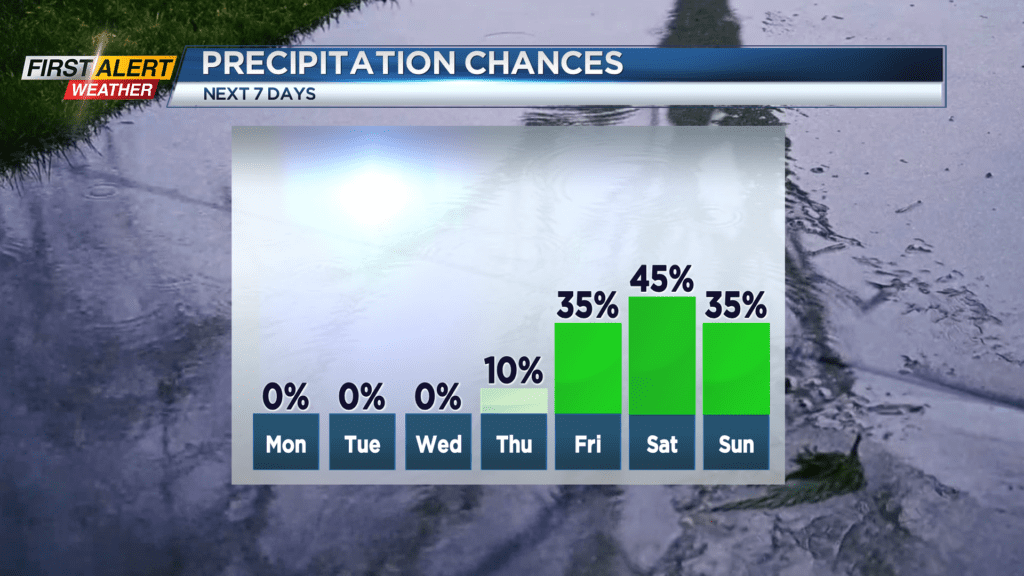
ROCHESTER, N.Y. – It has been almost two weeks since we have had any substantial rainfall in Rochester. In addition, there is a trend towards unseasonably warm weather for the coming week with the potential for near record warmth. Both weather elements are due to an unusually persistent ridge of high pressure that is centered over Western New York. This weather pattern will not be changing until the end of the week. When that happens, the potential for rain and much cooler weather will return to the Flower City.
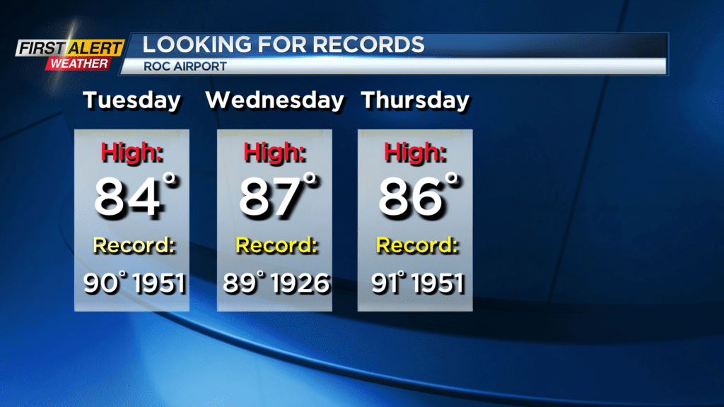
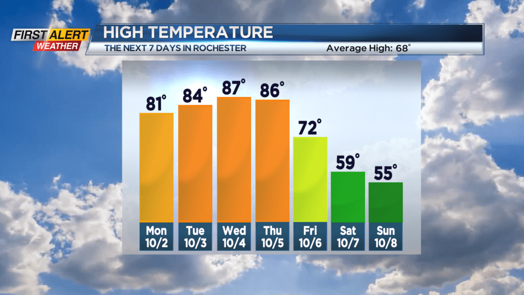
Sunday night look for mainly clear skies with some patchy valley fog developing. The low temperature will be in the middle 50s, but the mercury will fall into the upper 40s south of Rochester. Monday, Tuesday, Wednesday, and Thursday will feature more sunshine. Each day the temperature will be rising though the 80s during the day with the potential for near record warmth on Wednesday. The forecast is for a high of 87 degrees and the record for the day is 89 degrees which was set back in 1926.
Several cold fronts will then cross the area by the end of the week. This will bring an increasing chance of showers with much cooler weather for next weekend.
Stay tuned to News 10NBC First Alert weather for updates on the forecast.