First Alert Forecast: Summer makes a return for one day
[anvplayer video=”5189359″ station=”998131″]
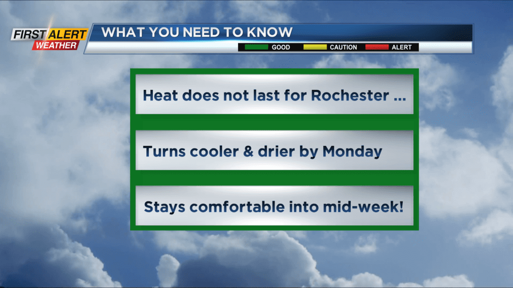
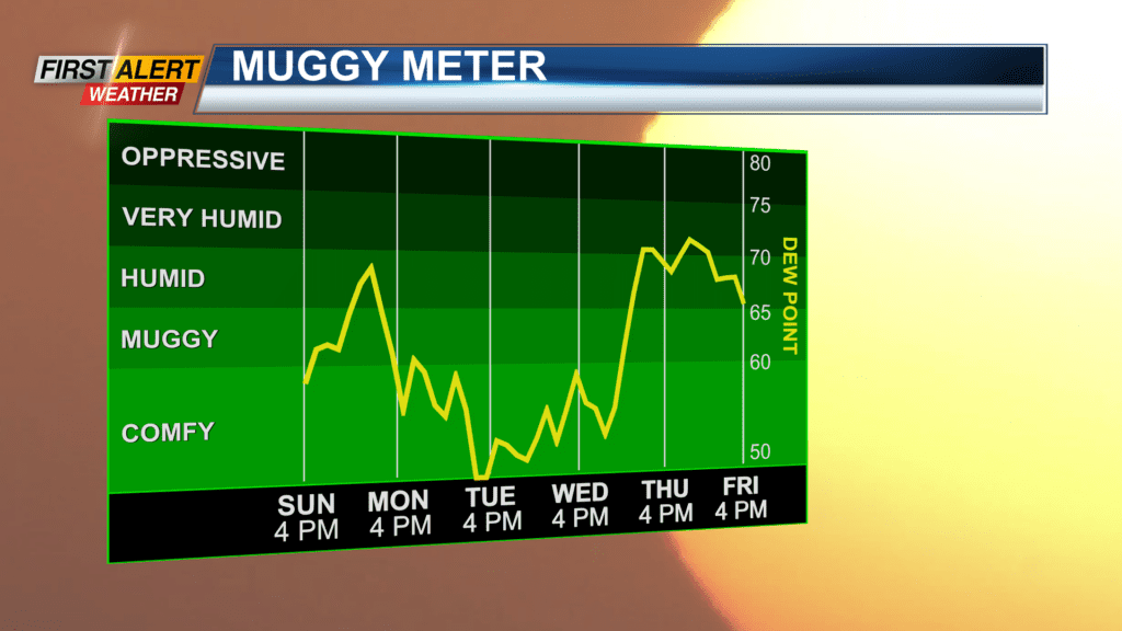
ROCHESTER, N.Y. – A southerly wind flow has produced increasing amounts of heat and humidity for Western New York. Sunday was the warmest day in almost two weeks for Rochester. However, it will not last as a cold front will cross the area Monday and this will serve to suppress the heat and humidity for the start of the work week.
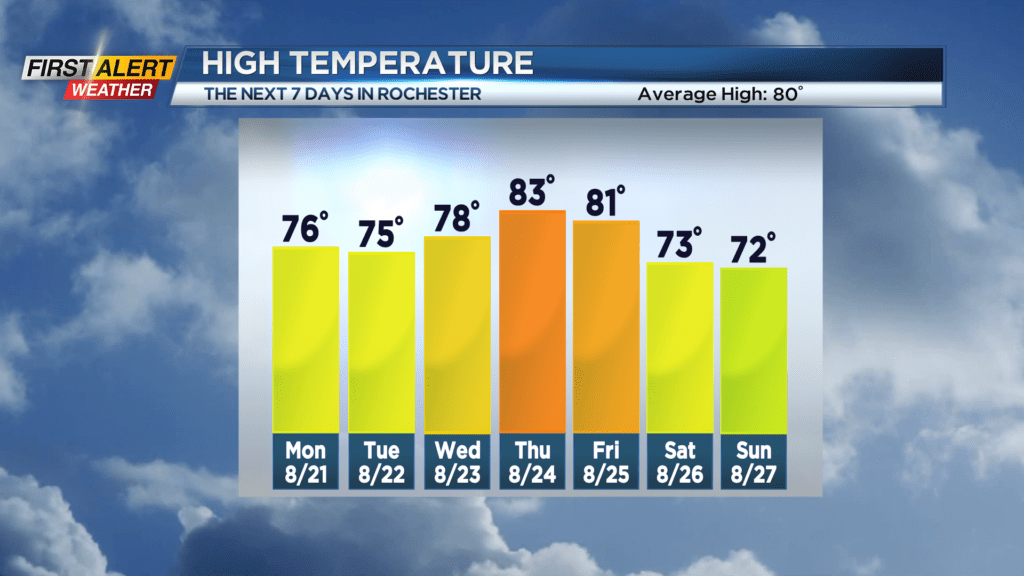
Sunday night look for skies to become mostly cloudy. It will not be as cool as last night with the low temperature in the middle 60s. Monday will bring morning clouds with just a small chance of passing sprinkles of rain. We should see more sunshine developing later in the afternoon. The humidity will drop throughout the day with the temperature reaching a more comfortable 76 degrees. Tuesday will feature some patchy clouds for the morning, then bright sunshine for the afternoon. Again, low humidity will make for a pleasant day with the high temperature in the middle 70s. Wednesday you can expect more of the same with sunny skies and the mercury rising into the upper 70s.
Stay tuned to News 10NBC First Alert weather for updates on the forecast.