First Alert Forecast: Switching your sunglasses to the umbrella
[anvplayer video=”5149868″ station=”998131″]
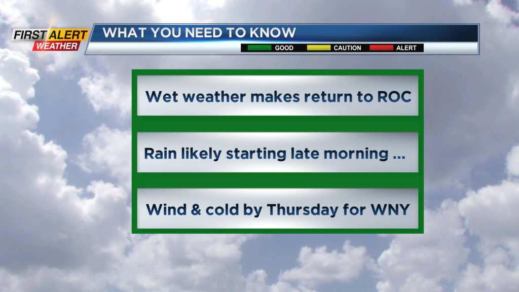
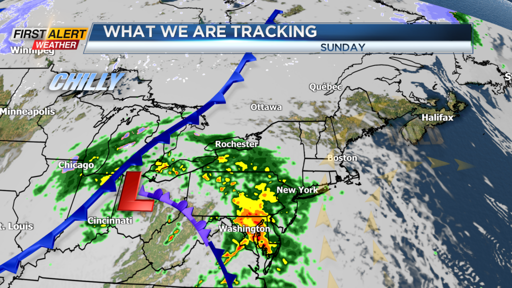
ROCHESTER, N.Y. – A high pressure system provided clear skies and pleasant temperatures for Western New York today. However, a storm racing in from the middle Mississippi Valley tonight will track right over Rochester for Sunday. This will bring periods of rain for Sunday with much cooler weather for later Sunday night and Monday.
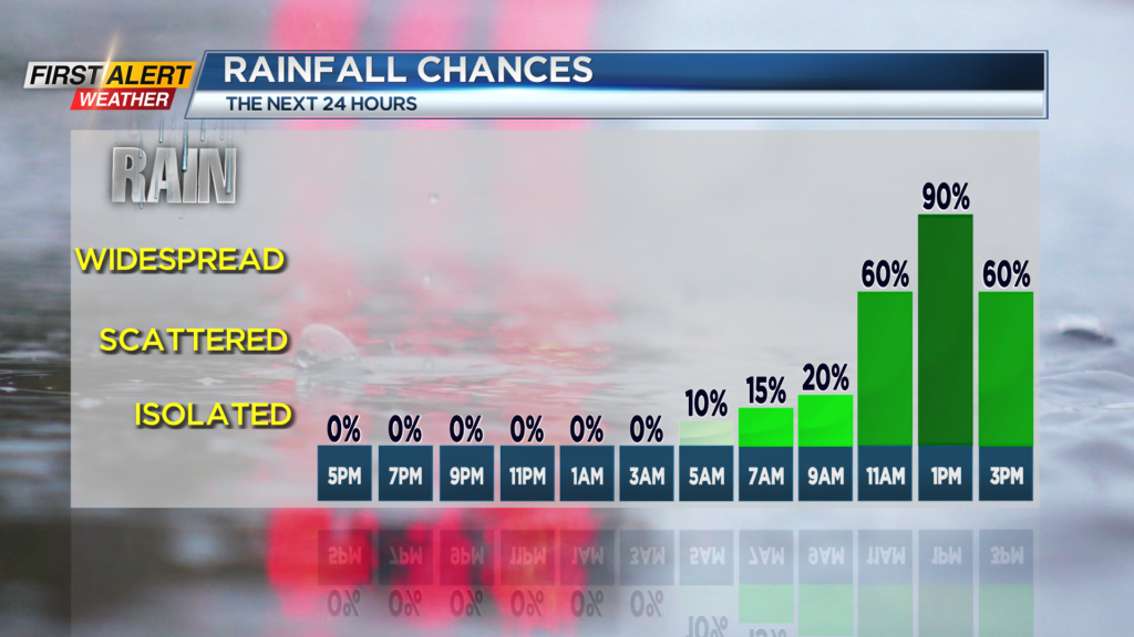
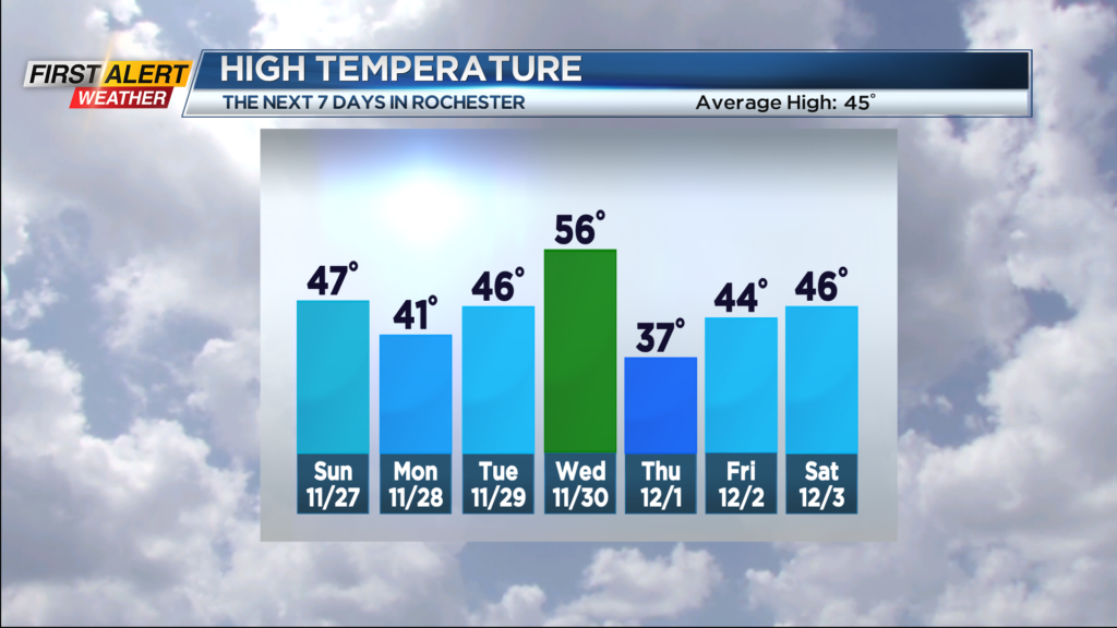
Tonight look for clear, starlit skies during most of the evening, then clouds will slowly increase after midnight. The low temperature will be in the upper 30s. Sunday should begin with dry weather, but rain will by late morning. The rain could be steady at times during the afternoon with the high temperature in the upper 40s. Monday night the rain will taper to scattered showers and as it turns colder any remaining precipitation may mix with wet flurries in the higher elevations. The low temperature is expected to be near 33 degrees. Tuesday will feature a mix of clouds and limited sunshine with the high temperature In the mid-40s.
Occasional rain will return again by Wednesday with temperatures in the middle 50s. Wednesday and Wednesday night, a strong low pressure system will track through the upper Great Lakes bringing sharply colder weather with increasing winds for Thursday. At this time, the News 10NBC First Alert meteorologists have not issued a yellow alert, but we continue to watch the intensity of wind speeds as there is the potential for the wind to gust near 50 mph or higher.
Stay tuned to News 10NBC First Alert for any updates to the forecast.