First Alert Forecast: Tailgating forecast
[anvplayer video=”5196055″ station=”998131″]
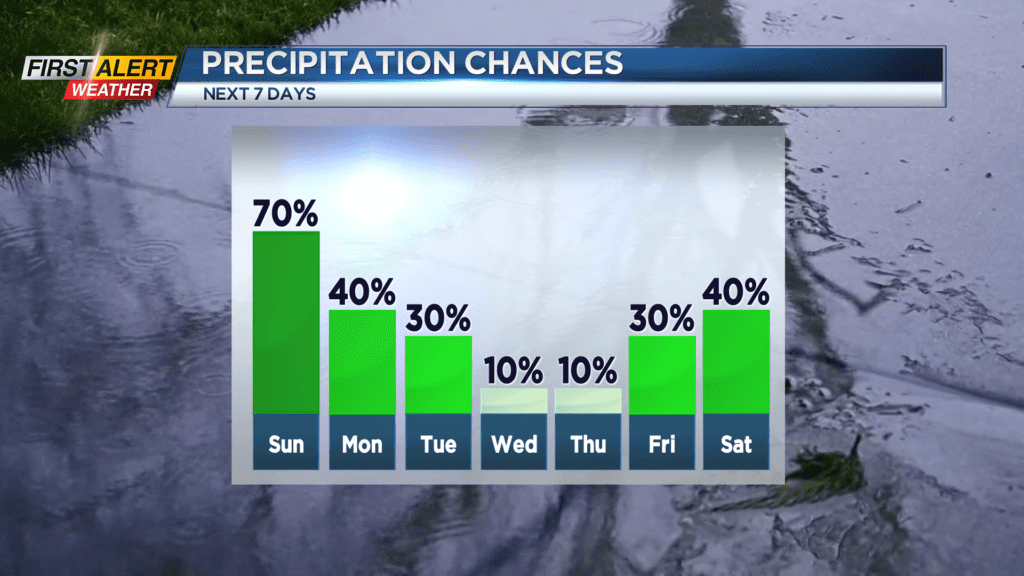
ROCHESTER, N.Y. – As expected, a widespread rainfall eventually moved into Western New York on Saturday. This rain was produced by a low-pressure system located over Ohio and Pennsylvania and, over the next 24 hours, this storm will slowly move off the east coast. However, a very cool northerly wind flow will continue for the remainder of the weekend and as a result bring occasional lake effect rain showers though Sunday.
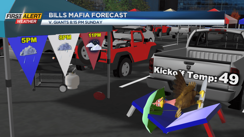
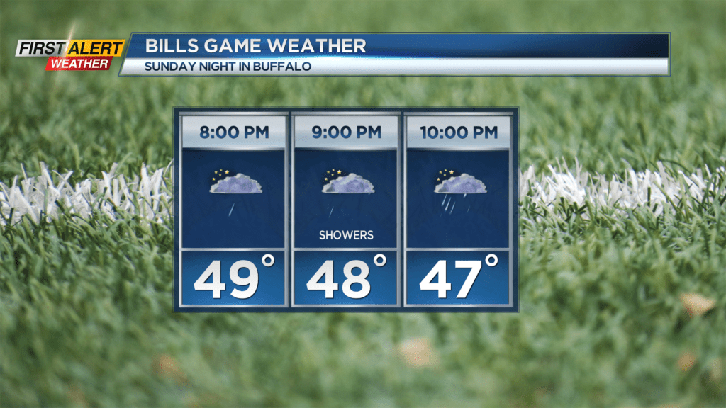
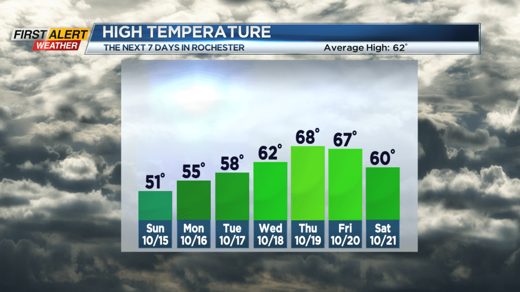
Saturday night, look for passing light rain showers. These showers should slowly taper during the overnight. The low temperature will be in the upper 40s. Sunday will unfortunately be another chilly, damp day for Rochester. More light showers are likely as the temperature will only reach the low 50s. If you are heading to Highmark Stadium in Buffalo to watch the Bills for Sunday night, there should be less rain during gametime, but scattered sprinkles or a light shower is still possible. The temperature will be falling though the 40s. Monday we will keep the gray skies with a few more spotty showers – especially east of Rochester. The high temperature will only reach the middle 50s.
This will be a slow-moving weather pattern, so any significant improvement will likely not happen until Wednesday and Thursday.
Stay tuned to New 10NBC First Alert weather for updates on the forecast.