First Alert Forecast: The Change of Seasons in the Forecast and the Calendar
[anvplayer video=”5135736″ station=”998131″]
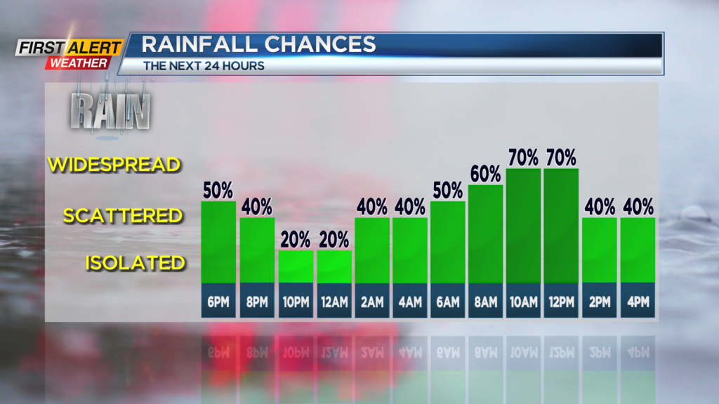
ROCHESTER, N.Y. – Some unsettled weather in the form of showers and thunder has returned to Western New York. A weak area of low pressure system will be passing just to the north of Rochester during the next 24 hours. As a result, the chance of rain will be highest for Monday morning right into the early afternoon when there is the potential for a few downpours. High Pressure will arrive by later Tuesday and early Wednesday which will bring a return to dry weather.
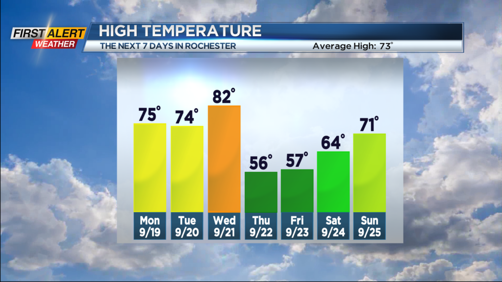
Tonight look for any lingering showers for the early evening to come to an end and then chance of another shower after midnight. The low temperature will be in the middle 60s. Monday expect occasional showers and thunderstorms into the mid-afternoon. A few downpours will be possible during that time. It will not be as warm at today with the high temperature in the low 70s. Tuesday should be mainly dry with partial sunshine. Again the temperature is expected to be in the low to middle 70s. Wednesday is the last full day of the summer season and it will feel like summer. The mercury will rise into the low 80s. Most of the day will be dry, but a thundershower will be possible later in the afternoon with more showers and thunderstorms expected Wednesday night.
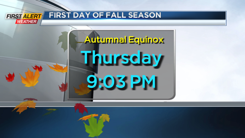
The official start of the fall season is Thursday. The autumnal equinox is at 9:03 PM. Often it can be said that the weather does not match the calendar, but this year it will. Thursday will be windy and sharply colder with the temperature reading only in the upper 50s. In addition, there will be the chance of occasional showers.
Stay tuned to News 10NBC First Alert for any updates to the forecast.