First Alert Forecast: The end to the mid-summer heat is in sight
[anvplayer video=”5191256″ station=”998131″]
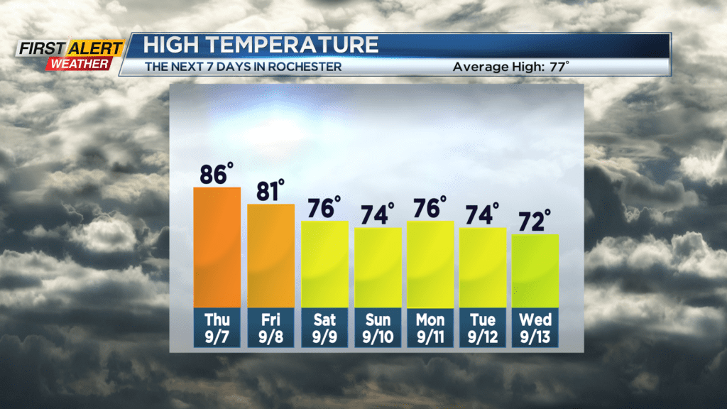
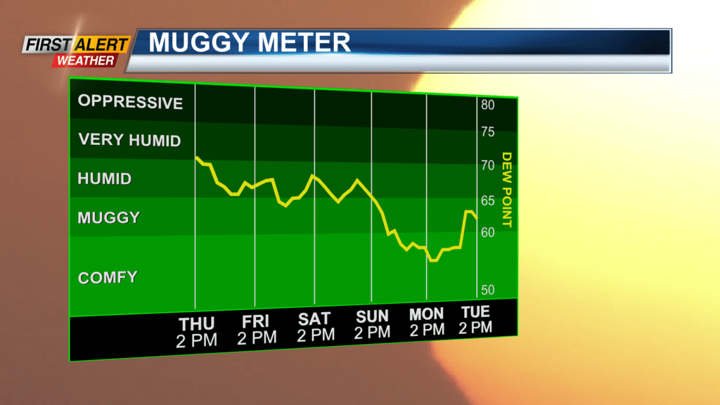
ROCHESTER, N.Y. – Western New York has experienced five days in a row of unseasonably warm temperatures with the pinnacle of the heat wave arriving Wednesday. The combination of the heat and humidity pushed the heat index into the mid to upper 90s for this Wednesday afternoon. A cold front is slowly pushing across the great lakes, and this will bring some showers and thundershowers to the Rochester area. This will effectively bring an end to the heat wave and usher in more seasonably and reasonable temperatures in the coming days.
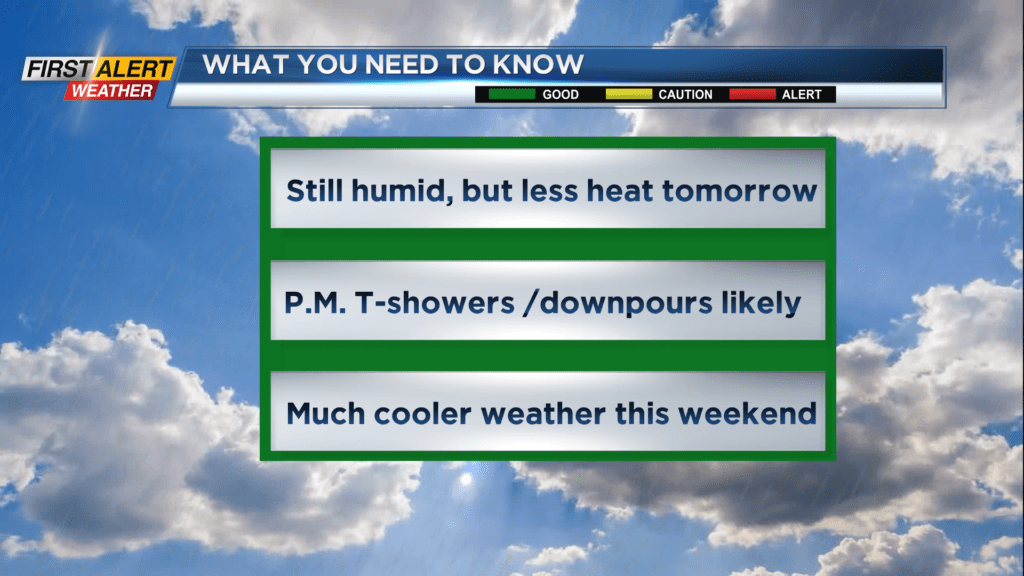
Wednesday night look for another warm and muggy night. There will be the chance of isolated thundershowers Wednesday night with the low temperature near 70 degrees. Thursday will bring partial sunshine with the chance of a few showers and thunderstorms, especially by the afternoon. It is still going to be rather humid, but much less heat is expected with the temperature rising into the middle 80s. Friday another thundershower is possible with the temperature in the lower 80s. The weekend will be much cooler with temperatures expected to be in the mid-70s. However, a shower is possible on Saturday and more frequent showers likely for Sunday.
Stay tuned to News 10NBC First Alert weather for updates on the forecast.