First Alert Forecast: The Signs of Change are in the Air
[anvplayer video=”5137142″ station=”998131″]
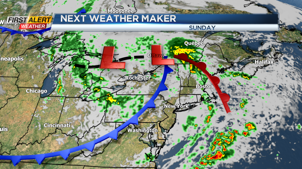
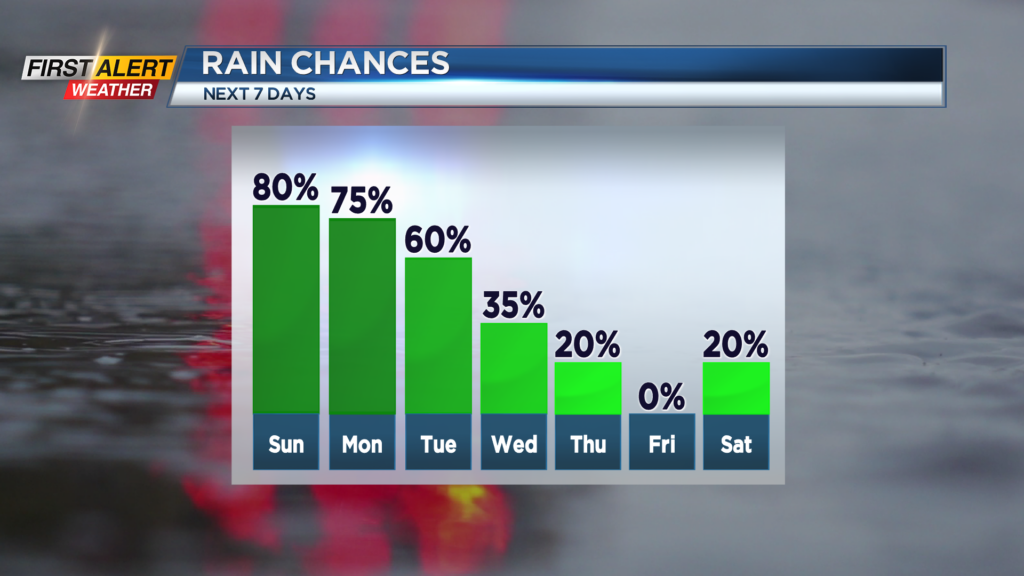
ROCHESTER, N.Y. – It was a beautiful September day in Western New York, but the weather pattern is set to change and it will not be a change for the better. An area of low pressure is set to move just to the north of Rochester in the coming days. This storm will slow down and stall-out for the first half of the week. This will bring occasional rain for at least the first half of the week, which will lead to damp and dreary conditions through Wednesday.
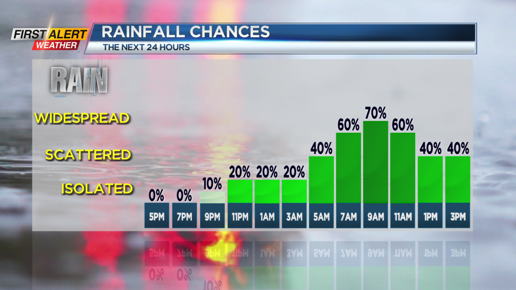
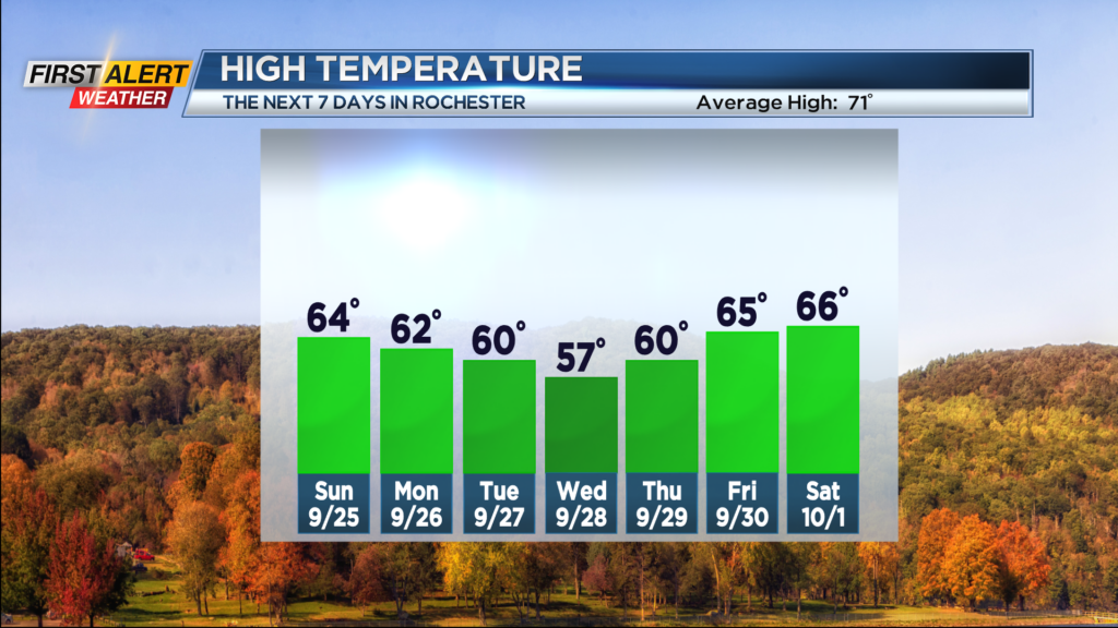
Tonight look for mostly cloudy skies. It should be dry for the evening, but showers will develop after midnight. The low temperature will be near 52 degrees. Sunday brings occasional showers with the chance of thunder. The temperature will rise into the lower to middle 60s. Monday will produce more showers and again the chance of some thunder. The temperature will remain in the lower 60s. This kind of weather will be a “running theme” this week with more showers likely for Tuesday and Wednesday. The temperature for both days will be within a few degrees of 60.
This low pressure system will finally begin to move into northern New England by the middle of the week. As a result, conditions will improve rapidly for the second half of the week. Thursday and Friday you can expect partly to mostly sunny skies. The temperature will be near 60 on Thursday and closer to the middle 60s for Friday. It should be a dry start to the weekend, then showers may return by Saturday night and Sunday.
Stay tuned to News 10 NBC First Alert weather for updates on the forecast.