First Alert Forecast: The temperature will go from one extreme to another
[anvplayer video=”5154554″ station=”998131″]
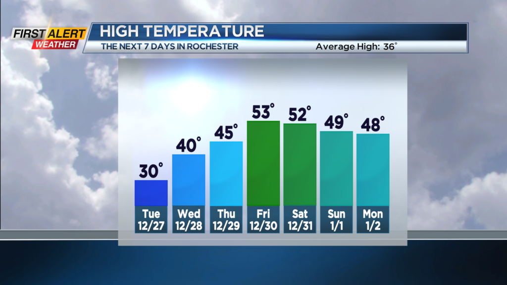
ROCHESTER, N.Y. – It has been a significant wave of very cold weather for Western News York. In fact, the Rochester Airport has had a below normal temperature for the last 14 out of 16 days. Christmas Day was the coldest in more than twenty years. However, there will be a significant change in the weather pattern in the coming days and it appears there will be a swing of almost 30 degrees by News Year’s Eve.
Tonight look for mainly cloudy skies with the chance of a few lake flurries west of Rochester. It will be another very cold night with a low near 19 degrees. Any lingering flurries west of Rochester will come to an end for early Tuesday. Then a mix of clouds and limited sunshine for the afternoon. The high temperature will be near 30 degrees. Wednesday will turn noticeably warmer with the high temperature near 40 degrees. The day should feature a mix of clouds and sunshine. The warming trend continues for Thursday with the high in the middle 40s and then reaching into the lower 50s on Friday. Expect a few spotty rain showers on Friday.
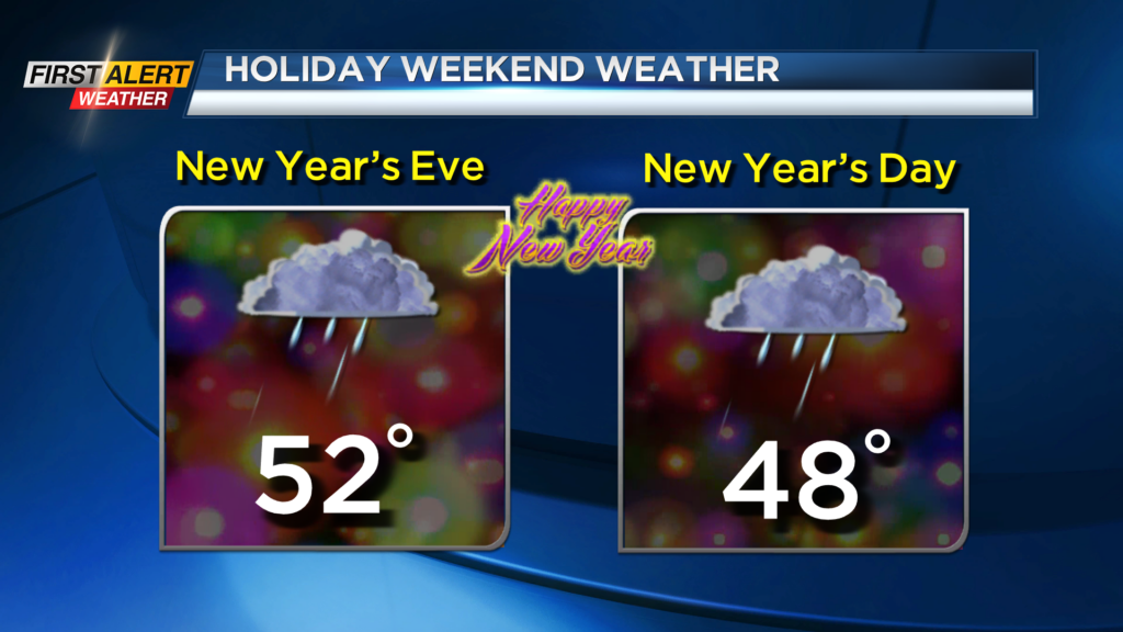
No sign of winter for New Year’s Eve and New Year’s Day. It will continue to be warmer with the mercury rising to within a few degrees of 50, but a few rain showers will be possible.
Stay tuned to News 10NBC First Alert weather for updates on the forecast.