First Alert Forecast: The winds of change will blow across western New York
[anvplayer video=”5150309″ station=”998131″]
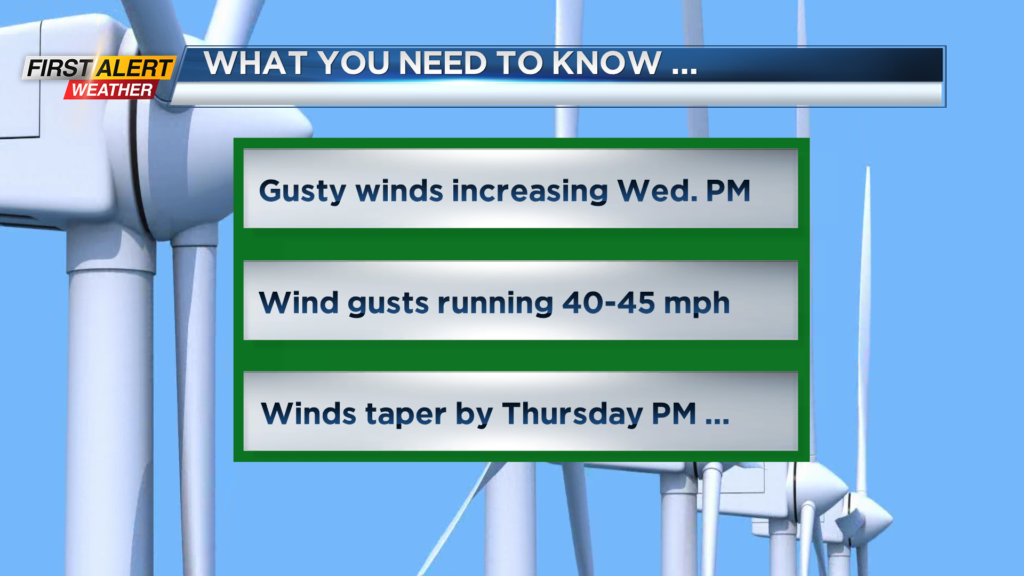
ROCHESTER, N.Y. – Strong low pressure system cutting through the upper great lakes in association with a cold front will bring some rapid changes in our weather over the next 24 hours. At this time, it appears the wind speeds should stay below the criteria for any damage across the area, but there will be a quick change in the temperature with rain changing to snow showers.
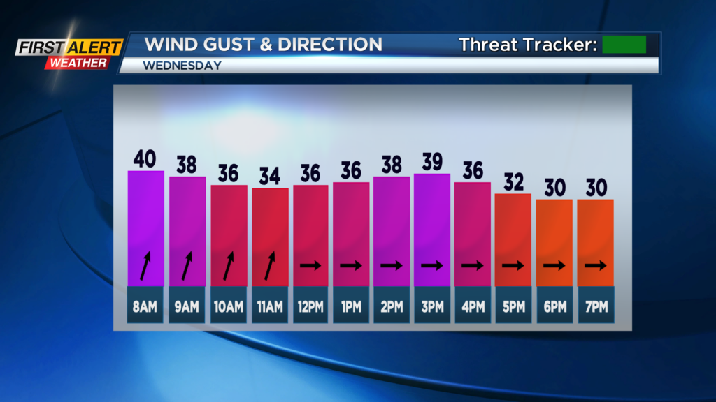
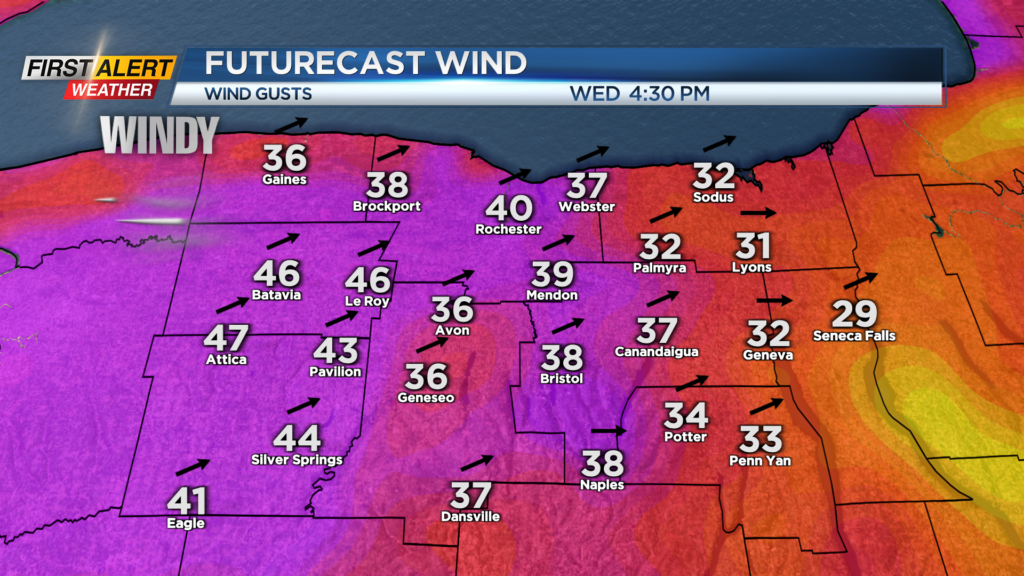
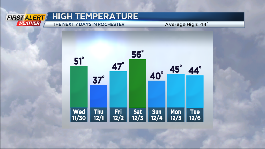
Tonight, look for mostly cloudy skies. It will be dry for the evening, then rain showers will arrive towards morning. The temperature will fall to within a few degrees of 40 and then the temperature will rise overnight. Look for more rain for Wednesday morning, before it tapers by the afternoon. It will be a mild start with the temperature near 50 degrees. However, the temperature will fall rapidly during the afternoon and the winds will gust to near 45 mph. At this point, the News10NBC First Alert meteorologists have not issued a yellow alert, as winds should stay below damage criteria. The windy conditions will continue Wednesday night with Lake Erie snow showers south and west of Rochester. Several inches of accumulation will be likely in Wyoming County, all other areas should see less than an inch. Thursday the flurries and the wind will taper, with the temperature remaining in the middle 30s.
Stay tuned to News 10NBC First Alert for updates on the forecast.