First Alert Forecast: The winter season holds on a little longer
[anvplayer video=”5166158″ station=”998131″]
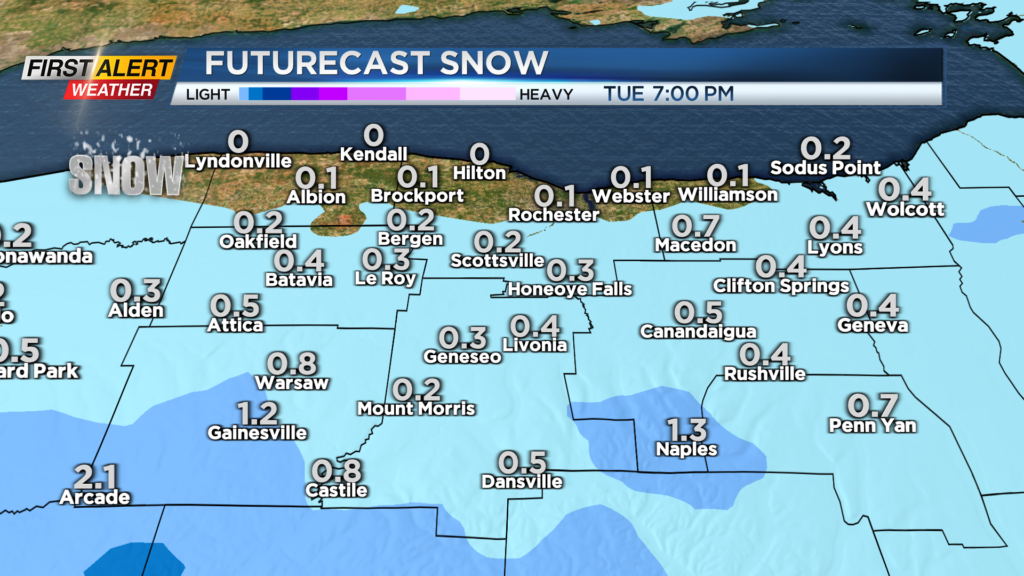
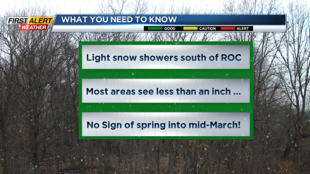
ROCHESTER, N.Y. – A weak low-pressure system will move from west to east passing just south of the Pennsylvania border for the overnight. However, most of the snow will be south of routes 5 and 20. As a result, most of the Rochester area will see little or no accumulation. Portions of the Southern Tier could see several inches, especially in the higher elevations. If you are looking for spring-like weather in the near term – you will be sadly disappointed. In fact, it is likely that unseasonably cold weather will be visiting Western New York for at least the next 10 days.
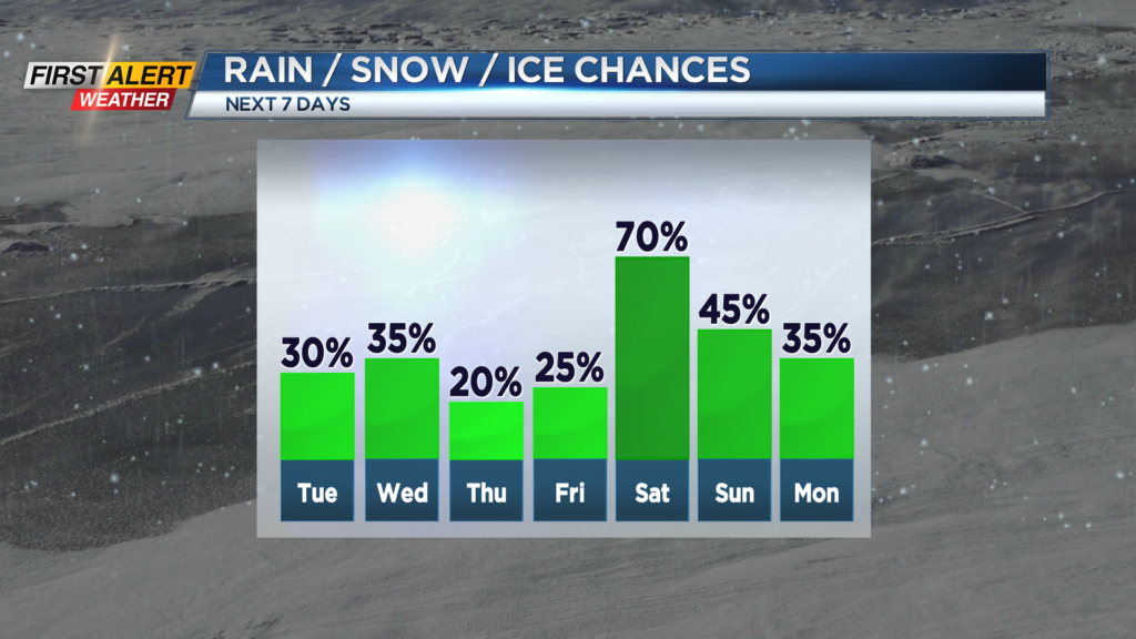
Tonight, look for cloudy skies and flurries which will be mainly south of Rochester. The temperature will fall into the upper 20s. Tuesday the skies could brighten for the early morning, otherwise it will be gray with flurries and snow showers developing for later in the afternoon. It will be a gusty wind with the high temperature in the middle 30s. Wednesday we will see more flurries or snow showers. It will be unseasonably cold with the high temperature in the low 30s. The chill will remain in the air again for Thursday with the mercury only rising into the lower 30s.
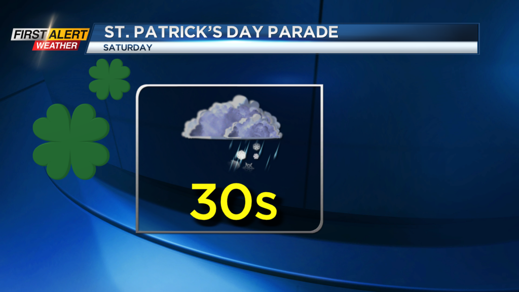
Friday our next storm will be approaching Western New York. Most of the day will be dry, but snow showers will arrive by evening with maybe a small accumulation for Friday night. It looks like a mix of rain and wet snow for Saturday. Probably not a pleasant day for the St. Patrick’s Day parade downtown. The temperature will remain in the 30s.
Stay tuned to News 10NBC First Alert weather for updates on the forecast.