First Alert Forecast: The winter season takes a vacation
[anvplayer video=”5154699″ station=”998131″]
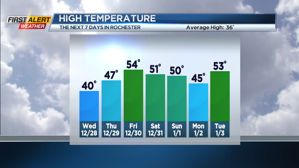
ROCHESTER, N.Y. – A fundamental change in the overall weather pattern is coming to Western New York in the coming days. Tomorrow, for the first time in more than four days, the temperature will be climb above freezing. This will mark the start of a long period of unseasonably warm weather which will last at least into the first week of January.
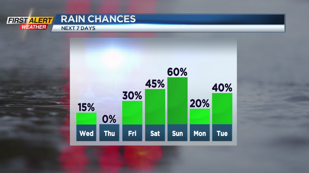
Tonight look for some lingering Lake Erie flurries mainly west of Rochester. The temperature will fall into the lower 20s and then the temperature will begin to rise later tonight. Wednesday will bring more clouds, but skies may begin to brighten during the afternoon. The high temperature will be near 40 degrees. Thursday the warming trend will continue with the mercury rising to the upper 40s. Expect a few breaks of sunshine at least in the morning. Friday will be mainly cloudy with the chance of a spotty rain shower late in the afternoon. As the snow melts, there could be some patchy fog developing. The temperature will rise into the low to middle 50s.
The mild weather will continue through News Year’s Eve and New Year’s Day. Again, both day will have the temperature near 50 degrees. However, the probability of rain showers will increase for New Year’s Day.
Stay tuned to News 10NBC First Alert for any forecast updates.