First Alert Forecast: Will the Nice Weather Hold for the Unofficial End of Summer?
[anvplayer video=”5132322″ station=”998131″]
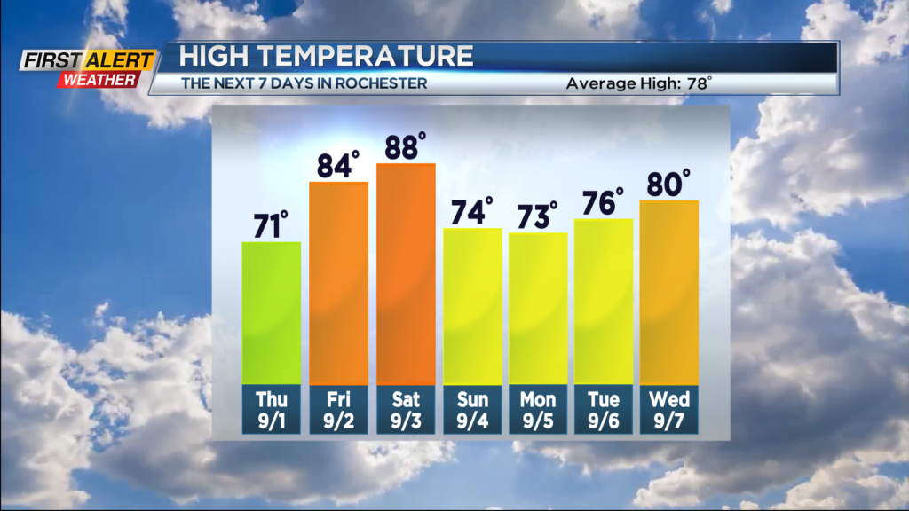
ROCHESTER, N.Y. – We had cold front pass through the great lakes last night and there is a second cold front set to move through the area for tonight. These fronts are bringing in progressively cooler temperatures and lower humidity to Western New York. In fact, there could be the hint of fall in the air for Thursday morning as the temperature will start in the 50s with the temperature spending most of the day in the 60s. However, this cooler weather will not last as summer will rally for the start of the holiday weekend.
Tonight, as the cold front approaches, there will be the small chance of a spotty shower for the evening. Otherwise look for partly cloudy skies and eventually a low temperature in the middle 50s by morning. Thursday will start with some patchy lake clouds and just the slight chance of a sprinkle. Then skies will become sunny with the high temperature near 71 degrees. Friday should be a beautiful day with lots of sunshine, lower humidity and a warmer temperatures. The mercury will rise into the low to middle 80s.
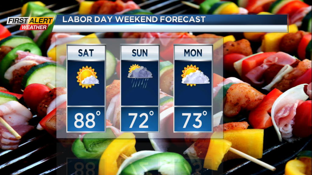
The heat is on for Saturday with unseasonably warmth as the temperatures will climb into the upper 80s. Expect the sunshine to continue for the start of the holiday weekend. Then you may have to adjust a your outdoor plans for Sunday as few showers and possibly a thunderstorm will be possible. The temperature will fall to the lower 70s. Then our weather should dry-out for Labor Day as skies will become partly sunny. Again the mercury will stay in the lower 70s.
Stay tuned to News 10NBC First Alert for updates on the forecast.