First Alert Forecast: Winter extremes finally begin to relent
[anvplayer video=”5154467″ station=”998131″]
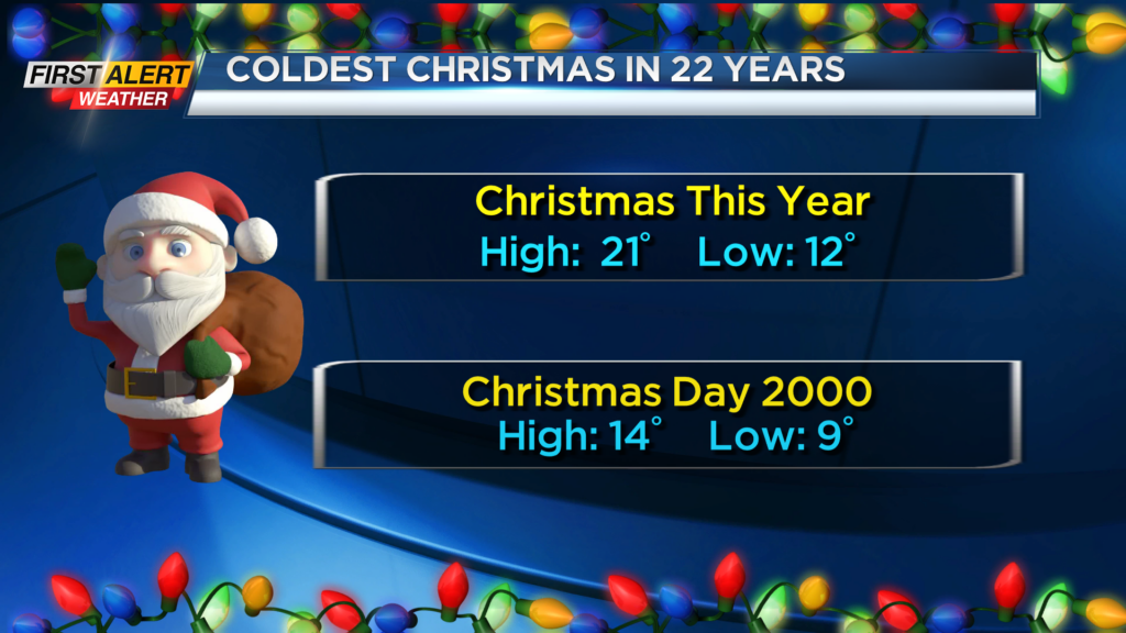
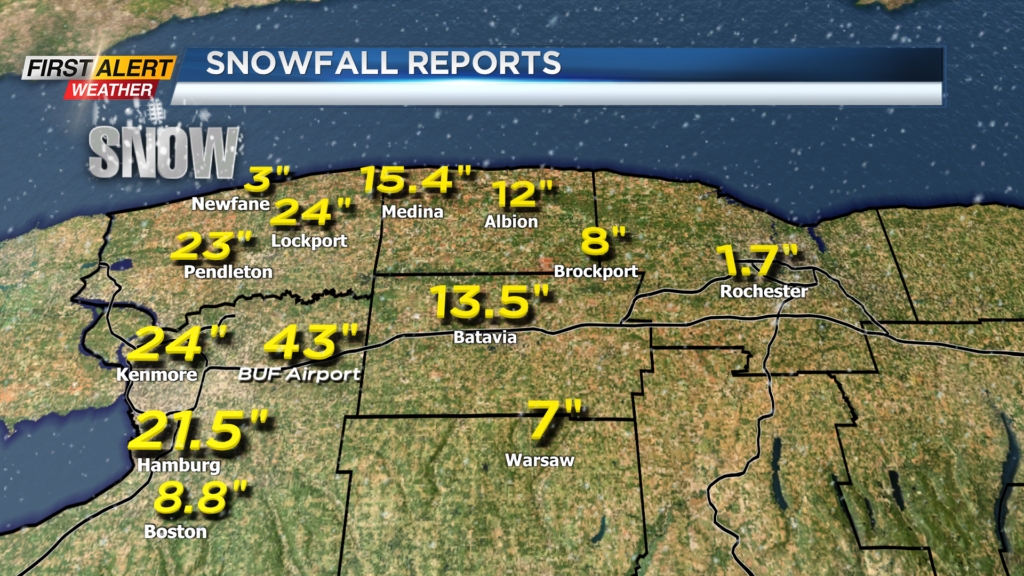
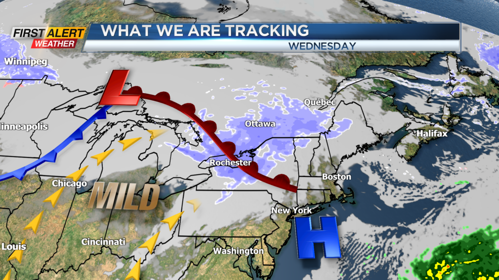
ROCHESTER, N.Y. – It was the coldest Christmas Day in 22 years for Rochester. The Lake Erie lake squall has been very persistent for the western counties where snow continues to fall in portions of Genesee, Wyoming and Erie Counties. During this last few days the Buffalo International Airport has measured an amazing 43 inches of snow. However, the News 10NBC First Alert meteorologists see a significant change coming in the weather pattern. In the coming days, and for the remainder of the year, noticeably warmer weather will make a return.
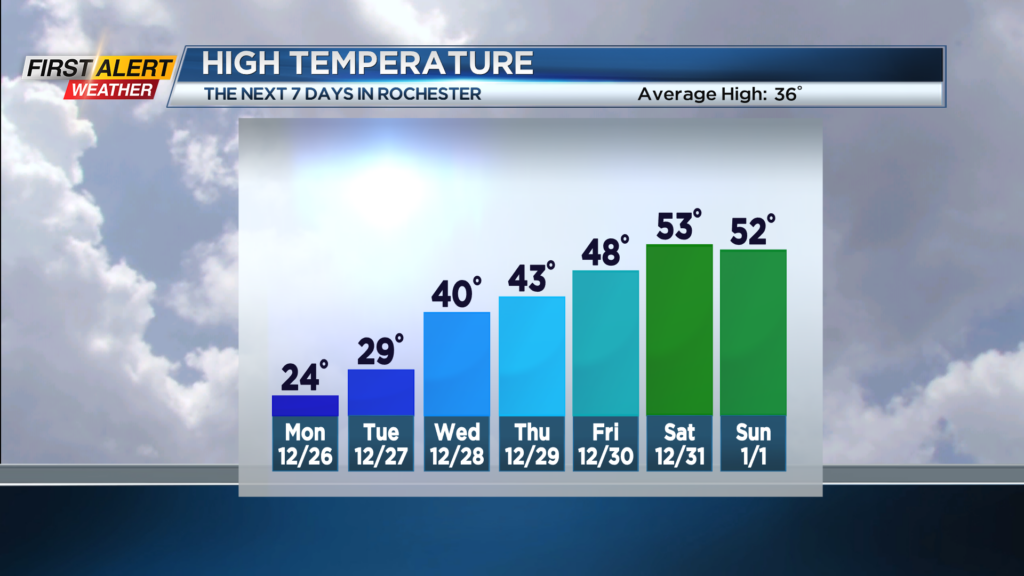
Tonight look for passing flurries. Any additional accumulation will be limited to just an inch or two in the western counties. The low temperature will be in the lower teens and skies should become partly cloudy after midnight. Monday will bring a few breaks of sunshine for the morning with more clouds by the afternoon. It will not be as harsh with much less wind and temperature in the middle 20s. Tuesday will feature breaks of sun and few flurries west of Rochester. The temperature will be approaching 30 degrees. Wednesday maybe a few sprinkles or a flurry for the morning, but it should be dry for the afternoon and eventually the temperature will reach near 40 degrees. Thursday will bring a few more spotty rain showers with the temperature in the middle 40s.
It appears the warming trend will continue into the New Year’s Weekend. The temperature could be into the 50s, but few passing rain showers will be likely.
Stay tuned to News 10NBC First Alert Weather for updates on the forecast.