First Alert Forecast: Winter-Like Gales Coming to an End
[anvplayer video=”5148960″ station=”998131″]
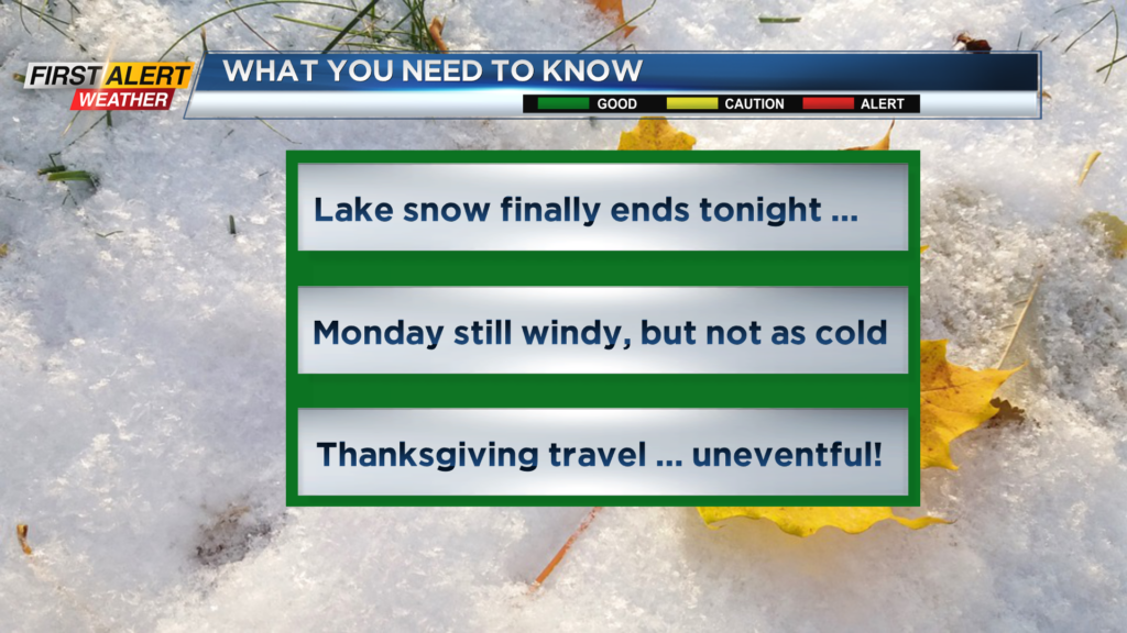
ROCHESTER, N.Y. – After a historic episode of lake effect snow for the Buffalo area, the winds of change are blowing across Western New York. Lake Erie snow will slowly shut down later this evening, but Lake Ontario snow squalls will continue and with a more west to northwest wind flow. Heavy lake squalls will continue just north of Syracuse. Once again, Rochester will be spared the deep snow, but the east end of Wayne County should see some accumulation for the overnight.
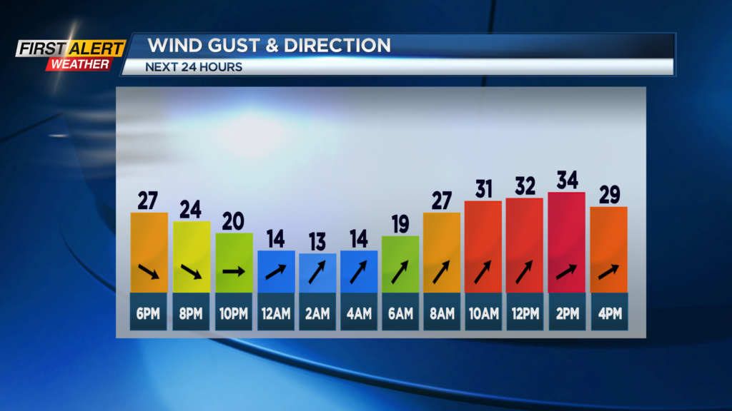
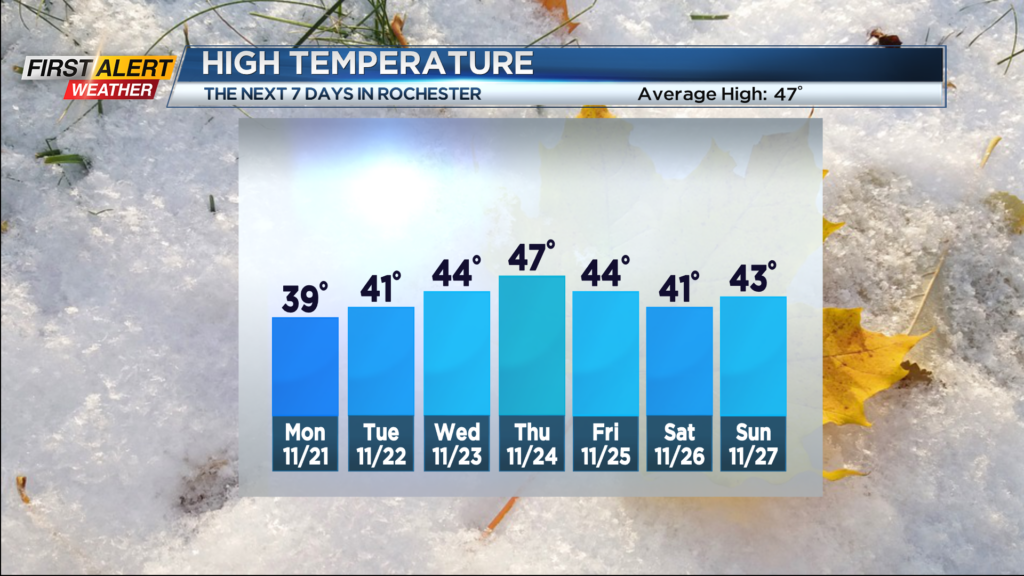
Tonight look for lake flurries near Route 104 with little or no accumulation expected. However, the northeast corner of Wayne County just east of Sodus should see an accumulation of 2 to 5 inches. Otherwise most folks will find just patchy clouds as the winds diminish overnight and a low near 20 degrees. Monday will bring a mix of clouds and limited sunshine. It will turn windy again with gusts near 35 mph and the high temperature near 39 degrees.
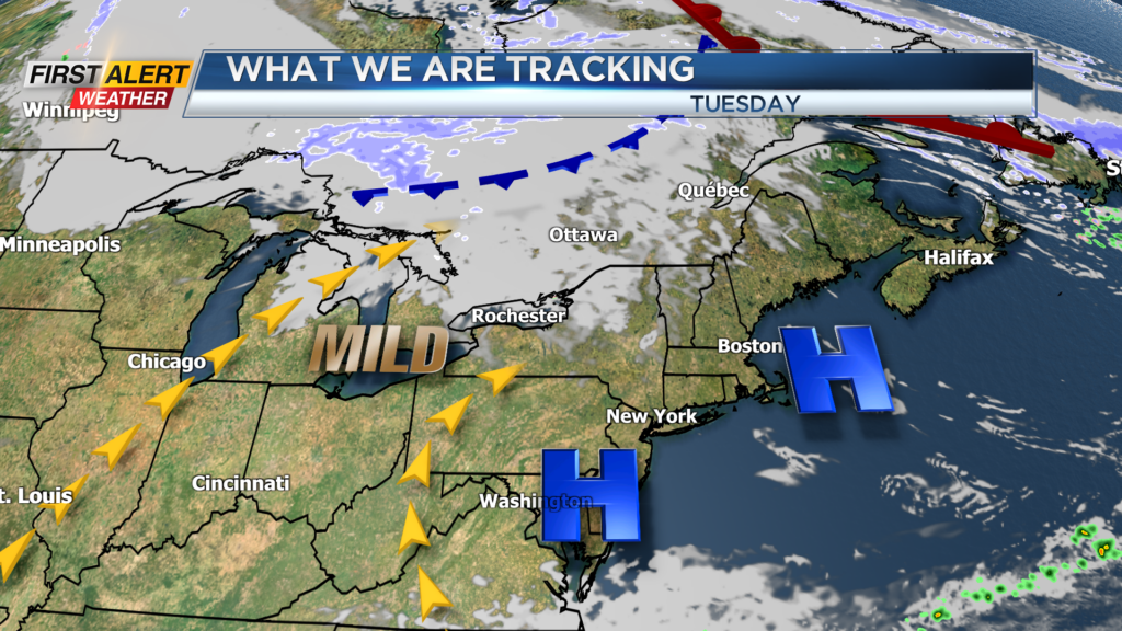
Good news for holiday travelers as generally calm weather will return to the Great Lakes. Tuesday, Wednesday and Thanksgiving Day will bring partly to mostly sunny skies. The temperature will moderate to near 40 degrees for Tuesday and into the middle 40s for Wednesday and Thursday. However, conditions will turn inclement on Friday and Saturday as rain will be developing. That rain may mix with wet snow later on Saturday.
Stay tuned to News 10 NBC First Alert for updates on the forecast.