First Alert Forecast: Yellow Alert continues for severe weather with the main focus south of ROC
[anvplayer video=”5188513″ station=”998131″]
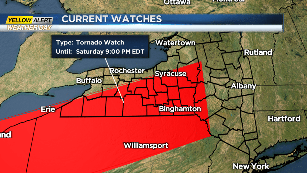
ROCHESTER, N.Y. – All day the atmospheric ingredients for severe thunderstorms have been a concern. However, the area with the greatest focus of severe storms has been across the southern tier and portions of the Finger Lakes. As a result, the National Weather Service has issued a tornado watch until 9:00 p.m. for southern portions of Livingston and Ontario Counties. This watch extends into central New York and northern portions of Pennsylvania. The News 10NBC First Alert meteorologists will likely continue a yellow alert for our area until a cold front passes by mid to late evening. At that time, behind the front, a more stable airmass will diminish the threat of severe weather for the remainder of the weekend.
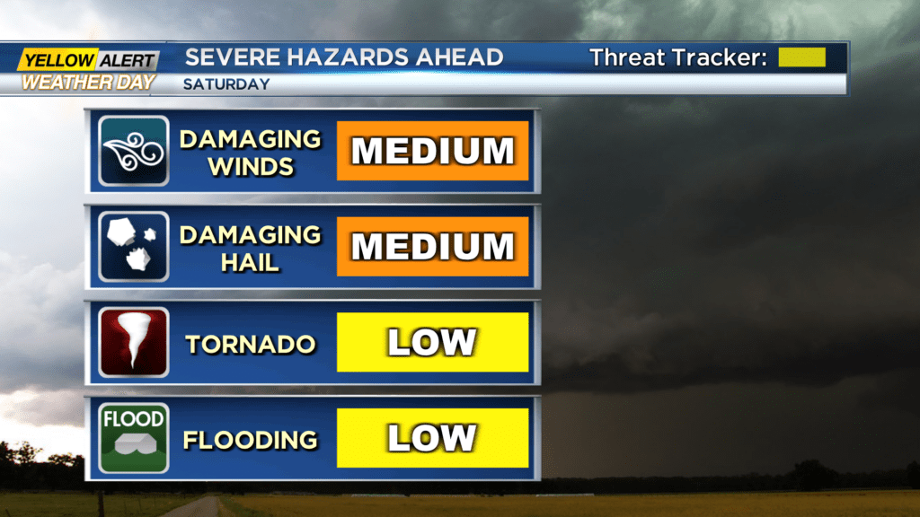
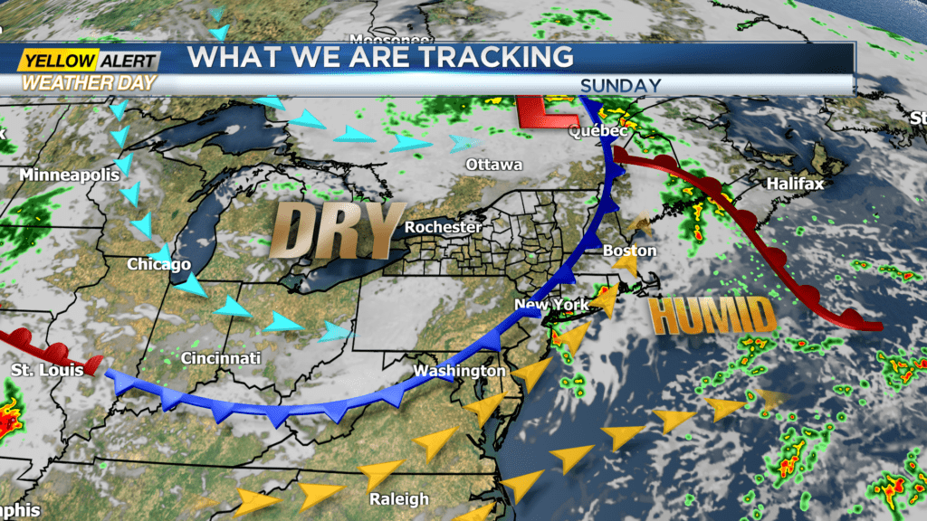
Saturday night there is the continuing threat until mid-evening for a strong to severe thunderstorm. Again, the greatest likelihood for severe weather – including large hail, damaging winds, torrential rain, and an isolated tornado – is for communities south of Rochester. Later Saturday night any lingering showers and thunderstorms will come to an end. The low temperature will be near 64 degrees. Sunday will bring a return to calm weather with mostly sunny skies. Lower humidity can be expected with the temperature rising into the upper 70s. Monday will feature more sunshine and comfortable weather. Again, the mercury will rise into the upper 70s.
Stay tuned to News 10NBC First Alert Weather for updates on the forecast.