First Alert Forecast: Yellow Alert ends as potential for severe weather diminishes
[anvplayer video=”5188552″ station=”998131″]
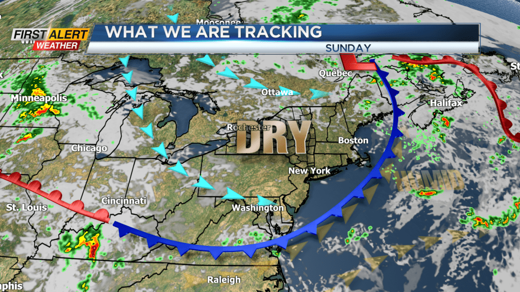
ROCHESTER, N.Y. – Earlier Saturday the atmospheric ingredients for a severe thunderstorm were a significant concern. However, most of the severe weather was confined to the southern tier of New York State and thus far no storm reports have been indicated in the seven-county area. The exception was portions of southern Yates and Steuben Counties where there were numerous power outages and trees down. There is still the chance of passing thundershower Saturday night, but it appears the risk of severe weather is significantly reduced. As a result, the News 10NBC First Alert meteorologists have discontinued the yellow alert for our area for the remainder of the overnight. In addition, a cold front will arrive with more a stable airmass which will bring lower humidity for the remainder of the weekend.
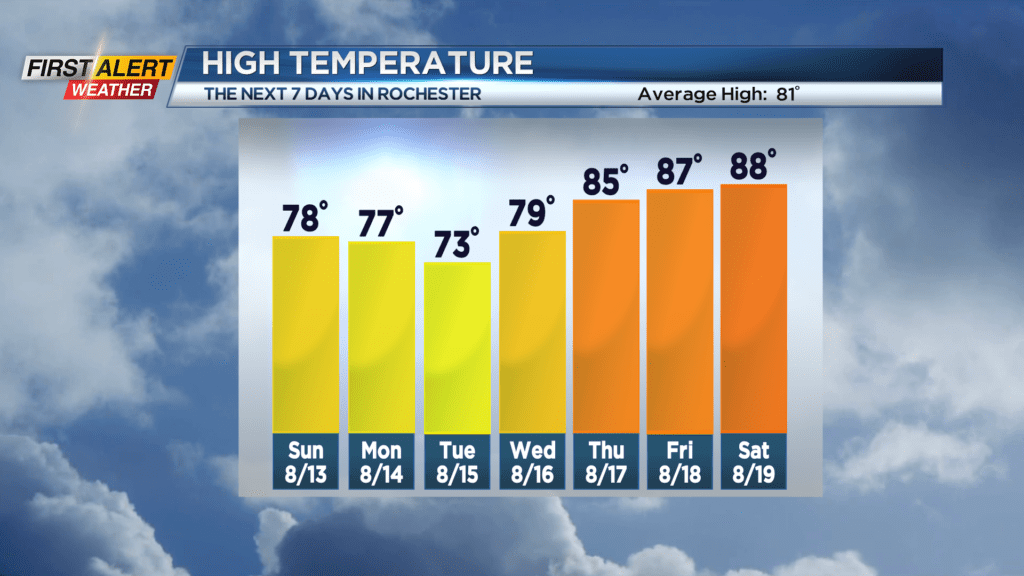
Saturday night, there is the hit or miss thundershower. And then later Satruday night any lingering showers will come to an end. The low temperature will be near 64 degrees. Sunday brings a return to calm weather with mostly sunny skies. Lower humidity can be expected with the temperature rising into the upper 70s. Monday will feature more sunshine and comfortable weather. Again, the mercury will rise into the upper 70s. The next storm is taking shape for Tuesday when the next round of showers and thundershowers will be likely.
Stay tuned to News 10NBC First Alert Weather for updates on the forecast.