First Alert Forecast: Yellow Alert for later in the week due to ice threat
[anvplayer video=”5163688″ station=”998131″]
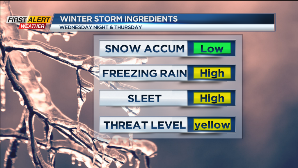
ROCHESTER, N.Y. – Calm and largely uneventful weather continues for Western New York for the next 48 hours. However, the News 10NBC First Alert weather team has issued a yellow alert for Wednesday night and Thursday for a potential icing threat for the Rochester area. This appears to be a large storm consisting of several low-pressure systems that will be located along a nearly stationary front to our south. There is greater confidence that this system will produce a widespread area of mixed precipitation with the greatest threat being freezing rain.
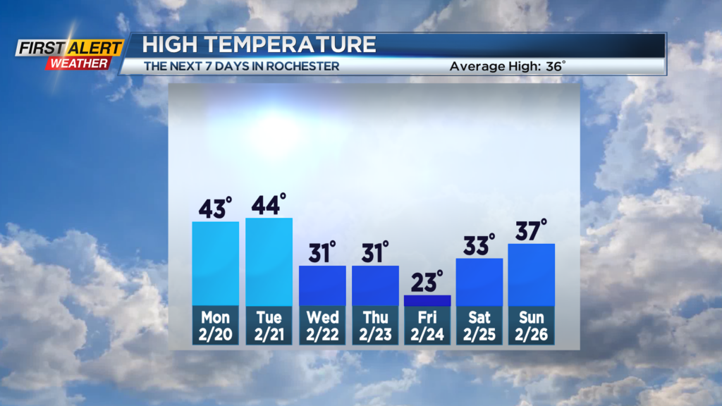
Tonight, look for mostly cloudy skies and for most of the night it will be dry. It will be rather mild for February with the low near 38 degrees. Monday there is the chance of passing rain shower and maybe a wet snow shower south of Rochester. Skies may brighten later in the afternoon. It will not be as mild with the mercury falling through the 40s and into the 30s.
Wednesday will start cloudy, but snow showers will develop during the afternoon. These snow showers will mix with sleet and freezing rain by the evening. The high temperature will be within a few degrees of 30. It appears that a mix of wintry precipitation is likely Wednesday night with a combination of snow, sleet and freezing rain. Early indications are that the greatest threat of ice accumulation will be south of Rochester. However, just a slight deviation in the position of the front could have a big impact on which communities will see the greatest amount of ice or snow. However, there is no doubt that there is the potential for icy roads, walkways, and even some isolated power outages. As a result, the News 10NBC First Alert meteorologists have continued a yellow alert for Wednesday night and Thursday.
Stay tuned to News 10NBC First Alert weather for updates to the forecast.