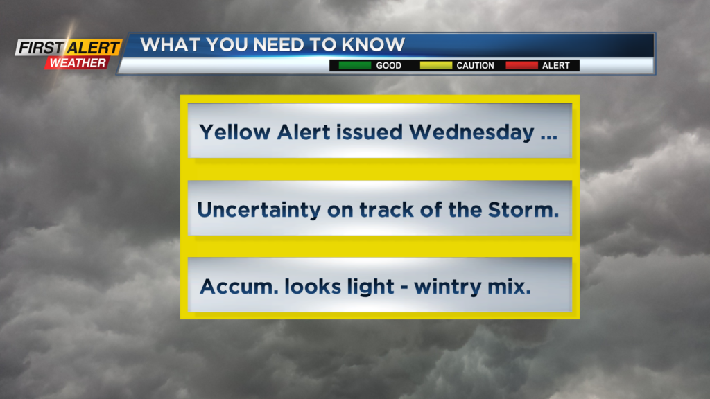
First Alert Forecast: Yellow Alert has been posted for Wednesday
[anvplayer video=”5158811″ station=”998131″]
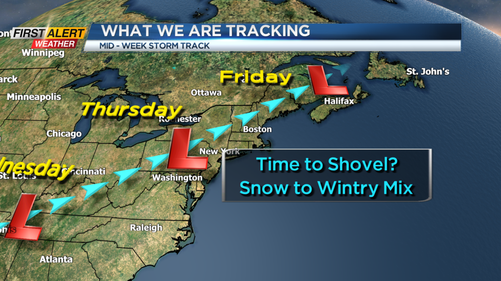
ROCHESTER, N.Y. – Two storms will impact Western New York this week. The first storm is now moving across the Ohio Valley and is currently producing a wet snowfall across the entire area for tonight and early Monday. The second storm is likely to be more significant as it nears Rochester by Wednesday. There are still some uncertainties on the exact track, temperature and the type of precipitation. None-the-less, there is sufficient concern on the local impact that the News 10NBC First Alert meteorologists have issued a yellow alert for Wednesday.
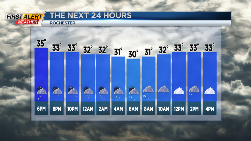
Tonight look for wet snow showers to taper to flurries by the middle to late evening. Accumulations should be limited to a coating to 2 inches for most of Western New York. Monday you can expect some lingering snow showers for the morning, with the chance of another coating to an inch. The high temperature will be near 34 degrees. Tuesday will feature gray skies with a passing flurries. There will be a gusty wind with the high temperature in the middle 30s.
As mentioned, Wednesday there is a News 10NBC yellow alert in effect. Look for wet snow, possible mixing sleet or rain through the afternoon. No doubt there is the potential for slippery conditions for the late afternoon commute with several inches of accumulation possible by Wednesday evening. The high temperature in the middle 30s. Wednesday night and Thursday will bring more snow showers with some additional accumulation likely. Gusty winds are likely for Thursday with the temperature falling into the 20s.
Stay tuned to News 10NBC First Alert for updates on the forecast.