First Alert Forecast: Yellow Alert posted for Wednesday
[anvplayer video=”5171038″ station=”998131″]
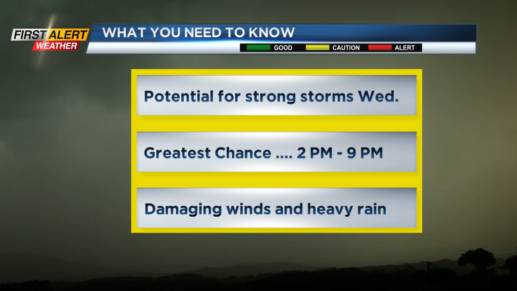
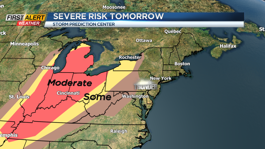
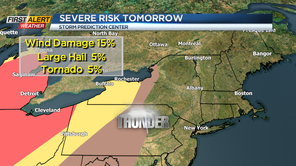
ROCHESTER, N.Y. – The rain ended on Tuesday with a cool, cloudy day for Western New York. During the next 24 hours a warm front will overspread the area, and this will usher in the warmest temperatures of the season. Unfortunately, this airmass also pump in higher amounts of humidity and this moisture will be fuel for the development of thunderstorms. As a cold front approaches the News 10NBC First Alert meteorologists expect showers and strong thunderstorms to develop, which will have the potential to produce damaging winds and briefly heavy rainfall. As a result, News 10NBC First Alert weather has issued a Yellow Alert for Wednesday due to the threat of severe weather.
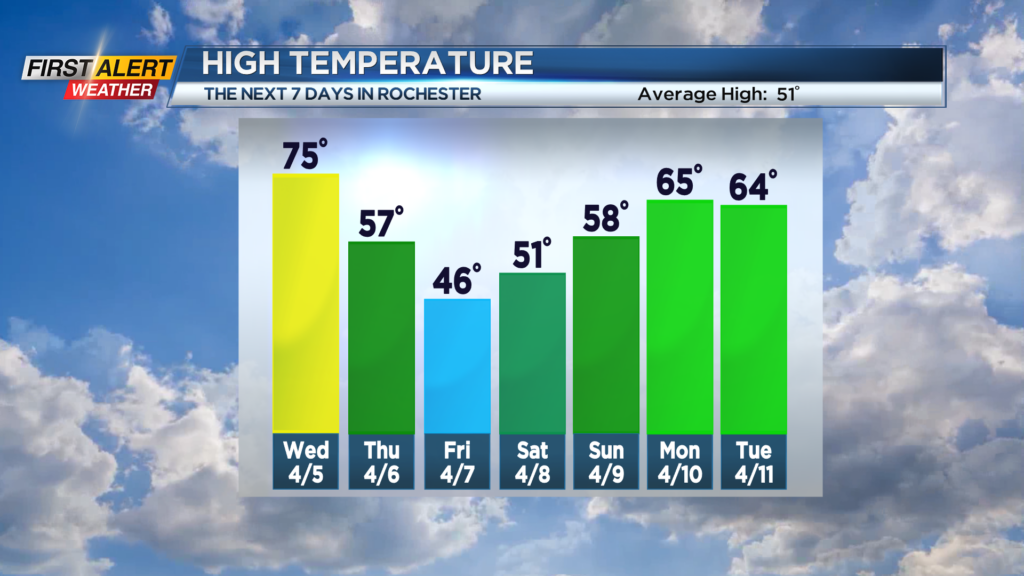
Tuesday night, look for mostly cloudy skies with just a small chance of a few sprinkles. The low temperature will be near 40 degrees, but the temperature will begin to rise later Tuesday night. Wednesday will bring increasing amounts of warmth and humidity. It is likely to be the warmest day so far this season. The high temperature should be in the low to middle 70s. At any portion of the day there is the chance of a shower or thunderstorm, but the greatest likelihood of severe weather will be mid-afternoon though early evening. Any storms could contain frequent lightning, heavy rain, and damaging winds. Thursday any light showers will end early with a few breaks of sun for the afternoon. It will be breezy and cooler with the temperature falling through the 50s.
Stay tuned to News 10NBC First Alert weather for updates on the forecast.