First Alert Weather: A brief shot of winter for Western New York
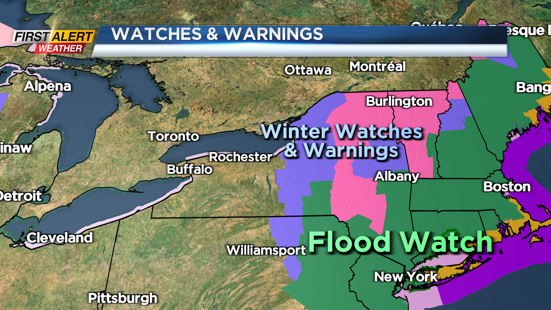
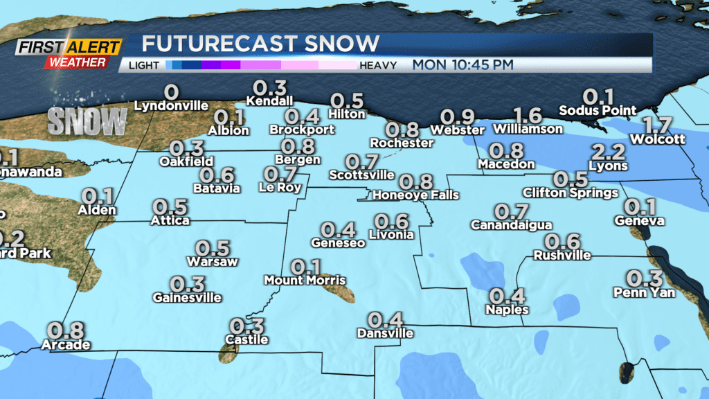
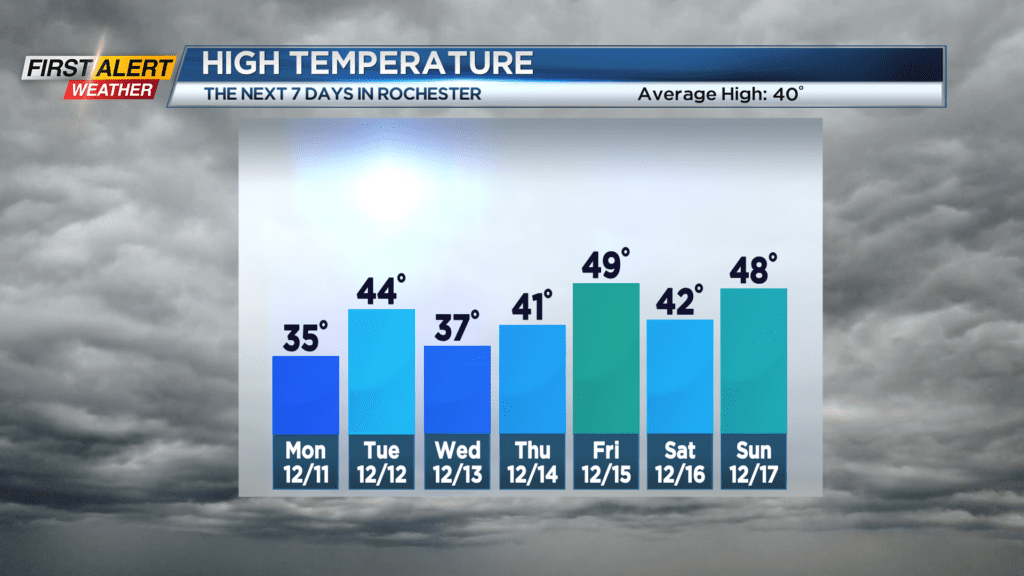
ROCHESTER, N.Y. – After enjoying a day of record warmth on Saturday, winter conditions will make a quick return for Monday. Winter storm warnings and advisories in effect for central and northern New York State, but this does not include the Rochester area. However, it will turn marginally cold enough that rain showers will turn to wet snow showers overnight south of Thruway. This will be especially true for the higher elevations. Then most of the area will see some snow showers and flurries for Monday. The News 10NBC First Alert meteorologists see a minimal accumulation over the next 24 hours.
Sunday night, look for scattered light rain showers and through the overnight, this precipitation will change to wet snow showers. The greatest chance of accumulation for Sunday night will be south of the NYS Thruway, especially in the higher elevations. The low temperature will be near 33 degrees. Monday will be blustery and rather cold as the temperature will stay in the middle 30s. Most of the area will see occasional snow showers or flurries and by Monday evening there could be just a coating of snow – mainly on the grassy surfaces. Tuesday will bring a few breaks of sunshine. Again, it will be breezy with the temperature rising into the low to middle 40s.
Stay tuned to News 10NBC First Alert weather for updates on the forecast.