First Alert Weather: A brighter and warmer end to the week
[anvplayer video=”5133772″ station=”998131″]
ROCHESTER, N.Y . (WHEC) — As promised, we’ve seen a little more blue returning to the sky Wednesday afternoon and evening, though some showers will still persist overnight.
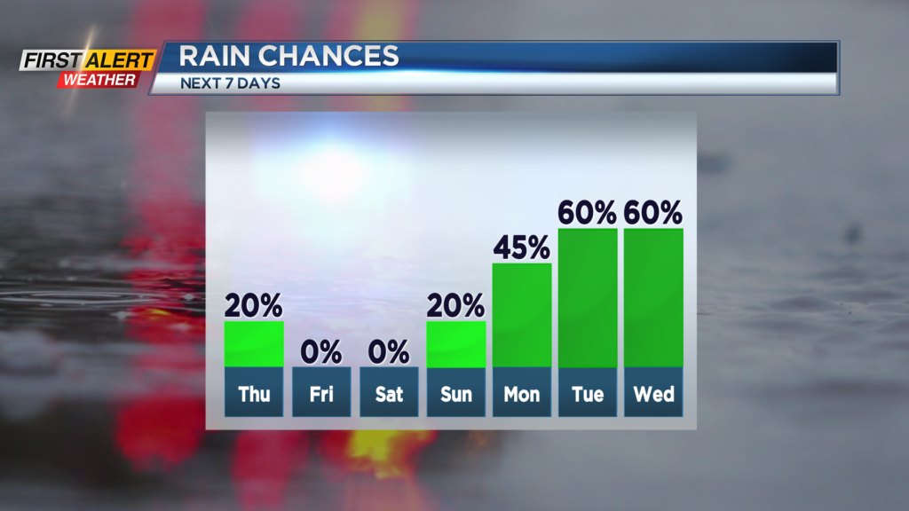
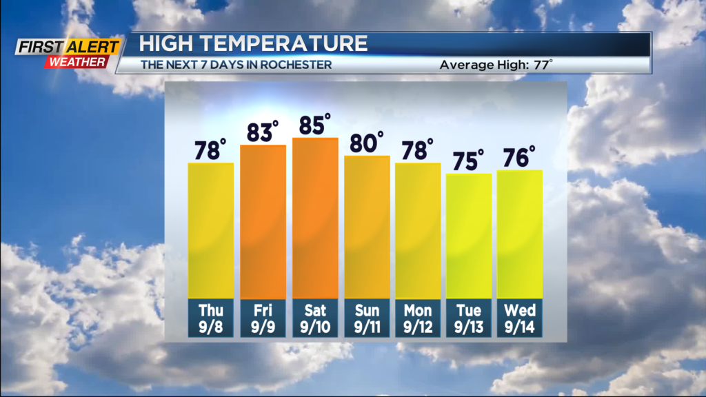
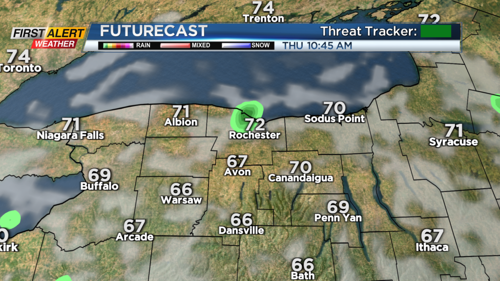
These should just be passing, and most of the night is dry under a mostly cloudy sky. Other than a rogue shower Thursday morning, we’ll see a mostly sunny sky returning, along with temperatures in the mid-70s by the afternoon. Friday will be a lovely day, with high-pressure overhead guaranteeing us a mostly sunny sky, and temperatures rebounding back into the 80s for the first time since last weekend.
Speaking of the weekend, it may be trending drier. Saturday still looks great, with a partly cloudy sky, dry weather and warm air. Sunday may still see a stray shower, but the system that will bring our next round of rain may be slightly delayed, meaning drier weather Sunday, and perhaps even into the start of Monday.
But the rain won’t be stopped, and we’ll see showers and some thunder returning on Monday, with periods of rain and rumbles through much of next week. We’ll keep you posted on the timing of the steadiest rain. At this point, the threat of any strong to severe storms is quite low, so we’ll remain green on the First Alert Threat Tracker for the foreseeable future.