First Alert Weather: A clear, calm and frosty start to Friday
[anvplayer video=”5138133″ station=”998131″]
ROCHESTER, N.Y. — We finally saw the sunshine return, thanks to a sprawling area of Canadian high pressure.
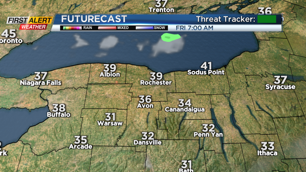
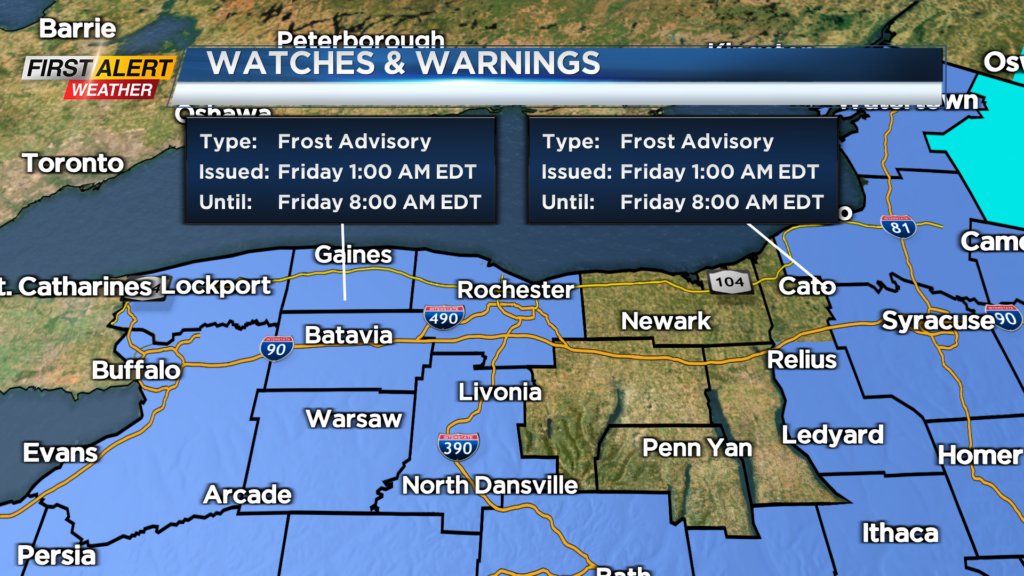
But with a cool airmass in place, that clear sky will lead to chilly conditions overnight. Frost advisories are posted for the majority of the area late tonight into early Friday morning. If you have temperature-sensitive plants that you want to keep healthy, it isn’t a bad idea to either bring them in or protect them tonight.
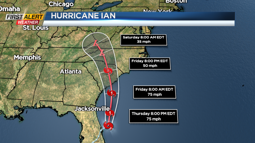
Friday will see more sun, with some high clouds drifting in from the south, as the huge cloud shield from Hurricane Ian continues to lift northward. Clouds will tend to thicken up a bit more on Saturday, but just a slight chance of a shower late Saturday, mainly in the Finger Lakes and Southern Tier as Ian works north.
Sunday will see a decrease in clouds, but winds will be ramping up. With temperatures in the 50s most of the day, that wind will give us a chill in the air. For the most part, moisture from Ian will stay south of us, with our next real chance of rain not arriving until Wednesday or Thursday of next week, with our next cold front and punch of cool fall air.
Ian update: Ian is now out over the Atlantic Ocean and is forecast to regain hurricane status before making landfall again in South Carolina, with the latest track taking it toward Charleston. Meanwhile, Florida continues to clean up from devastating storm surges, wind and flash flooding from torrential rain.