First Alert Weather: A cloudy and cool Tuesday before a warmup into weekend
[anvplayer video=”5133361″ station=”998131″]
ROCHESTER, N.Y. — Once again, we are waking up to cool and cloud conditions on Tuesday.
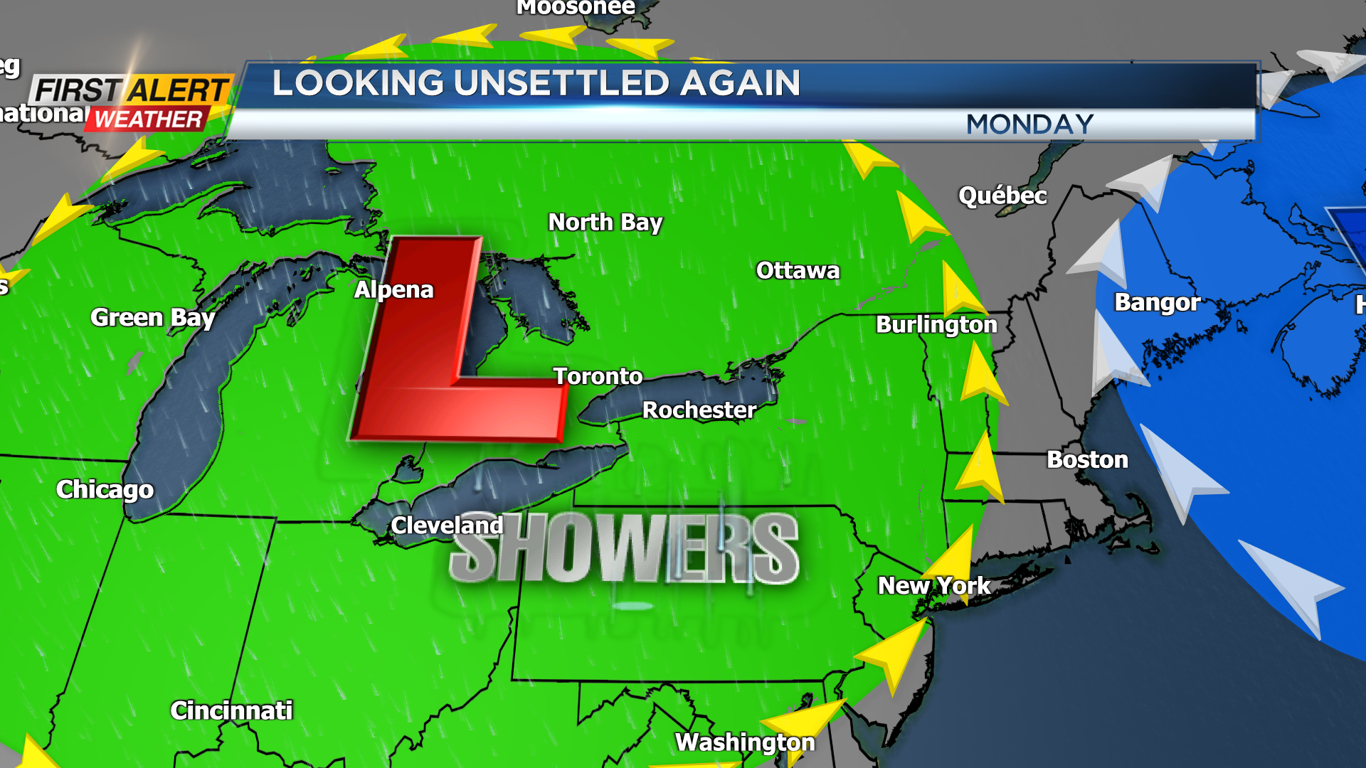
The good news is that the widespread rain that we saw on Monday has moved well to our south, but low pressure remains just off the East Coast. This means we will be stuck under the cloudy skies for Tuesday and with low pressure close enough that we may see an isolated shower later in the afternoon.
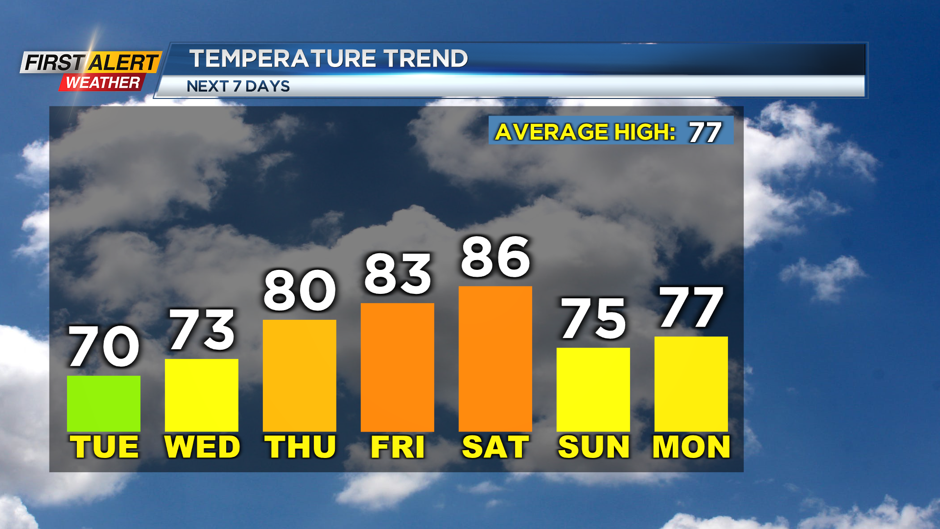
Most will remain dry, but a stray shower or sprinkle is not ruled out later on Tuesday. Also with the cloudy skies, we will be on the cooler side of things. High temperatures in the afternoon will once again struggle and only make their way into the upper 60s to near 70 degrees.
Now, although this week has been a bit cloudy and dreary so far things will get better late in the week.
After the cloudy skies for Tuesday and early Wednesday, the sun tries to return late into Wednesday before mainly sunny skies by Friday afternoon. The sunshine will also keep conditions warm, with highs in the mid 80s expected by Saturday afternoon.
Once again, we are waking up to cool and cloud conditions on Tuesday.
Things will also continue to turn drier before our next opportunity for wet weather moves in on Sunday. This will be thanks to an upper level low moving to our north early next week. The possibility of rain early next week is uncertain.
______________
Download the WHEC First Alert Weather app to stay up to date while on the go.
Watch the latest full forecast online.