First Alert Weather: A cold, snowy end to the weekend
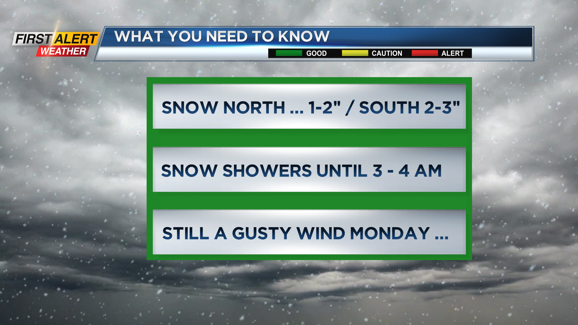
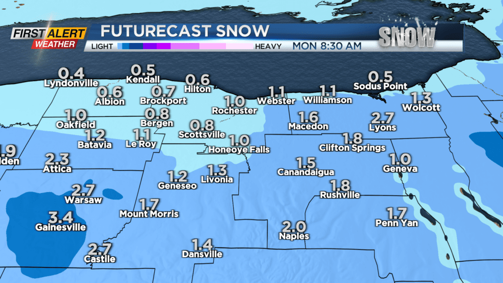
ROCHESTER, N.Y. – A strong low-pressure system located across northern New England is producing a brief return to winter conditions. This northwest flow of gusty winds, sharply colder temperatures will generate more snow to finish the weekend. Untreated roads will turn slick for this Sunday evening as accumulating snow will be likely for the overnight. Reduced visibility can be expected at times. However, the overall snowfall will be limited to just tonight with no impact expected on the Monday morning commute. As a result, the News10NBC First Alert weather team is not issuing a yellow alert at this time.
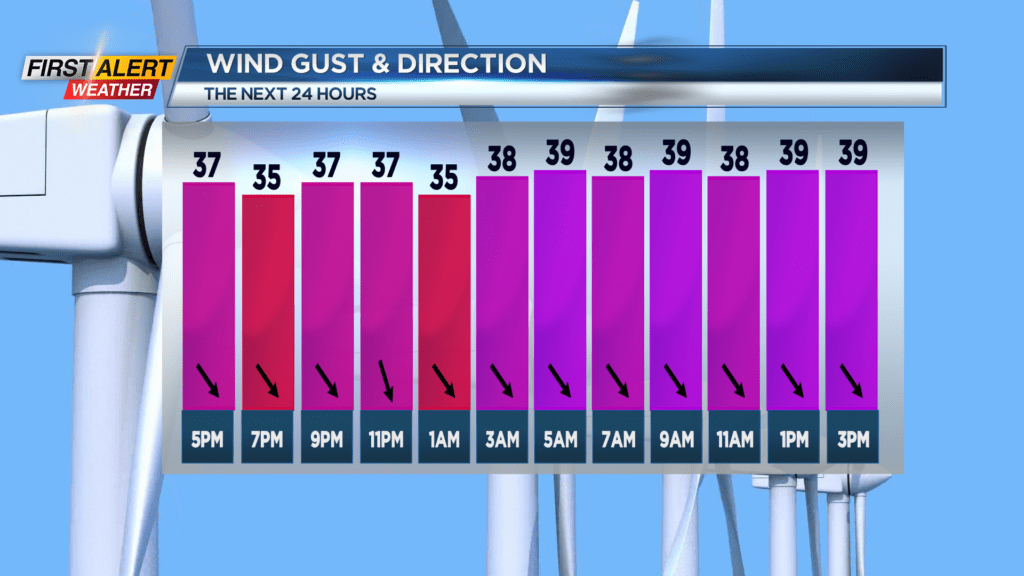
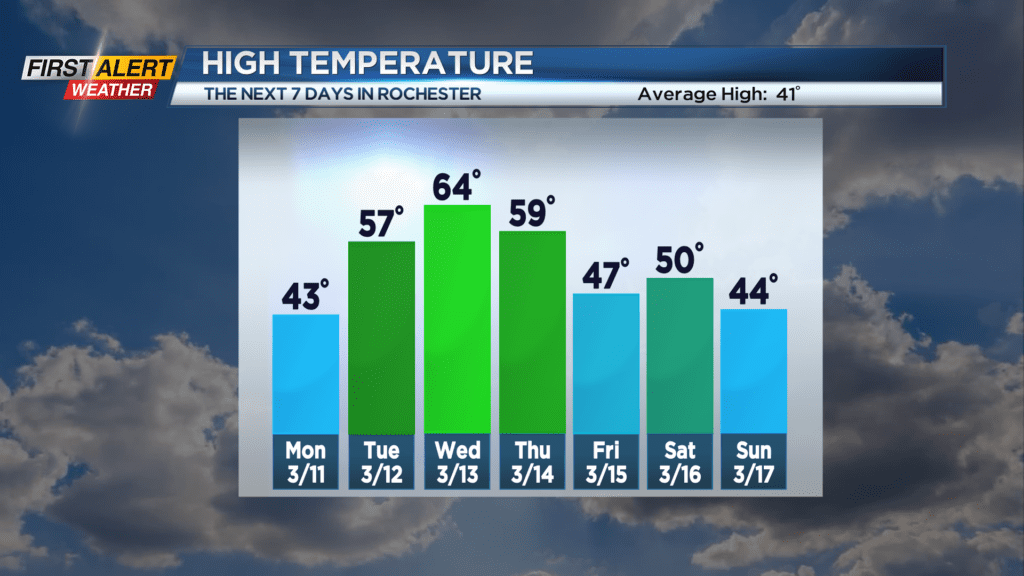
Sunday night look for occasional snow with accumulations limited to an inch or two for communities north of the NYS Thruway. However, south of the Thruway, especially in the higher elevations, accumulations will be closer to two to three inches. It will be windy at times with gusts near 40 miles per hour and the temperature will fall to within a few degrees of 30. Monday any lingering flurries will come to an end early, then skies will become sunny. It will still windy with gusts still near 40 miles per hour. The temperature will reach the lower 40s. Tuesday should be a pleasant day with partly sunny skies and a high temperature in the upper 50s. The warming trend will continue into Wednesday with the mercury reaching the middle 60s.
Stay tuned to News10NBC First Alert weather for updates on the forecast.