First Alert Weather: A few showers for Thursday but another warm-up on Friday
[anvplayer video=”5173440″ station=”998131″]
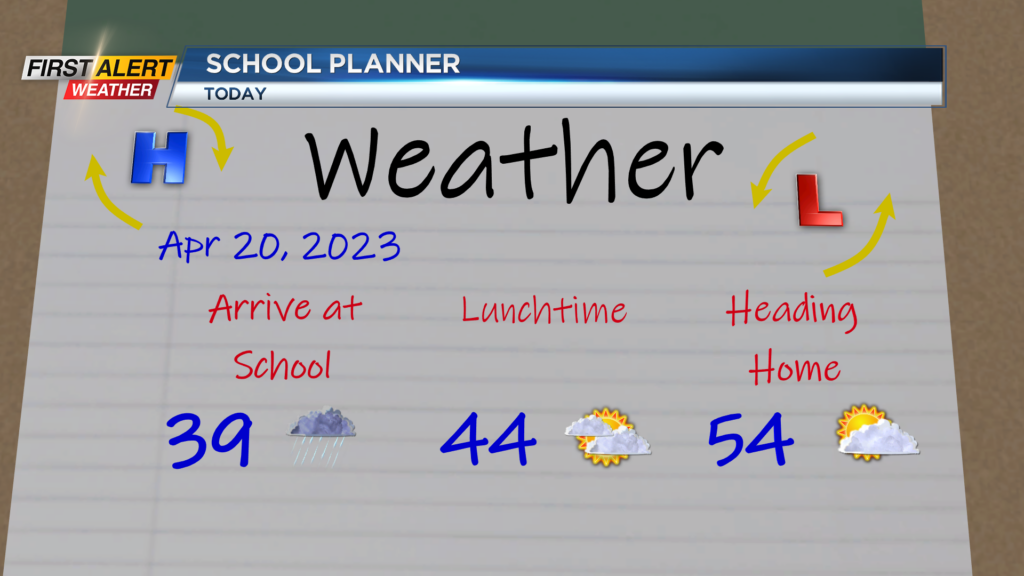
ROCHESTER, N.Y. — Another day and another chilly start. Temperatures are starting off near 40 degrees on Thursday morning but we are expected to turn mild in the afternoon.
Highs in the afternoon will depend on your location. Folks south of the Thruway will make their way into the 60s while areas north of the Thruway will be stuck in the 50s. This is thanks to a warm front that will stall across our region.
This warm front is also responsible for the light showers expected early Thursday morning. Showers will not last all day, but through 9 this morning there will be the chance for a shower or two.
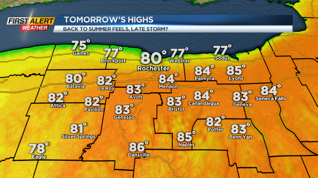
Then, the sun will return! Regardless of how cool or warm you will be later today; we are expecting the sun to return this afternoon under partly cloudy skies for everyone. That sunshine will continue into Friday, and unlike today, that warm front will bring us all warmth on Friday.
Friday will feel like summer once again as afternoon highs reach the mid and low 80s, with cooler weather along Lake Ontario. Most of the day will be filled with plenty of sunshine, but late in the day there is the chance for a shower or storm.
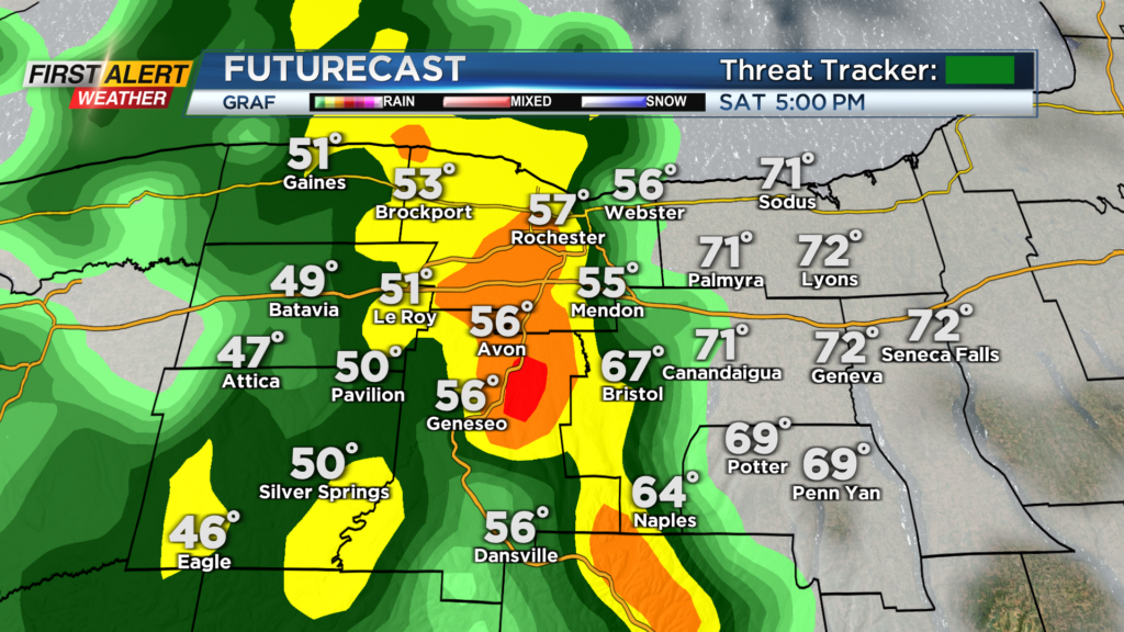
However, a better chance for rain and storms will come Saturday afternoon. As of now, Saturday morning and early Saturday afternoon look generally dry but after 2 pm is when things could turn wet.
The latest guidance is showing rain moving in after 3 p.m. from west to east with some of that rain being heavy at times in the evening. Stay tuned for any changes on this as this will affect your outdoor plans Saturday afternoon/evening.
______________
Download the WHEC First Alert Weather app to stay up to date while on the go.
Watch the latest full forecast online.