First Alert Weather: A return to winter, but a measly amount of snowfall
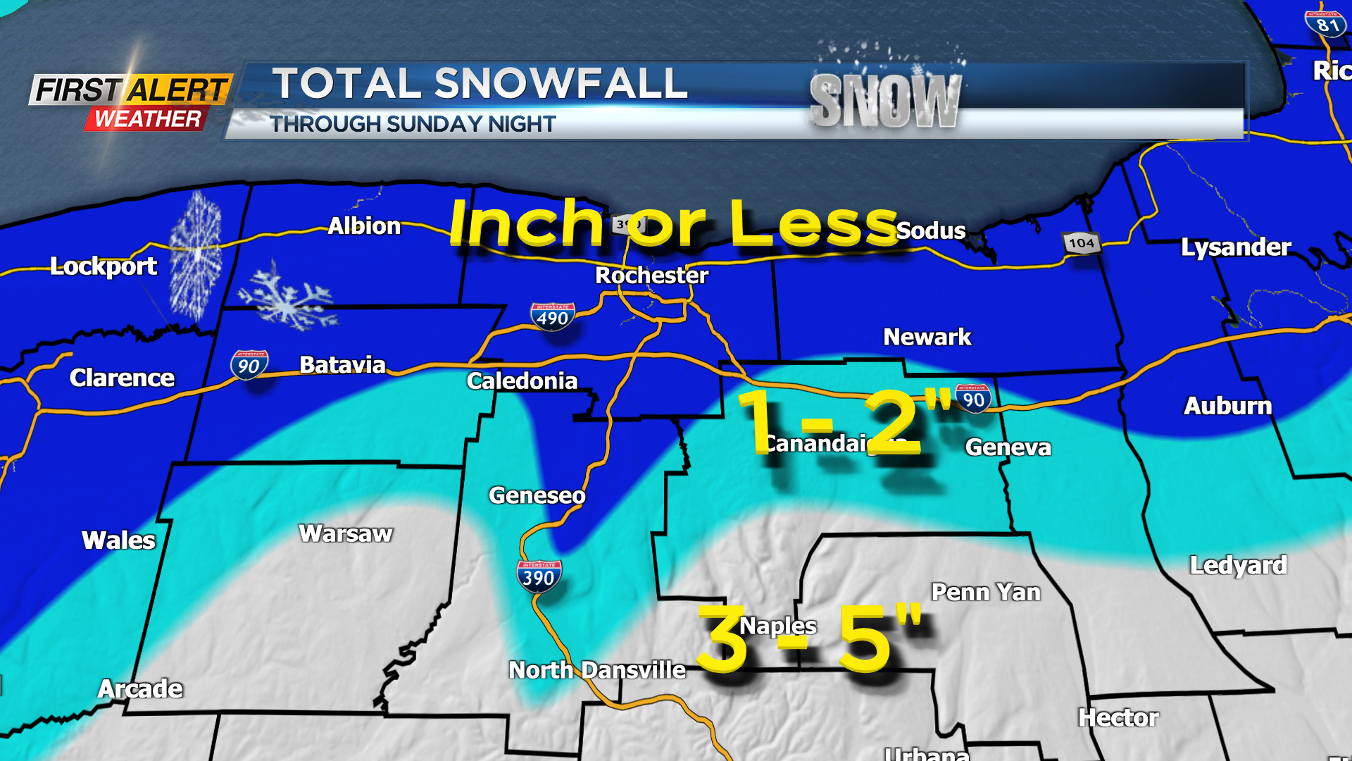
ROCHESTER, N.Y. – A low-pressure system that has produced a widespread wet snowfall for Western New York is already beginning to move off the east coast. The amount of snow has been small for Rochester with most of the accumulation on grassy surfaces. This is primarily due to marginally cold or borderline temperatures. Where temperatures are a few degrees colder, the accumulation will be a little greater and this is likely to be in the higher elevations south of Rochester. Snowfall will slowly taper and become more intermittent later this evening as drier weather is expected to return later Monday.
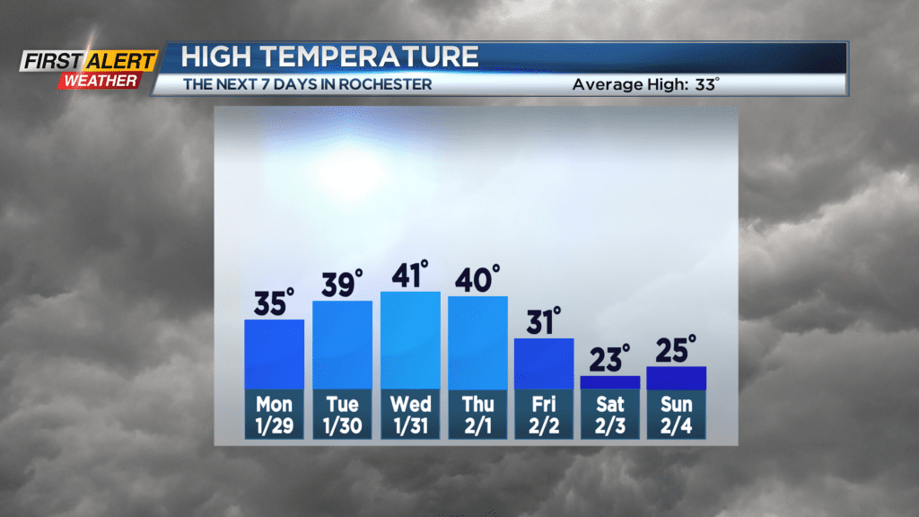
Sunday night, look for the steady snow to taper to flurries and snow showers. Any additional accumulation should be limited to an inch or less, but another one to three inches is possible in the higher elevations. The low temperature will be near 32 degrees. Monday you can expect a few snow showers and flurries for the morning, but little or no additional accumulation is expected. Otherwise just gray skies and a high temperature in the middle 30s. Tuesday and Wednesday we could sneak in a few breaks of sunshine, and it will be dry. Both days the temperature will be within a few degrees of 40. So, a calm and quiet weather is expected to end the month of January.
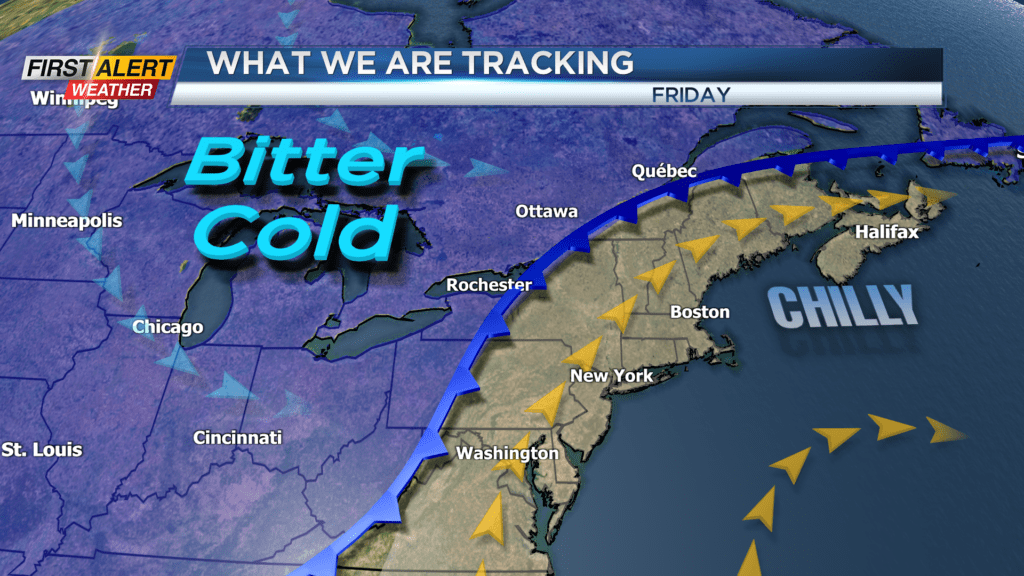
Then Thursday rain and wet snow showers will return and with a gusty wind and the temperature will be near 40 degrees. However, it appears that that sharply colder weather returns later Friday and the frigid temperatures are likely to last into the weekend.
Stay tuned to News 10NBC First Alert weather for updates on the forecast.