First Alert Weather: A sunny Valentine’s Day, but the clear skies won’t last
ROCHESTER, N.Y. — The sunshine was pleasant, but it was not a heartwarming Valentine’s Day as the temperature remained mostly in the 20s. Over the next 24 hours a fast moving, small low-pressure system will cross Western New York and bring the next round of precipitation.
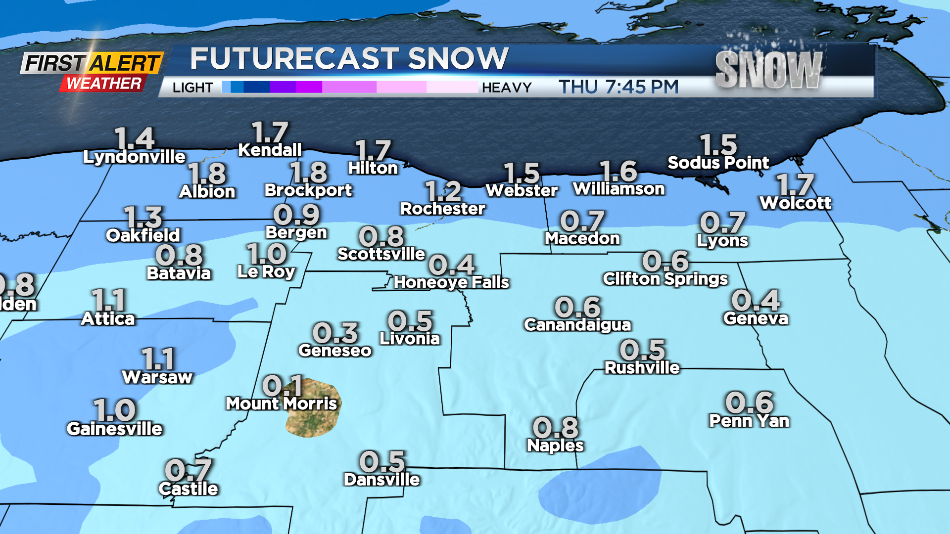
Marginally cold temperatures for Thursday will likely bring a mix of wet snow and rain for the afternoon. Any snowfall should be limited to just a slushy accumulation. As this storm moves east of Rochester, gusty winds will be on the increase for later Thursday night into early Friday. The News 10NBC First Alert meteorologists continue to watch the data, but right now it appears the winds should stay below any criteria for any significant issues.
As a result, in the short term, the News 10NBC First Alert threat tracker will stay “green”.
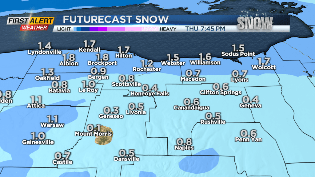
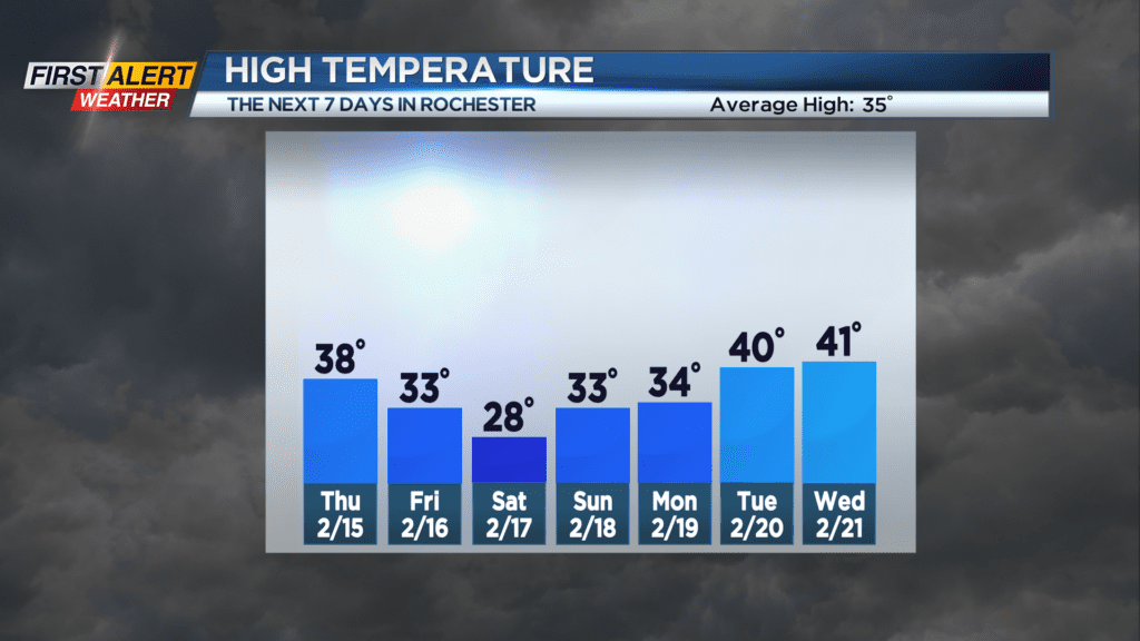
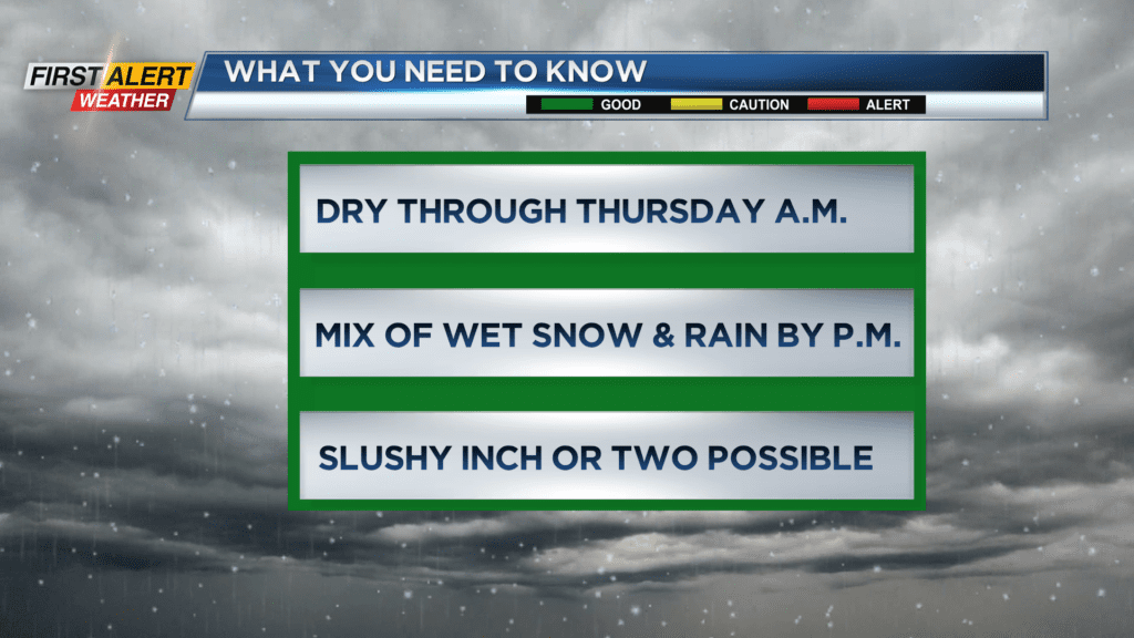
Wednesday night, look for patchy clouds early, then becoming overcast later. The low temperature will near 21 degrees. Thursday will be mainly cloudy for the morning, then by the afternoon you can expect a wet snowfall mixing with rain at times. A slushy inch or two of accumulation is possible by the end of the day. The high temperature will be in the upper 30s.
Thursday night lake snow showers will develop. It will turn windy around midnight with gusts pushing more than 45 miles per hour into Friday morning. The low temperature will be in the upper 20s. Friday may bring a few breaks of sunshine with Lake Ontario snow showers.
Some accumulation is possible especially east of Rochester into Wayne County. The temperature will only climb into the lower 30s.
Stay tuned to News 10NBC First Alert Weather for updates on the forecast.