First Alert Weather: A windy weekend across western New York
[anvplayer video=”5169149″ station=”998131″]
ROCHESTER, N.Y. – Our rain moves out following a cold front Thursday night, leaving us dry but cooler on Friday. Clouds will win out, but we’ll see some breaks of sun returning, especially through the afternoon.
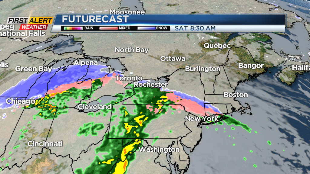
Highs will hold in the 30s much of the day, but should push into the lower 40s briefly during the afternoon. Our next storm system moves in on Saturday, with mostly rain. A wintry mix is possible very early Saturday morning at the onset of the rain, but it will be very short-lived. Rain takes over for a few hours into the early afternoon. We may see a lull in the rain, before picking up again late afternoon and into the evening as a cold front moves in. This will trigger some stronger winds, especially west of Rochester toward Buffalo.
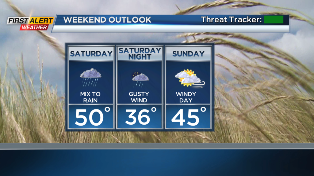
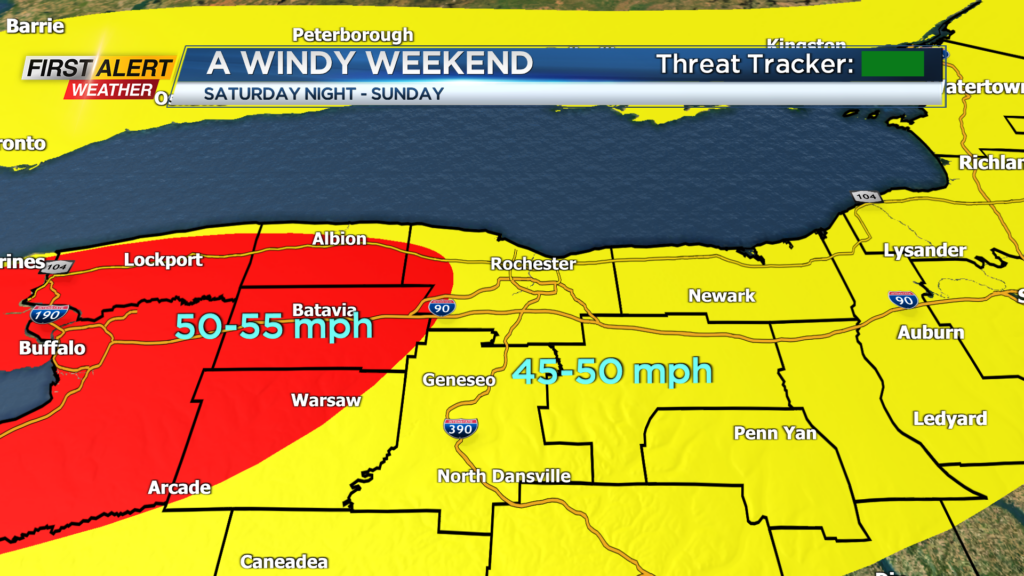
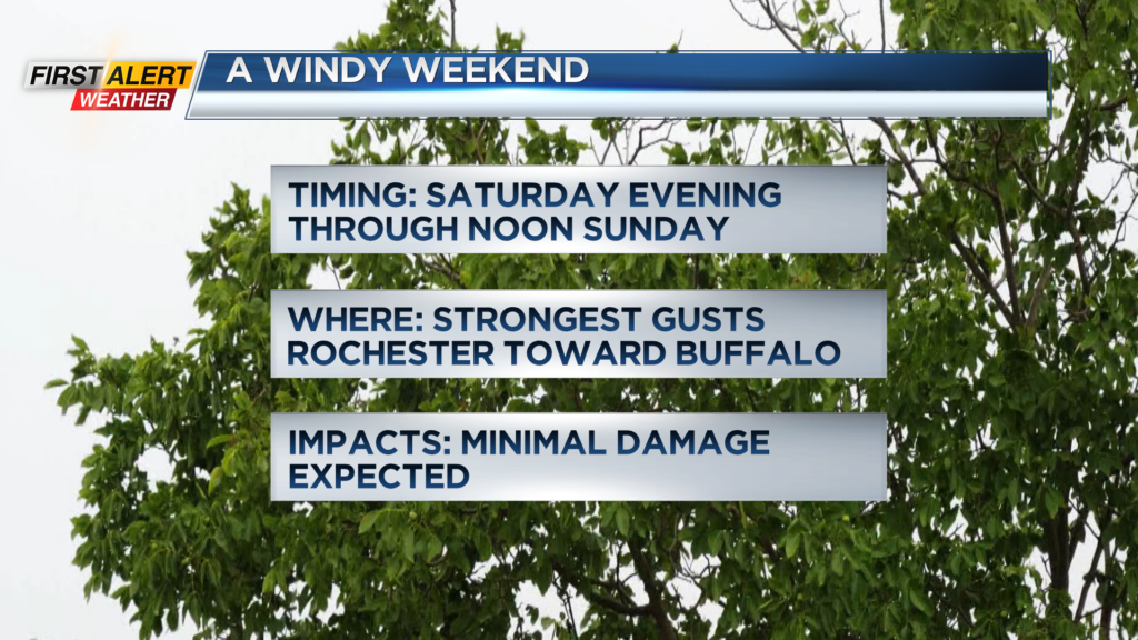
A few gusts there may push 50-55 mph overnight into early Sunday morning. The rest of the area will likely see some gusts 45-50 mph. While this likely won’t be strong enough to produce much, if any damage, it isn’t impossible a few sick or weak limbs may come down this weekend. Sunday dries out, but remains windy.
We’re still tracking another potential storm toward the middle of next week, but this is far from a certainty. If we do see something materialize, it is possible we see some snow. We’ll have a better idea of what we may or may not see as we head into the weekend. First Alert meteorologists Alex Bielfeld and Glenn Johnson will have updates through the weekend.