First Alert Weather: A Winter weekend with rain and snow
[anvplayer video=”5159832″ station=”998131″]
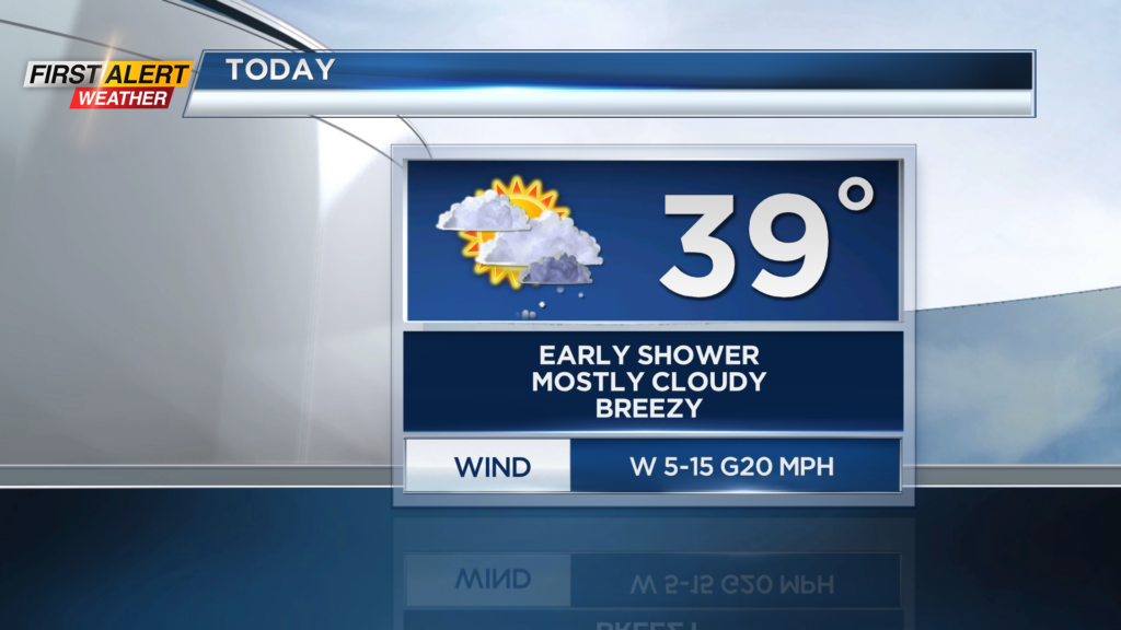
ROCHESTER, N.Y. – Waking up this morning to a mild start with temperatures in the mid and upper 30s. Don’t expect much movement in those temperatures though as we will remain in the mid 30s this afternoon.
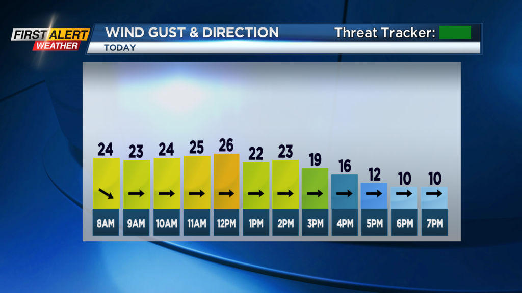
We will also be a bit breezy with gusts near 25mph early today which will make it feel a little cooler outside. We do have some breaks in the clouds this morning and those breaks will give way to some sun through the early afternoon today before cloudy skies return tonight.
There is the chance for a light rain or snow shower this morning, but most of us will remain on the dry side this morning and today. Clouds will again return tonight and give way to rain and snow showers for Sunday. We will generally start off with rain showers tomorrow before some cold air tries to intrude from the north later in the day.
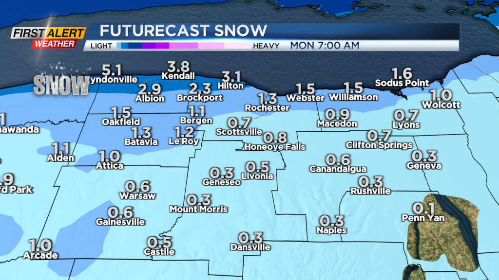
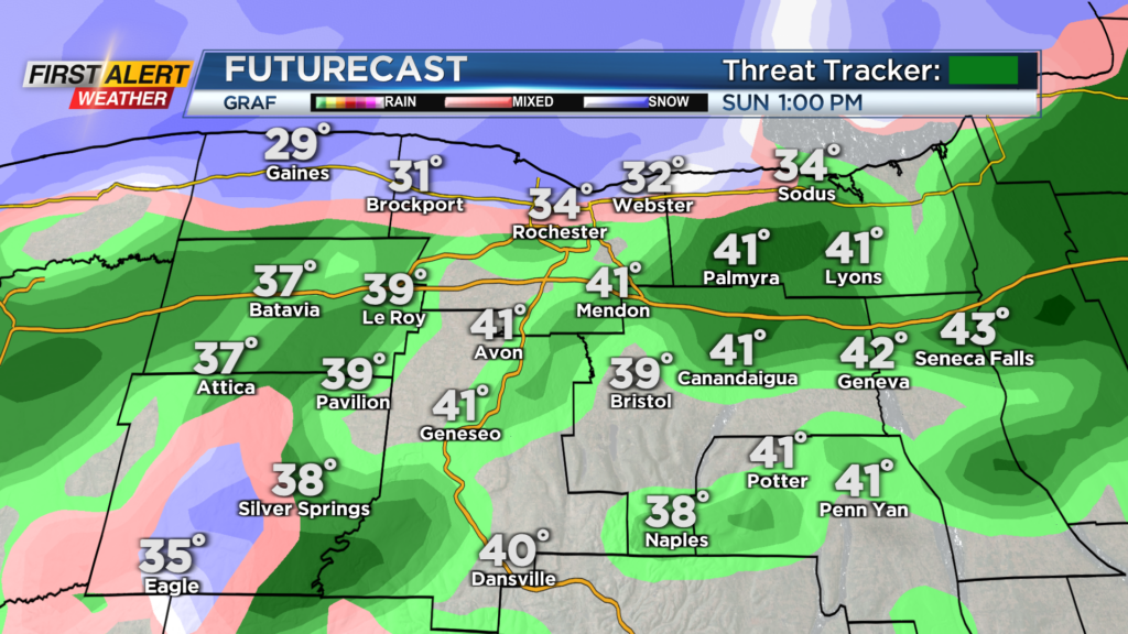
We will slowly transition over to snow showers from northwest to southeast through the day as temperatures start near 40 and then drop into the 20s by the evening hours. Snow accumulation will be light, if any at all, but we are going to keep an eye for the northwestern part of our viewing area in Orleans County as they could see upwards to three inches of snow by Monday morning. Most though will see less than an inch of snow.
Even with the lack of snow, a slick spot or two is possible tomorrow evening due to the snow showers and temperatures below freezing late. Snow showers will likely continue into Sunday night with an isolated snow showers on Monday.