First Alert Weather: A wonderful weekend before a threat for strong storms Monday
[anvplayer video=”5187683″ station=”998131″]
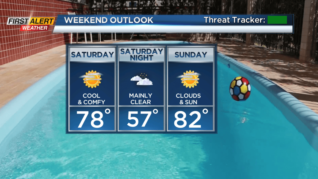
ROCHESTER, N.Y. — It is a beautiful start to the weekend as we are waking up this Saturday with partly cloudy skies and cool and comfortable conditions.
Saturday will feature just that as well, plenty of sun is expected this Saturday with cool and comfortable conditions as afternoon highs only reach the upper 70s. There is the chance for a passing shower in the afternoon south and east of Rochester, but a shower that does pop will be light and brief. Sunday will feature just about the same.
We will be dry on Sunday, and a little warmer. Afternoon highs on Sunday will reach the low 80s and we will still see plenty of sunshine. Clouds will roll in late Sunday evening ahead of some showers possible by Monday morning. The First Alert Weather Team continues the Yellow Alert for Monday as there is still a threat for strong to severe thunderstorms in the afternoon. We will likely start off Monday on the cloudy side with a few showers possible. The key here will be if that warm front responsible for a few Monday morning showers will lift north of our region or sit south. This will have big implications on whether we see severe weather or not. This is because south of the warm front is where all the thunderstorm energy will be, while north of the front there will be virtually none.
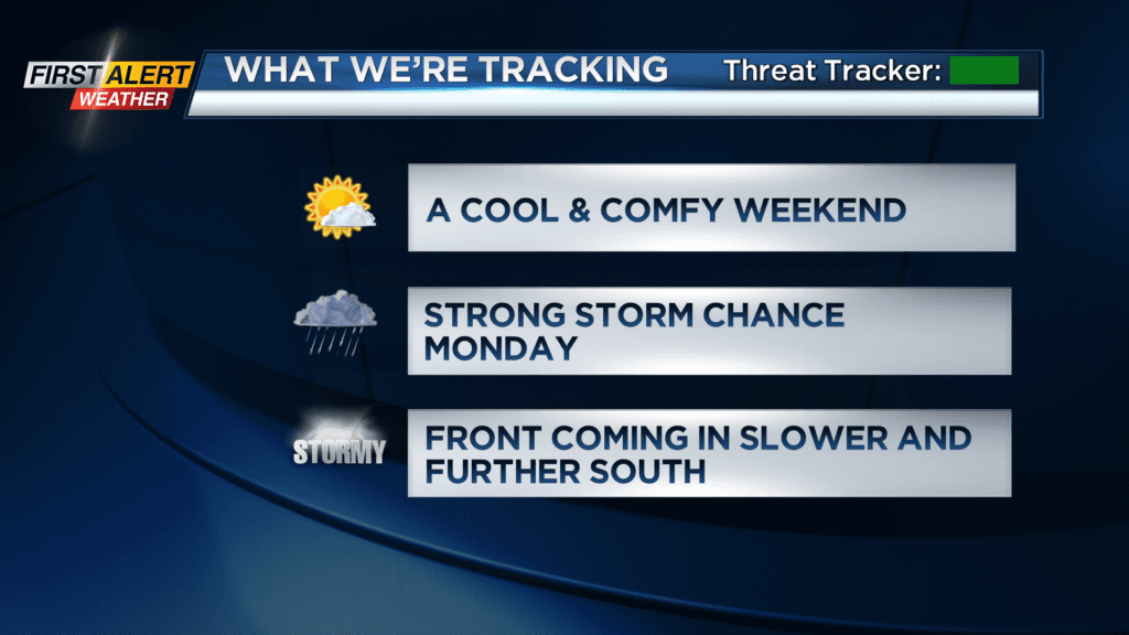
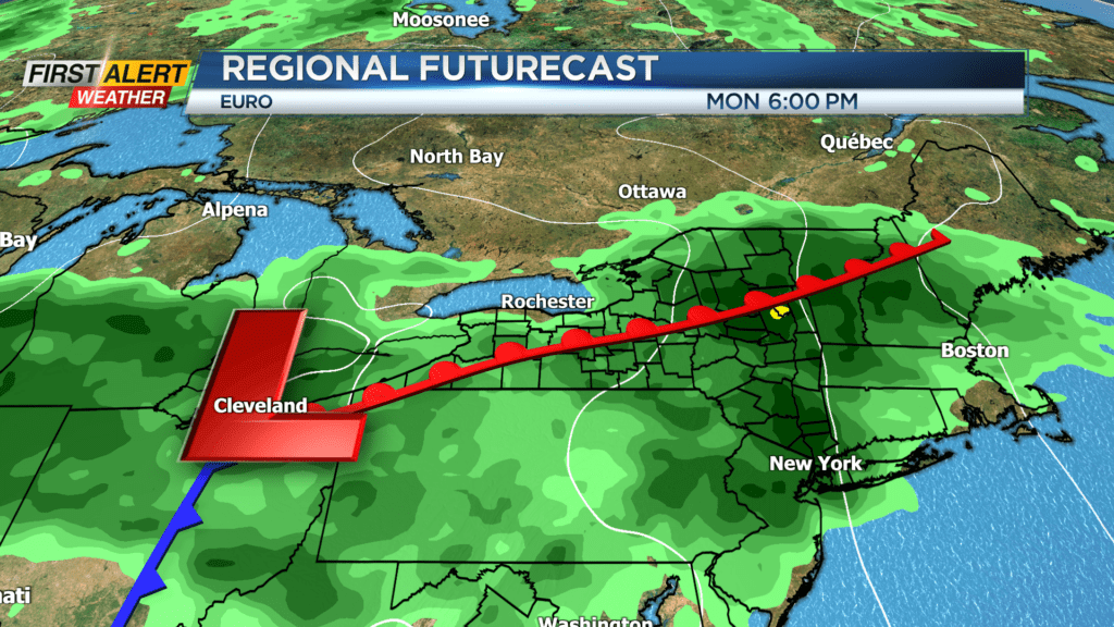
As of Saturday morning, models have begun to trend a little slower and further south with the front keeping Western New York out of the threat for severe storms Monday afternoon. The forecast right now is calling for a few showers Monday morning before a few severe storms Monday afternoon. Then, with the slower progression of this system, there will be a good chance for widespread rain on Tuesday with no severe weather.
As mentioned above through, the Yellow Alert is still in effect for Monday, and we will keep you updated on any changes leading up to our severe threat.