First Alert Weather: Active weather pattern brings a variety of weather this week
[anvplayer video=”5149868″ station=”998131″]
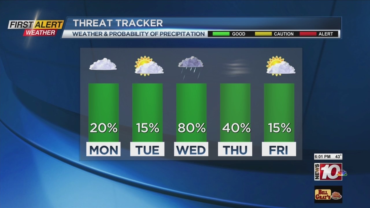
A low pressure system is moving over Rochester this Sunday evening which will provide more damp weather. As that storm moves out, drier weather returns for Tuesday and Wednesday before another stronger low pressure system travels north of Rochester for mid-week. This will eventually bring another shot of colder air for the start of December. However, the greater impact could be the gusty winds arriving for Thursday.
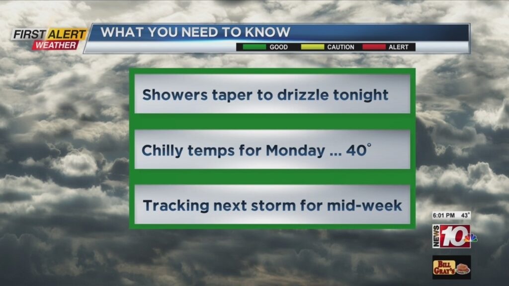
Tonight look for spotty light showers and drizzle. The low temperature will be in the upper 30s. Monday you can expect chilly conditions with the temperature near 40 degrees, but the temperature will fall later in the day. It will be mainly dry and cloudy, but skies may brighten later in the afternoon. Tuesday appears to be pleasant for late November with partial sunshine and the high temperature in the middle 40s. The last day of November should be mild with the temperature rising into the mid-50s, but a passing rain shower will be likely.

The News 10NBC First Alert meteorologists will be watching Thursday as that second storm moves across the upper Great Lakes. Lake snow showers will be possible southwest of Rochester with sharply colder weather expected as the temperature struggles to climb much above the upper 30s. The rapid change in temperature will produce strong winds with gusts possible in excess of 45 miles per hour. At this time, no yellow alert has been issued, but conditions will have to be monitored in the coming days.
Stay tuned to News 10 NBC First Alert for updates on the forecast.