First Alert Weather: After quiet weather, a storm is coming Friday and Saturday
[anvplayer video=”5153718″ station=”998131″]
ROCHESTER, N.Y. — The weather will be uneventful on Tuesday and some of Thursday before things go downhill later into Thursday into Friday.
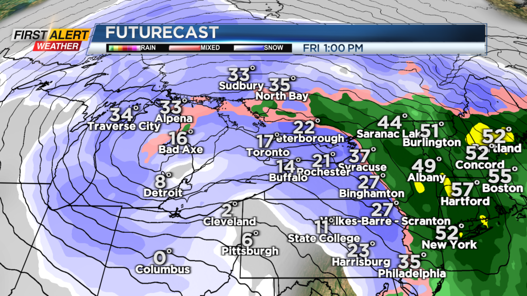
A large storm system will develop west of Rochester in the next couple of days. It will bring some rain, or a brief mix of rain, into the region for Thursday afternoon.
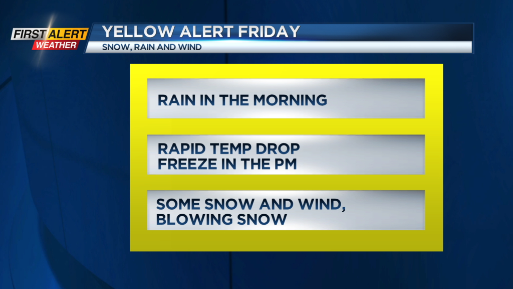
Initially, the storm will warm things up Thursday night into Friday morning with temperatures in the 40s to near 50 with rain to start Friday.
A powerful arctic front will cross the region around midday Friday. This will send temps plunging into the teens with some snow during the afternoon. The sudden drop in the temp will cause a rapid freeze.
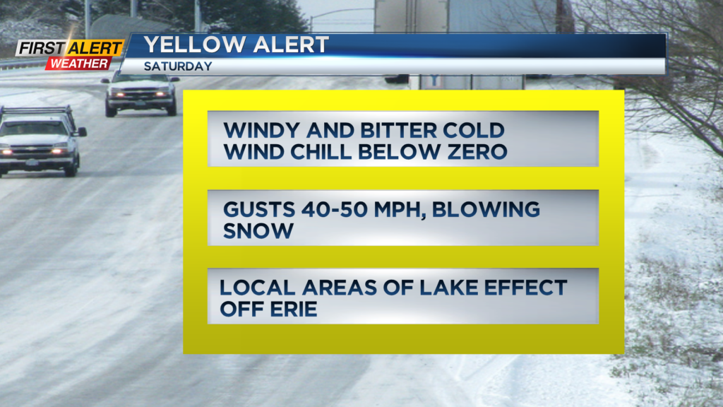
Travel could become very difficult with icy, snow covered roads developing. Strong winds will arrive later Friday into Saturday with areas of lake snow and blowing snow into Christmas Eve.
At this time the overall snow amounts do not appear to be excessive but many of us could see 3-6″ of snow Friday into Saturday. The weather will quiet down some for Christmas Day with local lake flakes and cold weather on Sunday.
Stay tuned to News10NBC for the latest on the timing of the freeze Friday, updated snow forecasts, and the latest on the wind threat.
______________
Download the WHEC First Alert Weather app to stay up to date while on the go.
Watch the latest full forecast online.