First Alert Weather: Another cloudy day before the sun returns
[anvplayer video=”5133614″ station=”998131″]
ROCHESTER, N.Y. — We are starting Wednesday with cloudy skies across the region and similar to Tuesday, cloudy skies will likely stick around.
However, we will see some breaks in the action as some sun will be possible later into Wednesday. Temperatures are once again on the cool side and as we move forward throughout the day. We will likely remain on the cooler side of things as high temperatures only reach the low 70s.
There will also be another chance for a light rain shower or passing sprinkle so keeping the umbrella with you couldn’t hurt. Cloud cover continues into tonight, but a better chance for the sun to move in for Thursday, which will likely start off on the cloudy side of things. A transition over to partly cloudy skies is likely during Thursday afternoon.
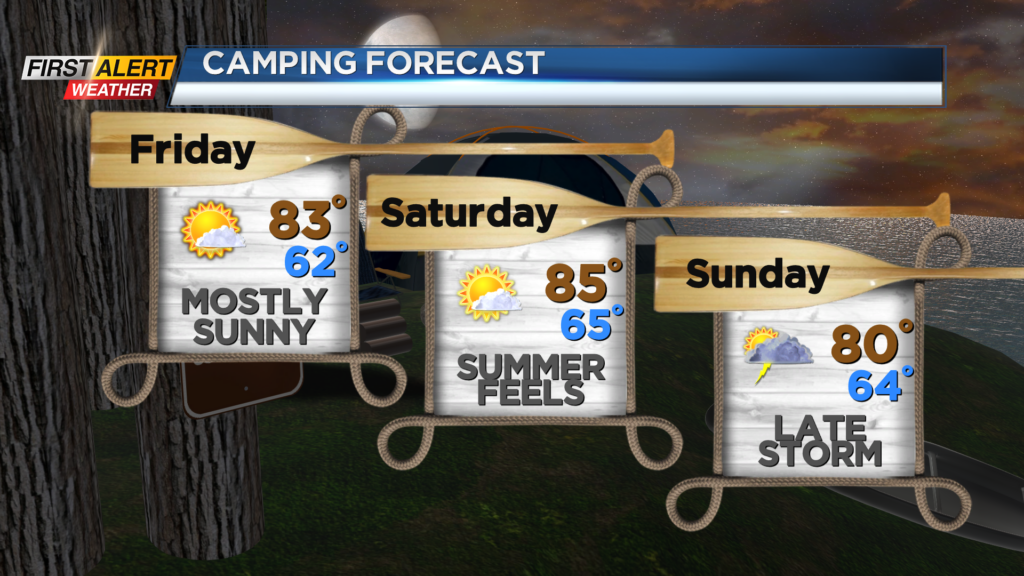
There is the chance for a light shower south, but most will turn dry. With the sunshine in place we will warm up as well as highs return to the mid and upper 70s. More sunshine is expected for Friday as well and with that our temperatures will make a return to the mid and low 80s.
The warming trend will continue for the weekend as Saturday will feel like summer with high temperatures in the mid 80s once again.
High pressure will also keep us dry as sunny skies are expected. However, on Saturday we will be tracking our next area of disturbed weather that will try and move in late Sunday.
As of now most of Sunday looks dry, but late in the day clouds will increase and potentially give way to an isolated rain shower or thunderstorm. The shower chances will only increase as we head into early next week also with an upper-level low slowly drifting to our north keeping us unsettled.
______________
Download the WHEC First Alert Weather app to stay up to date while on the go.