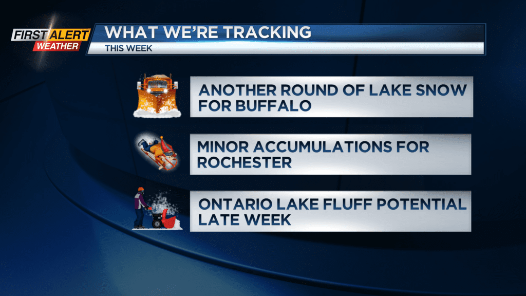
First Alert Weather: Another round of lake snow west, with cold air everywhere
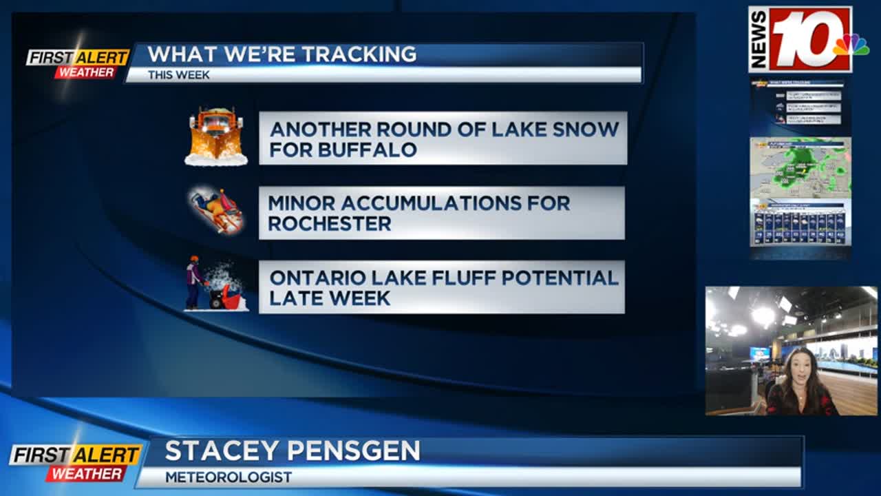
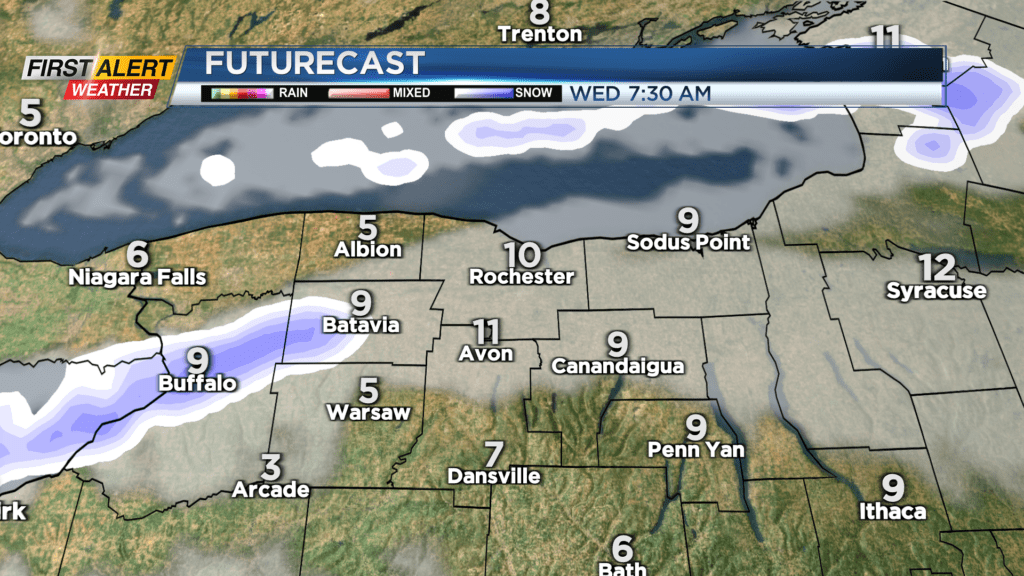
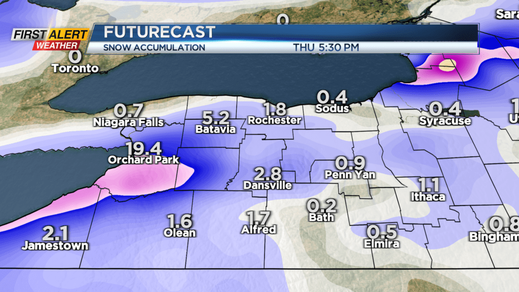
The Buffalo area is bracing for another 1-2 feet of snow over the next few days. A Lake Snow Warning is up for far western New York, also including Genesee and Wyoming counties. Like the last snow event, the heaviest snow will fall in and around Buffalo, with amounts dropping off significantly the further east you go. Parts of Genesee County could see a half foot of snow, while Monroe County sees little more than a few inches, especially west of Rochester. So, location matters with these lake bands!
While the snow may be selective, the cold is not. Temperatures will drop into the single digits tonight where we see some clearing, and lower teens where the clouds linger. Wednesday won’t improve much, with a brisk wind making the teens feel more like the lower single digits and even sub-zero wind chills. Areas that do see some snow on Wednesday will also have to contend with blowing snow.
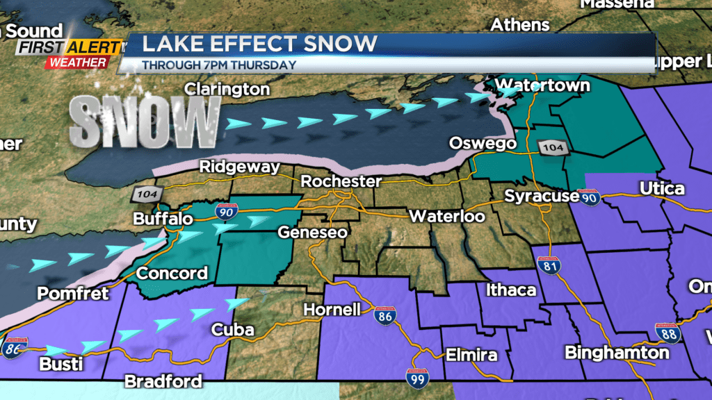
A disturbance moving through the area late Thursday into Friday will bring another round of scattered snow showers, followed by some lake effect snow Friday into Saturday, this time off of Lake Ontario. This will give the Rochester area and our northern counties a better shot at at least a few inches of lake fluff Friday into Saturday. This will also be accompanied by another shot of chilly air, with highs not making it out of the teens on Saturday. If you’re already looking ahead to the Bills game on Sunday, we won’t see snow, but there may be a slight breeze and chilly air.