First Alert Weather: Another round of snow for Sunday
[anvplayer video=”5148725″ station=”998131″]
ROCHESTER, N.Y. Well no snow here in Rochester, but many folks near Buffalo will begin the dig out of over 5 feet of snow that has fallen since Thursday.
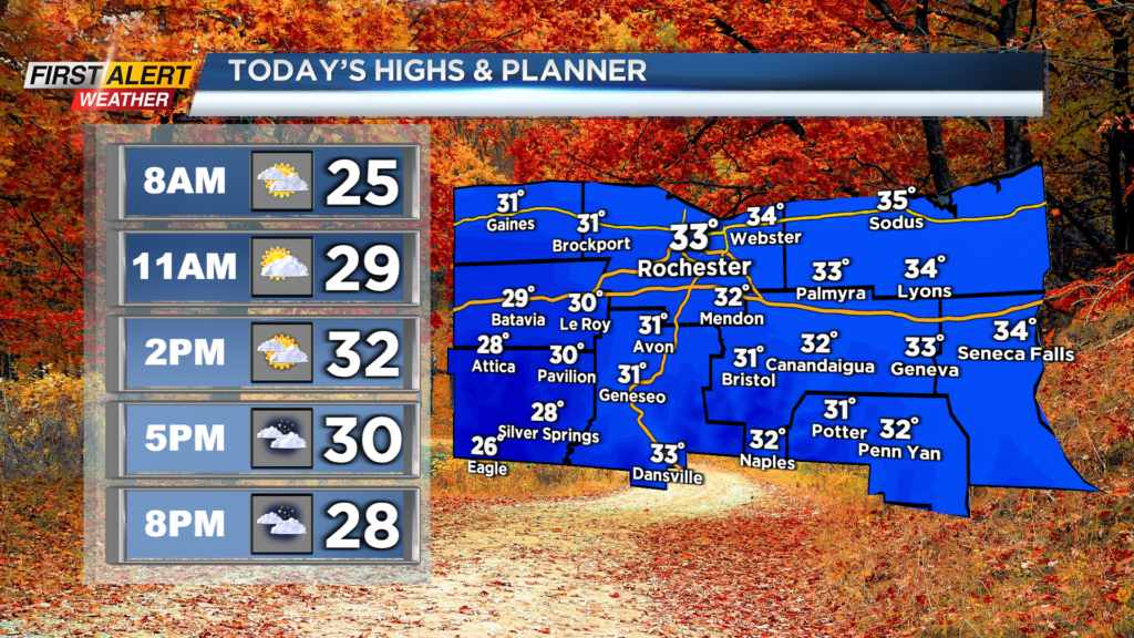
For us though, we will generally be quiet today. We are waking up to another cold start with temperatures in the 20s, but we are dry. Mainly cloudy skies this morning will give way to some sun through today before clouds increase late this evening.
Temperatures will not warm up much as we only make our way near freezing this afternoon. We will also be on the breezy side, which means it will feel even colder than that as wind chills hang out in the teens. Clouds will increase ahead of our next chance for snow which arrives late tonight and Sunday.
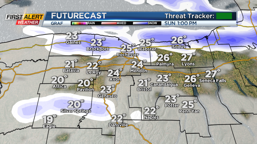
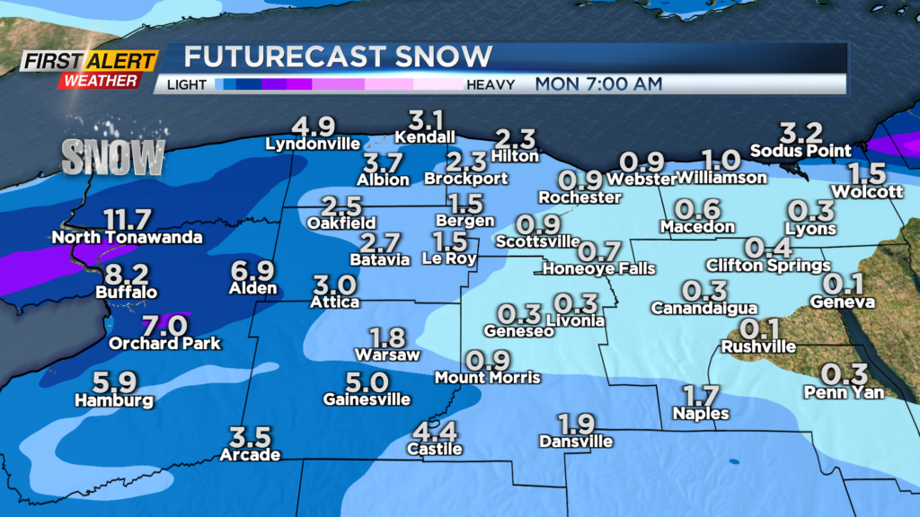
A cold front in the Midwest will swing through and bring us a few snow showers and snow squalls overnight before lake effect snow kicks in from Lake Ontario. Lake snow tomorrow afternoon will generally hang out along the lakeshore and east of Rochester.
Limited visibility and slick roads at times will be possible Sunday afternoon and evening. Lake snow will continue into Monday morning before drying out by the afternoon. Another story for us on Sunday will be the wind.
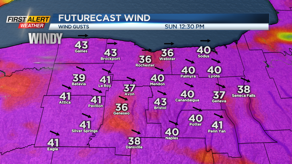
Winds will pick up when the front passes through, and gusts tomorrow will approach 40 m.p.h. No damaging gusts are expected, but it will make it feel much colder out there with wind chills in the low teens to single digits at times.
First Alert Meteorologist Alex Bielfeld has your Saturday forecast.
Also, this wind will blow snow back onto roadways and create near-whiteout conditions at times with our lake snow expected. Heads up on the roads and outside during the day on Sunday.