First Alert Weather: Better today before snow chances Monday night
[anvplayer video=”5166013″ station=”998131″]
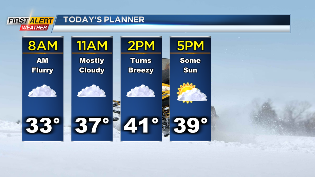
ROCHESTER, N.Y. – Not that bad of a start this morning, no snow on the roads and temperatures are near the freezing mark. There are a few isolated snow and rain showers across our region this morning, but nothing concerning early today.
A flurry or sprinkle will be possible early this morning but overall, we will be stuck under overcast skies with highs making their way near 40. There is a chance for sunshine late this afternoon as clouds break later today as well. Into tomorrow, the sun will give way to clouds and then a chance for a few rain or snow showers late Monday evening. We will be tracking a weak wave of low pressure that will slide to our south and bring us some wintry weather Monday night and into Tuesday.
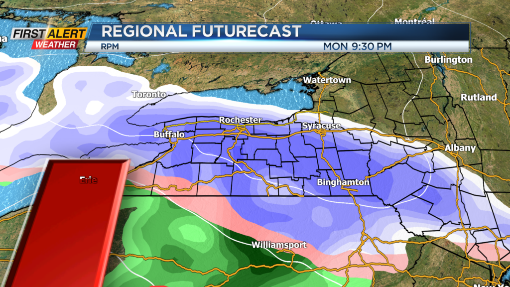
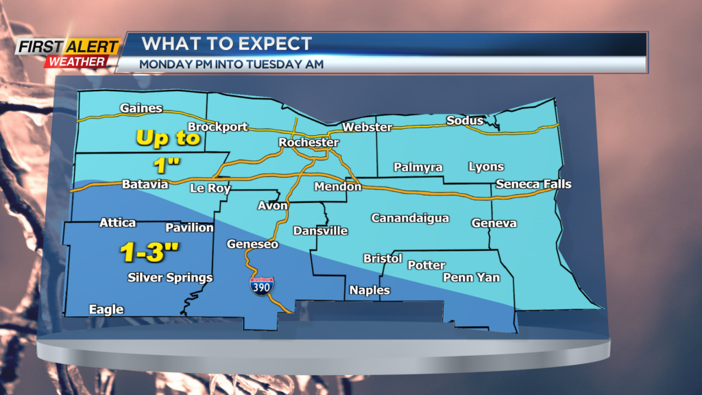
Models do remain divergent, but depending on where a heavier band of snow sets up, a few areas could see near four inches of snow by Tuesday morning. As of now, we are thinking the heaviest of the snow sets up south of Rochester and in the Southern Tier.
So as of now, southern parts of the viewing area could see one to three inches of snow, while most will see near an inch by daybreak Tuesday. With the opportunity for a little heavier snow locally, we will keep our eyes on the chance for a few slick spots early Tuesday morning. With the uncertainty, make sure you stay tuned for any changes over the next 36 hours.