First Alert Weather: Bitter cold on Wednesday with local lake effect snow for some
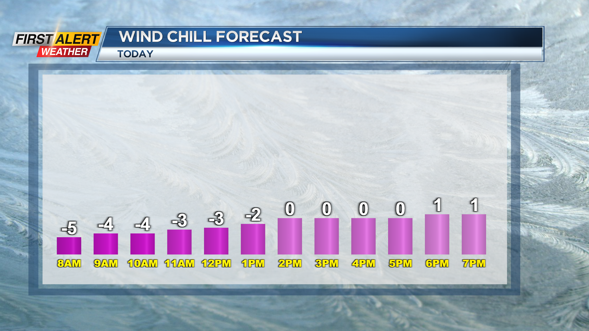
ROCHESTER, N.Y. — It will feel like wind chill below zero for much of Wednesday with with temperatures in the teens, clouds, and a gusty wind.
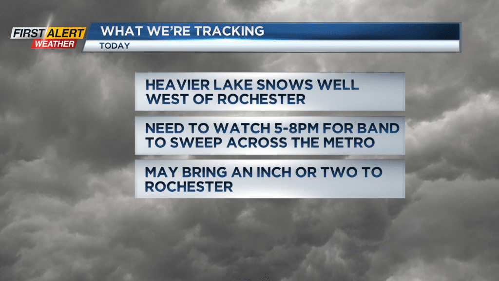
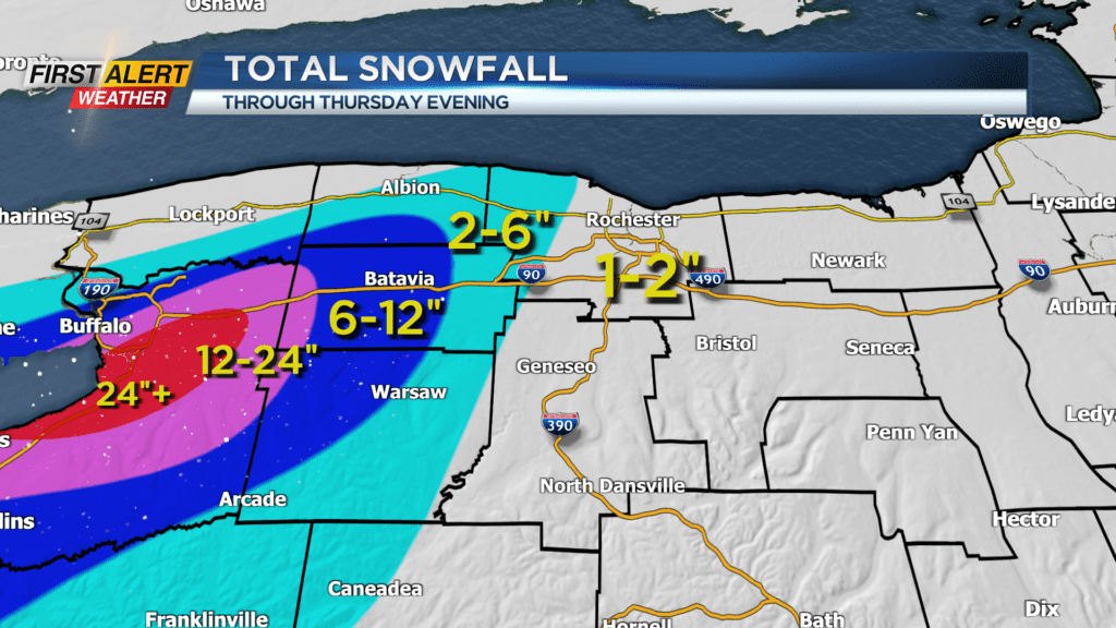
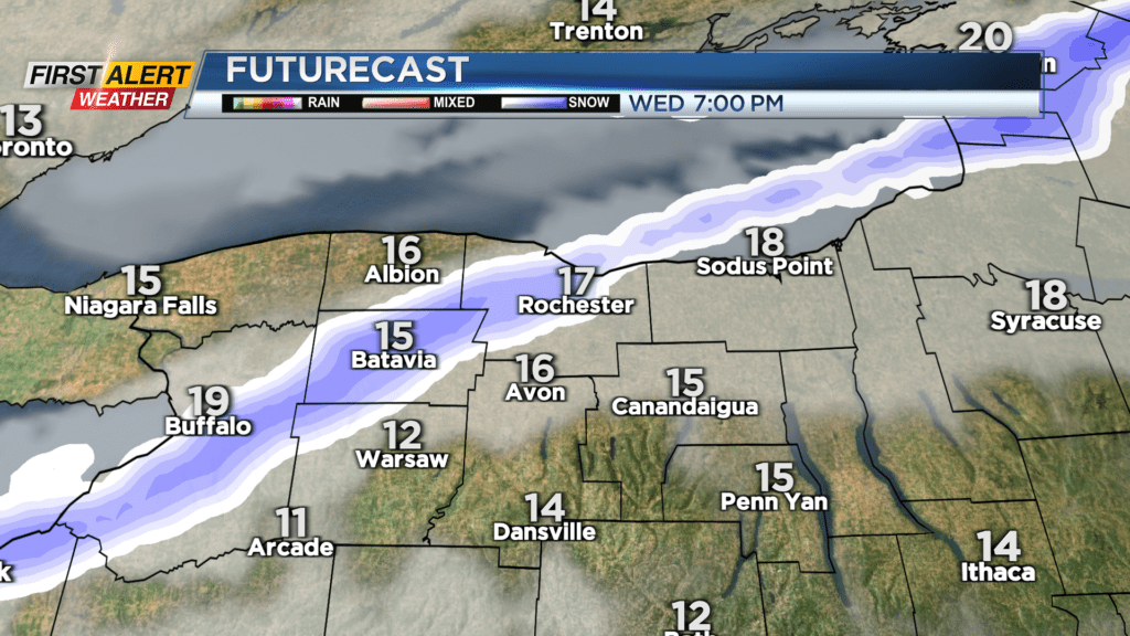
Heavy lake effect snow near Buffalo on Wednesday morning is forecast and will spread further east in the afternoon into Wednesday night. It will bring a little snow to Rochester in the evening.
Amounts will be manageable around our region with most of us seeing an inch or two. A few towns on the westside may get a bit more depending on how that band sets up later Wednesday.
Southern Orleans County and parts of central and western Genesee County may pick up local amounts over 6″ into Wednesday night. That band will weaken and settle south overnight into Wyoming County Thursday morning with some snow showers into the Finger Lakes.
Areas of lake flakes and snow showers will continue at times into Friday with light accumulations. Keep an eye on the Saturday forecast for Lake Ontario snow that may bring accumulations into Rochester and along Route 104. Stay tuned to News10NBC for the latest updates on the lake effect snow today for any impacts during the evening commute.