First Alert Weather: Breezy, balmy on Friday, but the weekend will eventually turn wet
ROCHESTER, N.Y. — High pressure to our west will keep us dry and mild through the end of the work week before that pattern breaks down this weekend.
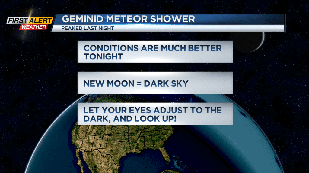
The Geminid meteor shower peaked Wednesday night, but we should see a nice clearing sky Thursday night. You will likely still be able to see some meteors if you step outside once the sky is dark, let your eyes adjust to the dark, and look up!
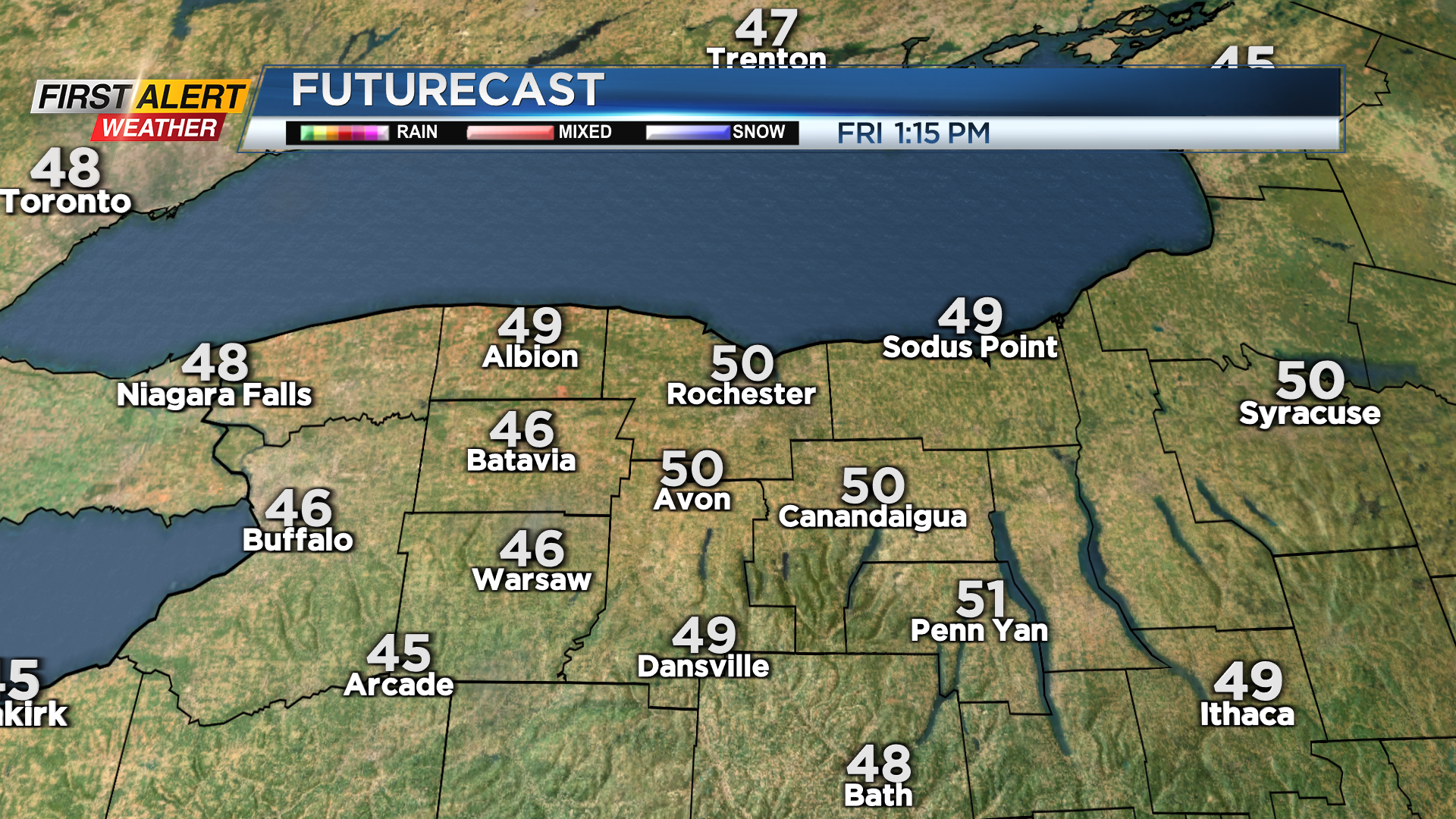
Temperatures on Friday should flirt with 50 degrees under a mostly sunny sky. The wind will be noticeable, with a few gusts pushing 30 mph out of the southwest.
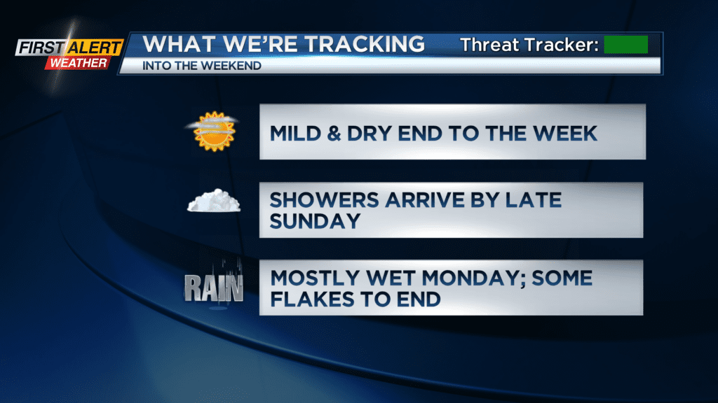
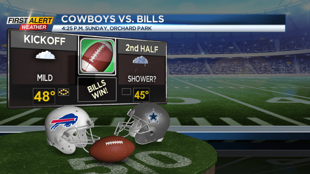

Clouds return on Saturday, but we’ll remain dry with temperatures in the mid 40s. A storm system moving up the east coast will merge with another low moving across the Ohio Valley and Great Lakes to bring us some showers by late Sunday, and eventually a steadier rain Sunday night into Monday morning. If you have plans to go to the Bills game, plan on some wet weather by the end of the game.
While the majority of our precipitation from this system will fall in the form of rain, colder air blowing in on Monday will likely change rain showers over to some snow showers by later Monday and some limited lake effect Tuesday morning. Rainfall amounts could drop a half inch of rain in some spots, maybe more east of Rochester, with only minor snowfall amounts by Tuesday afternoon.