First Alert Weather: Bundle up out the door today!
[anvplayer video=”5148824″ station=”998131″]
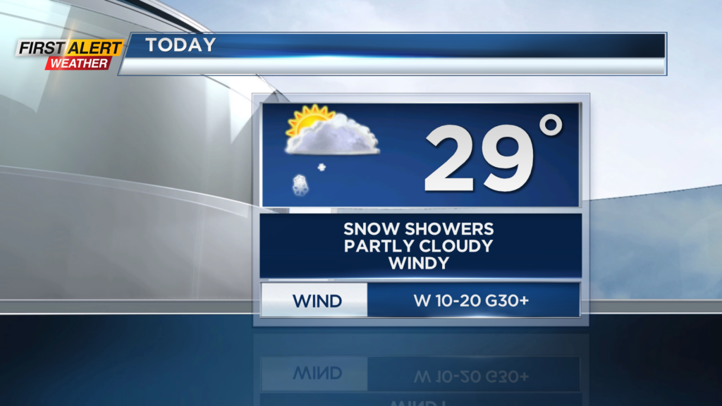
ROCHESTER, N.Y. It is a cold start to our Sunday here in western NY as temperatures have started in the low 20s.
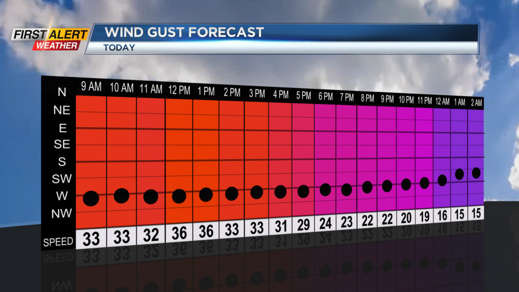
It’s not just the temperatures but the wind chills as gusty conditions are in place. Early this morning, we are seeing wind chills in the single digits. Winds will remain gusty through today and gust upward to 35 m.p.h., which means it will continue to feel colder.
Wind chills today will likely remain in the teens and single digits, even with a good amount of sunshine, so make sure you bundle up! Most of today will be filled with partly cloudy skies, but a few snow showers will be possible from time to time.
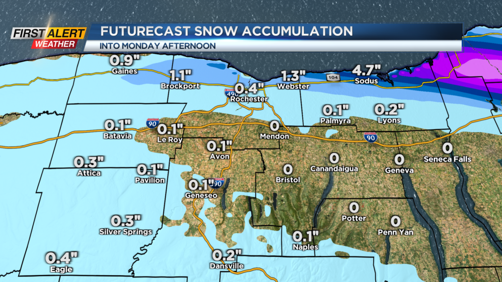
Winds out of the northwest will kick up lake effect for us off Lake Ontario, which means folks along the 104 corridor should be heads up for limited visibility on the roads at times and slick roads at times as well. This is not a widespread event, and only about an inch or two of snow is expected.
The best chance for snow accumulations will be for areas east of Rochester. Lake snow chances continue into early tomorrow morning when we begin to see some clearing by the afternoon. After a few flakes early tomorrow, the rest of the week into Thanksgiving is looking great.
There should be no travel issues Wednesday and Thursday looks perfect with highs in the upper 40s under partly cloudy skies. We will see clouds try to increase late as we are watching for our next round of unsettled weather to move in on Friday and Saturday.