First Alert Weather: Calm for Tuesday before wind and rain later
[anvplayer video=”5150198″ station=”998131″]
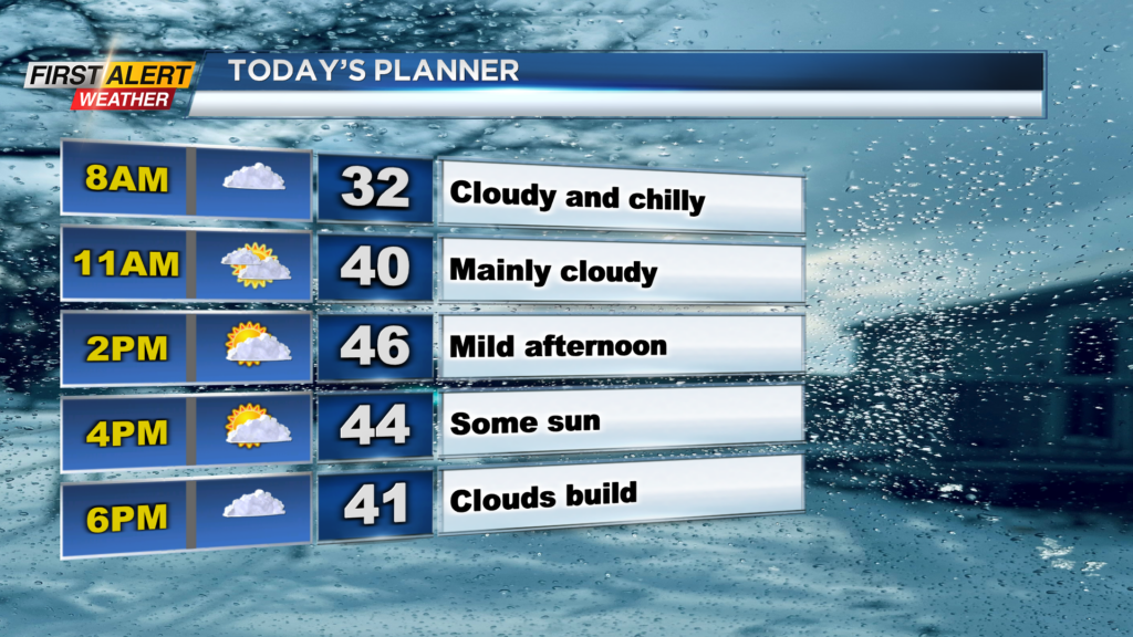
ROCHESTER, N.Y. — It’s a cool and cloudy start for Monday morning with temperatures in the mid and low 30s under overcast skies.
Temperatures will be a bit chilly in the morning before making their way into the mid-40s this afternoon. We will also deal with the overcast skies before a little sun in the afternoon.
The sun will not last too long as clouds will once again build late into Tuesday, ahead of our unsettled weather for Wednesday.
A strong cold front will swing through Wednesday with wind, rain, and a temperature drop. Wind will be the main story as we could see gusts push over 40mph at times into the afternoon and evening.
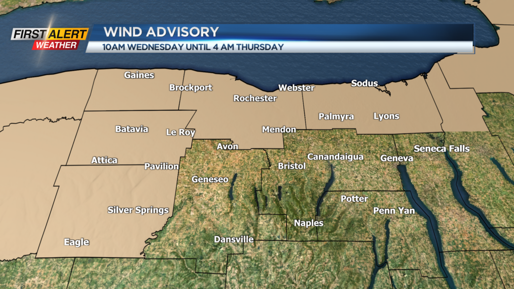
The National Weather Service will let a Wind Advisory will go into effect for a good portion of our viewing area with the winds expected. With the wind, we will also be dealing with the rain.
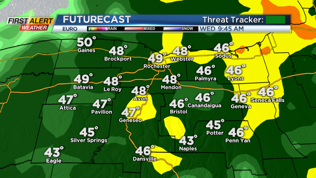
On Wednesday morning, we will see widespread rain across our region. That rain could be heavy at times limiting visibility on roadways for the morning commute and creating some pooling and ponding.
Rain will continue into the early afternoon but once the cold front swings through early Wednesday afternoon, we will be looking at a large temperature drop and a change over to lake flakes.
Temperatures early Wednesday afternoon will reach near 50 degrees before crashing to near freezing by the evening’s commute. Lake flakes and wind tomorrow evening could also create a few issues with slick conditions on area roadways.
Lake flakes and gusty winds will continue through Wednesday night and through Thursday. Also with gusts near or over 40mph, there will be that opportunity for localized power outages before things clear Friday.
______________
Download the WHEC First Alert Weather app to stay up to date while on the go.
Watch the latest full forecast online.