First Alert Weather: Calm for Wednesday before we turn active late this week
[anvplayer video=”5153917″ station=”998131″]
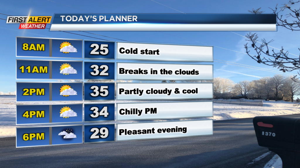
ROCHESTER, N.Y. — It’s a cold start to Wednesday as temperatures are starting off near 20. Even after a cold start to the morning, we will remain chilly with highs only reaching the mid 30s in the afternoon.
Even though we are chilly, we will see the sun return later into Wednesday as we break out to partly cloudy and even mostly sunny skies! So overall, we will not be too bad and basically the “calm before the storm” as things turn active on Thursday.
Most of Thursday should be quiet before rain showers roll in during the evening hours. Winds will remain calm Thursday evening as well, but when the cold front approaches and swings by Friday morning is when we will see the winds really become a factor.
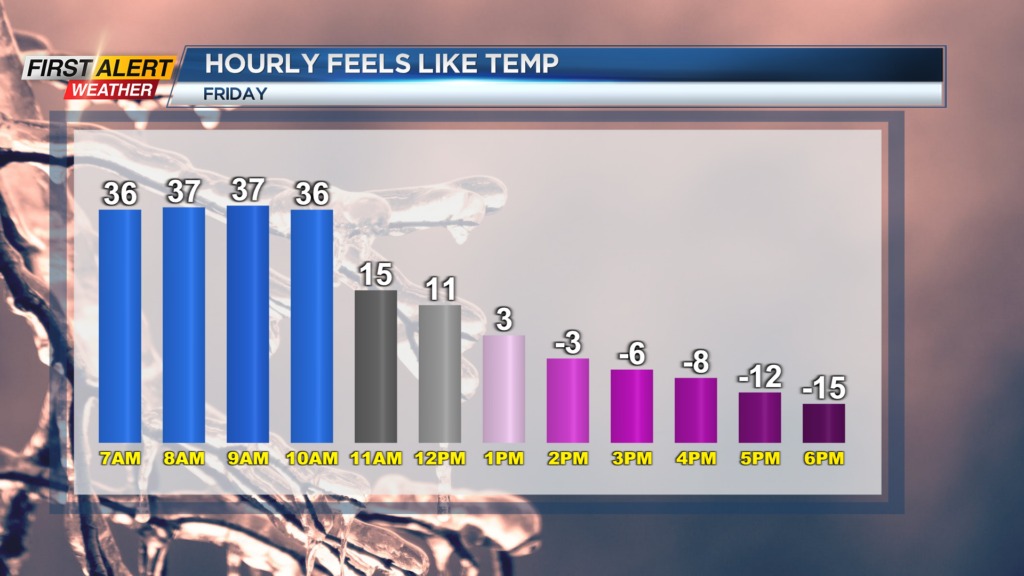
A Yellow Alert has been issued for Friday and Saturday this week due to the winds, snow, and travel impacts ahead. Winds for Friday and early Saturday will have an opportunity to gust near 60mph across our region.
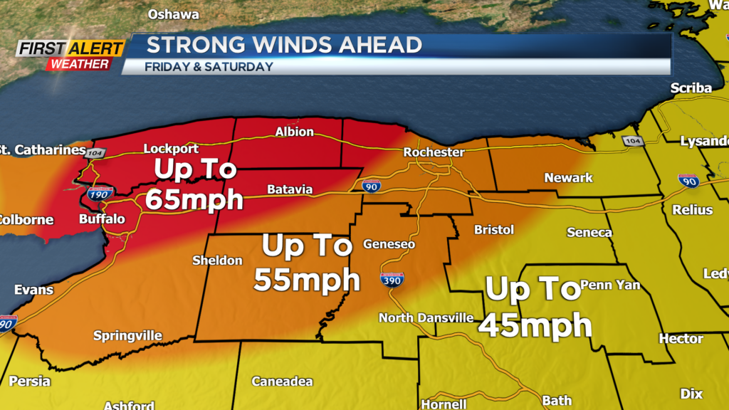
With gusts that high, we will have the chance for scattered power outages. We will be monitoring outages because this cold front won’t just bring us gusty winds, but also bitter cold temperatures.
Temperatures on Friday will start off near 40 degrees before tanking into the single digits by the evening. Also with the winds, it will feel much colder as wind chills dip to near -20 for some by the evening hours Friday. We will remain gusty into Saturday before things slowly subside late.
We will also be dealing with lake effect snow off of Lake Erie late Friday through Christmas, which will have travel implications for those heading out or from Western NY this holiday weekend.
Stay up to date with the First Alert Weather Team this weekend with the active weather ahead and the travel impacts for your plans.
______________
Download the WHEC First Alert Weather app to stay up to date while on the go.
Watch the latest full forecast online.