First Alert Weather: Calm today before rain and wind Saturday
[anvplayer video=”5150870″ station=”998131″]
ROCHESTER, N.Y. — We’re waking up to another chilly start across the region on Friday with temperatures hanging out near 30 degrees. The good news? The wind has settled down significantly which means that wind chills are not a factor.
Winds for Friday will be rather calm before they turn breezy later into the day and then gusty overnight. Friday will also feature a mix of sun and clouds through a good chunk of today before clouds increase later with our next shot of unsettled weather for Saturday.
Even with the late cloud cover, we will see our temperatures make their way into the mid-40s for afternoon highs.
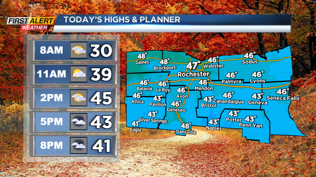
Heading out today? Make sure you got the jacket with you, and also this evening for any evening plans as temperatures will be chilly. Winds will pick up late tonight with an increased chance for showers after midnight.
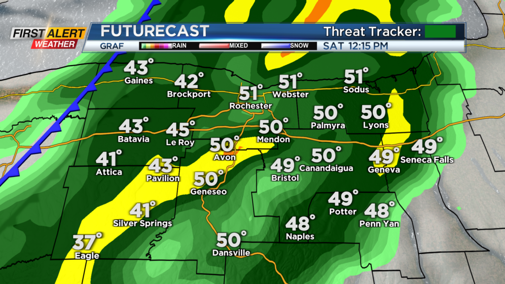
Scattered showers will be possible as we wake up on Saturday morning but a better chance for rain will be towards the middle of the day as the cold front pushes through. Rain chances will drop after the passage of the front, and with the colder air on the backside, we will see a few flakes fly for Saturday evening and night.
We're waking up to another chilly start across the region on Friday with temperatures hanging out near 30 degrees.
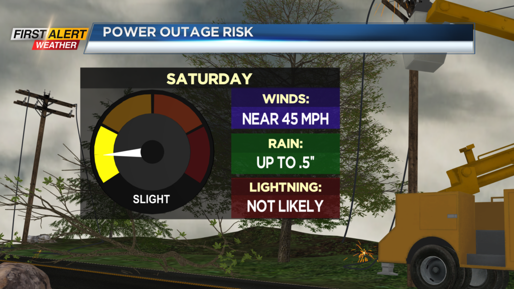
Winds will likely be the biggest story with this next front for tomorrow. We will begin to see the gusts pick up late tonight, and as we wake up tomorrow gusts will likely be near 30mph.
Wind gusts will be on and off through the morning hours tomorrow, but when the front passes through tomorrow afternoon is when we expect the gusts to be consistent. There will be gusts as the front pass through and during the afternoon hours. Saturday will have gusts near 45mph once again.
Power outages will be very isolated for Saturday, just like Wednesday. Make sure you also tie down any loose decorations as well. Winds will remain gusty into early Saturday night before turning breezy for Sunday. We will also see much colder air filters on the backside of the front as the wind will switch from southwest to northwest.
Highs for early Saturday afternoon reach the low 50s before crashing into the 30s by the evening. The colder weather will also linger into Sunday with highs in the upper 30s and breezy conditions.
______________
Download the WHEC First Alert Weather app to stay up to date while on the go.
Watch the latest full forecast online.