First Alert Weather: Chillier air and some lake flakes on Friday
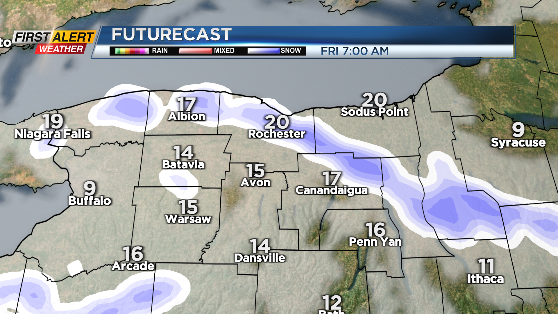
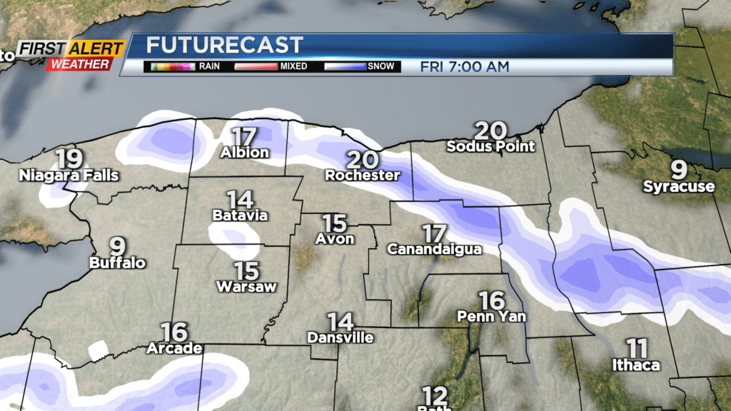
ROCHESTER, N.Y. — Thursday was a “milder” and fairly quiet day, but a cold front moving through Thursday night will usher in some slightly chillier air on Friday and that will lead to some limited lake effect snow.
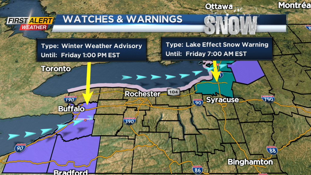
Those flakes will start around midnight with the arrival of the cold front, then the lake effect gets going shortly thereafter. Most will see an inch or less out of this by Friday morning, but there may be some flakes flying around for the morning commute. Winds will be shifting around a bit on Friday, which will shift the lake effect across the area. So, most will see little additional accumulation on Friday, despite some flakes around. It’ll be another chillier day with highs in the lower 20s on Friday.
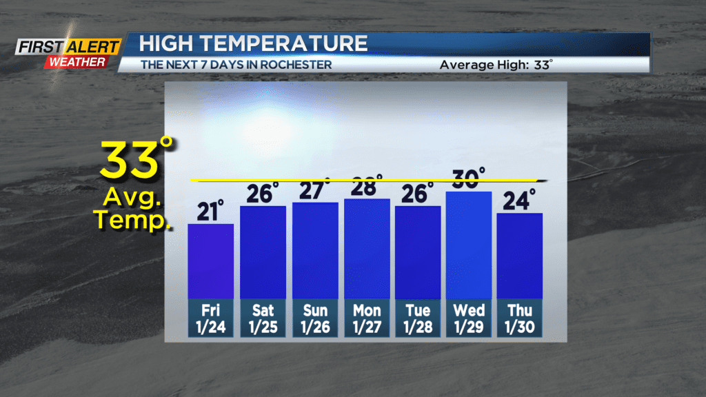
Some clearing in the sky Friday night will allow temperatures to drop into the lower teens on Saturday morning. There may be a few passing snow showers on Saturday, but all in all we’ll see some sunshine, clouds winning out overall and fairly quiet weather. Another cold front will be approaching on Sunday, bringing another chance for some snow showers, and a brisk breeze developing. The wind will probably be our most noticeable weather factor Sunday through Tuesday, with a busy wind at times, but no issues expected at this time.
As far as snowfall goes, we’ll see occasional snow, with our best chance of a few inches of accumulation coming on Tuesday of next week with the arrival of another cold front. But at this point, most snow will have just minor impacts, so we remain Green on the Threat Tracker.