First Alert Weather: Chillier wind and some lake flakes return on Wednesday

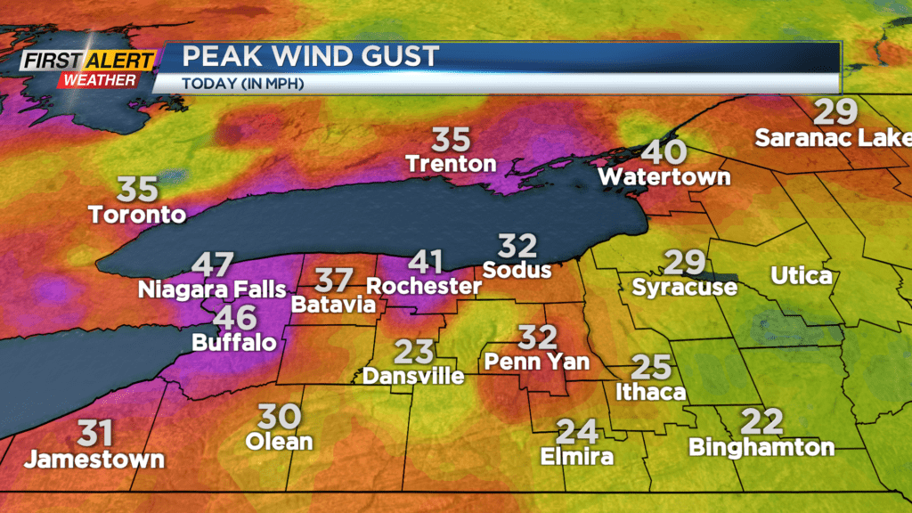
ROCHESTER, N.Y. — Tuesday had a gusty wind, but it was a fairly mild wind with highs well into the 40s.
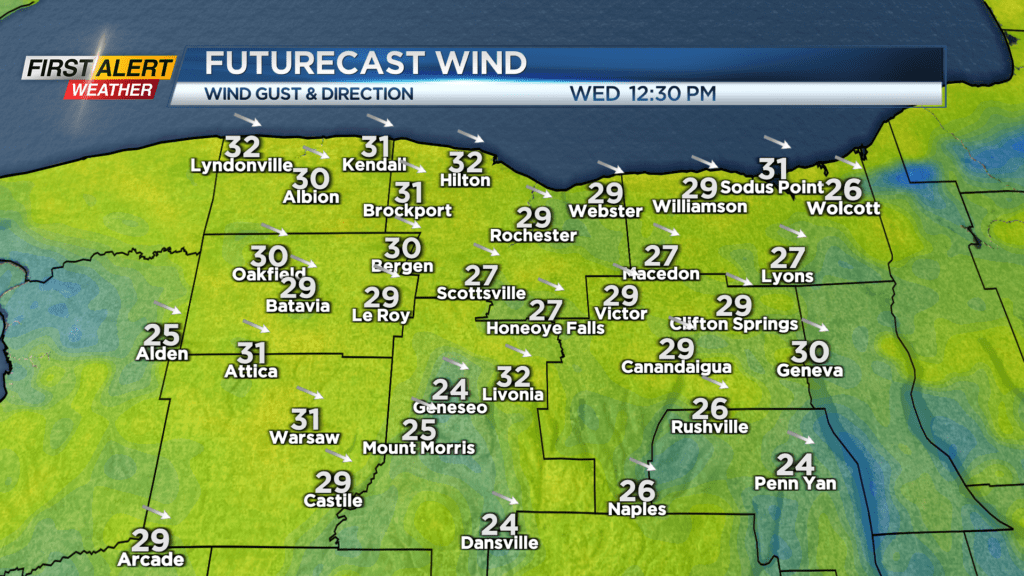
That changes for Wednesday, as a cold front pushes through. We’ll get some gusts pushing 30-35 mph out of the west. So once again, this shouldn’t be enough to cause issues, but it’ll be a noticeable breeze, and it’ll be a chillier breeze.
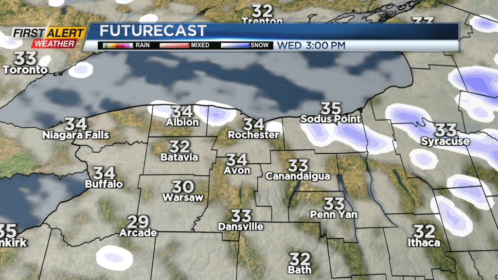
Temperatures on Wednesday will struggle to push into the mid 30s. We’ll also see some limited lake effect developing in the colder air. Amounts should be minimal, with most areas seeing little to nothing, and those locations that do see a lake band shouldn’t see more than a quick inch or two. High pressure then begins to build in for Thursday and Friday, bringing return to dry weather and some sunshine. In fact, we should climb into the upper 40s to near 50 by Friday.
Our weekend looks fairly uneventful. We’ll be watching a potential coastal storm later in the weekend and into early next week, which could potentially bring us some rain showers by late Sunday, and perhaps a few snow showers by Monday.
This is still a ways away, so it is something we’ll monitor until we get a little closer.