First Alert Weather: Clearing sky and quieter weather to end the week
[anvplayer video=”5185045″ station=”998131″]
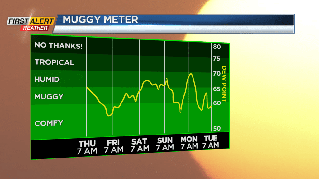
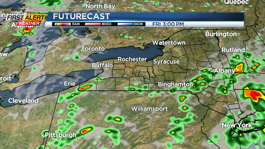
Our Yellow Alert is dropped and our storms are long gone. We’ll see a clearing sky tonight, with humidity dropping off for Friday. We’ll end the week on a fine note with a mostly sunny sky and just the slight chance of an isolated afternoon shower in the Finger Lakes. But that will be the exception, with most staying completely dry.
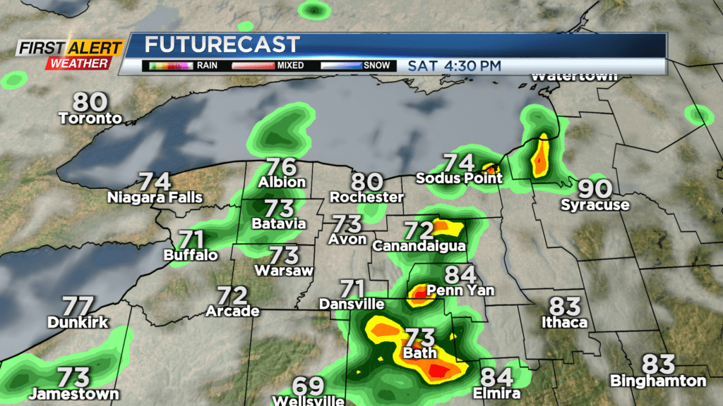
The weekend becomes unsettled once again with showers and thundery downpours, but we’ll see dry time throughout the weekend. Specifically, Saturday should start out dry, with rain and some thunder developing during the afternoon and evening hours. Some storms may continue overnight and into the first part of Sunday, before a drying trend. So, the wettest part of the weekend should be later Sunday and earlier on Sunday, with dry weather to start and end the weekend. Humidity ramps up once again, which means it’ll turn more uncomfortable once again, but it also means the moisture content is increasing. So, any thunderstorms that develop have the potential to produce locally heavy rain once again. The flood threat is low at this point, but our storm threat needs to be monitored.
Next week turns a little more settled, with mainly dry weather Tuesday and Wednesday, with rain chances going up again by later in the week. As far as temperatures go, we don’t see any big heat in the near future, with seasonable highs in the lower 80s.