First Alert Weather: Cold and blustery before another round of wind Saturday
[anvplayer video=”5150683″ station=”998131″]
ROCHESTER, N.Y. — It’s a cold and blustery start to Thursday morning, and that will likely continue through the day.
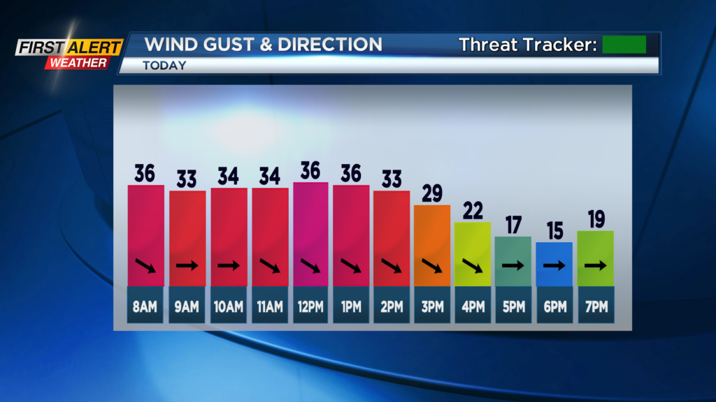
Winds are still gusting to around 35 mph and that will continue into the early afternoon before winds slowly subside in the evening. Power outages are not likely with the wind, but the bigger story with the wind will be the feels-like temperatures.
Air temperatures on Thursday morning are near freezing and will only make their way to the mid 30s this afternoon. With the winds a factor, it will feel like the teens this morning before only feeling like the 20s this afternoon.
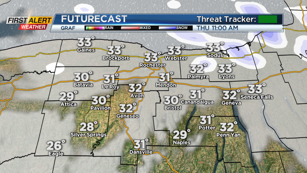
A few snowflakes will also fly through today as we see a bit of a lake response, but only upward of half an inch of additional snow is expected. Things to turn much nicer to end the work week with highs in the mid 40s on Friday under partly cloudy skies, but clouds increase and winds pick up again late with our next storm for Saturday.
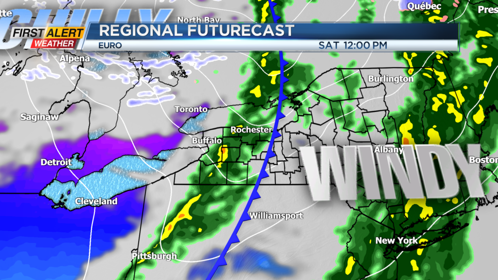
Another cold front will swing through on Saturday and bring us a chance for showers and the winds will increase once again. A few showers will be possible through the morning and into the early afternoon on Saturday before things slowly dry out late. Winds though will have a chance to gust upwards to 45mph again with the passage of the cold front.
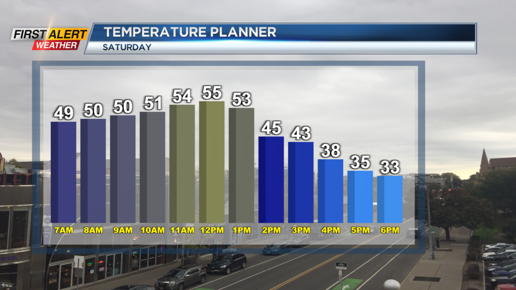
With gusts that high again, we could see isolated power outages on Saturday. Also, our temperatures will once again crash. Highs Saturday will occur in the early afternoon as they reach the 50s, but will drop into the 30s by the evening hours with the front passing by. so once again, be prepared for wind, rain, and cold this Saturday just as we saw on Wednesday.
It's a cold and blustery start to Thursday morning, and that will likely continue through the day.
______________
Download the WHEC First Alert Weather app to stay up to date while on the go.
Watch the latest full forecast online.